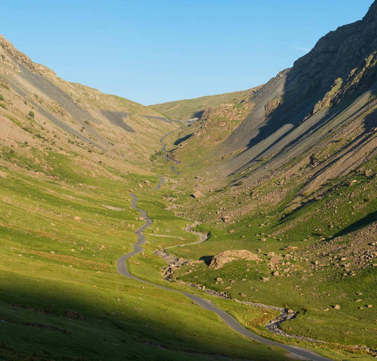

Honister Pass
On 5 December 2015, in twenty-four hours ending at six in the evening, 341.4 millimetres of rain fell on Honister Pass. That is more than thirteen inches. It is the United Kingdom's official 24-hour rainfall record, and it happened during Storm Desmond, which would go on to flood much of northern England. The number is hard to feel until you stand at the top of the pass on any ordinary wet day and watch the cloud sitting on Fleetwith Pike just metres above your head. Honister catches weather. It catches more weather than almost any other place in Britain. The road that crosses it is shaped by that fact, and so is everything else.
The Highest Crossing on the B5289
Honister Pass climbs to 1,167 feet on the B5289 - one of three road passes linking the Keswick and Borrowdale area to the lakes of Buttermere, Crummock Water, and Loweswater. The other two are Whinlatter Pass to the north and Newlands Pass between them. Honister is the southernmost, the highest, and the steepest of the trio, with gradients up to one-in-four (25%) on the climb out of Borrowdale. The saddle at the watershed is called Honister Hause, using the Cumbrian word hause for such a feature, and from the top you can drop in either direction: north-west down toward Buttermere village and Gatesgarth at the southern end of Buttermere lake, or south-east down to Seatoller in the valley of Borrowdale.
What Sits at the Top
Most mountain passes empty out at their summit. Honister does not. At the top of the pass stand Honister Slate Mine - the last working slate mine in England - and the Honister Hause Youth Hostel, where coast-to-coast walkers and climbers stop for the night. The two buildings exist because of the same geology: the green slate beneath them has been quarried here since the late 17th century, and the road across the pass exists in part to move that slate out. The mine still runs underground tours of the workings and operates England's first via ferrata, where harnesses and fixed cables let visitors climb cliff paths that miners once worked. From the summit, footpaths lead west to Fleetwith Pike, south to Grey Knotts, and north to Dale Head - turning the pass into a hub for some of the most accessible high-fell walking in the Lake District.
The Record Storm
Storm Desmond pushed Atlantic moisture against the Lake District fells for almost two days in early December 2015. The mechanism is well understood: warm, wet air rising rapidly over the western escarpment cools and dumps its water on the windward slopes. Honister Pass sits squarely in that target zone. By the time the 24-hour total reached 341.4 millimetres, every river downstream was in flood. Cockermouth went under for the second time in six years. Carlisle's Eden burst its banks. The Honister rainfall figure became the new official UK record, and it remains so. Drive the pass in any heavy rain since and you can see the system at work - water sheeting off Fleetwith Pike, becks rising visibly in minutes, the road glassy with runoff.
Driving the Pass Today
The B5289 is a public road, but it is not an easy one. The Borrowdale side rises steeply through tight bends past slate spoil and bracken. The Buttermere side drops just as steeply, with views down toward Gatesgarth and the lake opening below. In summer the road is busy with cyclists and walkers, in winter it sometimes closes for ice and snow, and at any season the weather can change within minutes. The pass is not the most scenic in the Lakes - that competition is crowded - but few crossings tie weather, geology, and human work so tightly together. Slate beneath. Rain above. A road running between. Everything you see has been shaped by one or the other, or by both.
From the Air
Coordinates 54.5167 N, 3.21667 W. Honister Pass crosses a clear north-west to south-east saddle in the central Lake District, identifiable from the air by the steep dark scree of Honister Crag and the worked spoil of Honister Slate Mine on the south-east side of the summit. The B5289 road is visible as a pale switchback on both flanks. Recommended altitude 4,000-5,500 ft AGL. The pass holds the UK 24-hour rainfall record (341.4 mm during Storm Desmond, 2015); expect rapidly developing orographic cloud and turbulence in any westerly flow. Nearest airports: Carlisle Lake District (EGNC) to the north, Blackpool (EGNH) to the south.
Nearby Stories
- Lowther Castle 5.5 km away
- Black Combe 6.6 km away
- Levens Hall 6.8 km away
- Threave Castle 13 km away
- Ruthwell Cross 18 km away
- Raeberry Castle 24 km away
- RAF Spadeadam 24 km away
- Cashtal yn Ard 33 km away