
Hung Hom
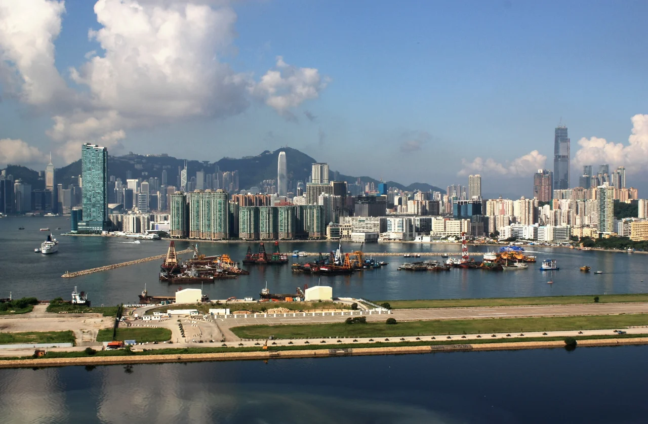
The bay kept shrinking. Hung Hom Bay has been partially reclaimed several times since 1850, each reclamation pushing Hung Hom's shoreline a little further south into Victoria Harbour, gradually burying features like Rumsey Rock that once gave the bay its character. The neighborhood grew eastward parallel to the Hong Kong and Whampoa Dock. What started as a small area on the Kowloon Peninsula became, through successive acts of engineering, a substantial district of approximately 22.30°N, 114.18°E — bounded by the harbour to the south, King's Park to the west, and a ring of hills to the north.
Redrawing the Map
The name Hung Hom translates roughly as "red ridge" in Cantonese, referring to the reddish soil of the hills behind the bay. During the Japanese occupation from 1941 to 1945, the district was renamed Yamashita District — a Japanese personal name replacing a Chinese geographic description. It was one of the few places in Hong Kong to be renamed during the occupation. The name reverted after the war. The reclamation history that defines Hung Hom's geography is part of a broader story across Hong Kong: the city has been in continuous dialogue with the harbour, taking land from the water when population pressure and commercial need demanded it. Hung Hom Bay, once a significant natural indentation in the Kowloon coastline, is now a partially enclosed body of water, its perimeter defined by land that did not exist in 1850.
The Tunnel Under the Harbour
On 2 August 1972, the Cross-Harbour Tunnel opened at Hung Hom, connecting Hong Kong Island and Kowloon beneath Victoria Harbour. It was the first underwater road tunnel in Hong Kong. Route 1, the arterial road it carries, makes Hung Hom the Kowloon terminus for the most direct road connection between the two sides of the harbour. The tunnel meets the Kowloon shore at a reclaimed site in Hung Hom Bay — more reclaimed land serving a connection between two pieces of land that themselves include significant areas of reclaimed harbour. The ferry pier at Hung Hom also serves as a departure point for routes to North Point and Central on Hong Kong Island, running alongside the tunnel as an older, slower form of the same crossing.
A Station at the Junction
Hung Hom Station is the southern terminus of the East Rail Line and a key stop on the Tuen Ma Line, making it one of the most important interchange points in the MTR network. For decades it was also the departure point for the Intercity Through Train, which carried passengers from Hong Kong to Guangzhou, Beijing, and Shanghai — the only direct rail connection between Hong Kong and mainland China before the West Kowloon terminus opened with the Guangzhou-Shenzhen-Hong Kong Express Rail Link. The loss of that through-train role changed Hung Hom's character as a transport hub without diminishing its importance. Ho Man Tin station and Whampoa station, accessible as of October 2016 via the extended Kwun Tong Line, added further rail connectivity to the northeastern parts of the district.
Polytechnic, Temples, and a Living Neighborhood
Hong Kong Polytechnic University occupies a significant footprint in Hung Hom, making the neighborhood home to one of Hong Kong's eight publicly funded universities. The Pak Tai Temple on Ma Tau Wai Road, built in 1876, is a Grade III historic building — one of the older surviving structures in the district, a small piece of continuity in a neighborhood that has been remade repeatedly around it. Holy Carpenter Church and St. Mary's Catholic Church serve the residential population that makes up most of Hung Hom's daily life. The northern section mixes residential towers with older industrial buildings. The view south from any elevated point looks out across Hung Hom Bay toward the former Kai Tak Airport runway — a long strip of reclaimed land that juts into the harbour from the east, now being redeveloped but still carrying the memory of the flights that once landed on it, aircraft descending through the Kowloon hills with their wingtips over residential rooftops.
From the Air
Hung Hom sits at approximately 22.304°N, 114.183°E on the southeast tip of the Kowloon Peninsula. From the air at 2,000–3,000 feet, the Cross-Harbour Tunnel toll plaza is visible on the Kowloon side, with Hung Hom Station immediately inland. The former Kai Tak Airport runway — the distinctive finger of reclaimed land extending into Kowloon Bay — lies roughly 2 km to the northeast. Victoria Harbour separates Hung Hom from the Hong Kong Island waterfront to the south. The nearest major airport is Hong Kong International Airport (VHHH) on Lantau Island, approximately 35 km to the west. Pilots familiar with the old Kai Tak approach will recognize the tight geography: aircraft once flew directly over the densely built Kowloon neighborhoods before banking sharply onto final approach.
Nearby Stories
- Lok Ma Chau Loop 2.3 km away
- Portas do Cerco 2.3 km away
- Kweilin Incident 17 km away
- Wanshan Archipelago Campaign 34 km away
- Nanxiong Formation 115 km away
- Battle of Nanpeng Island 148 km away
- Heyuan 169 km away
- Cape Maobitou 632 km away