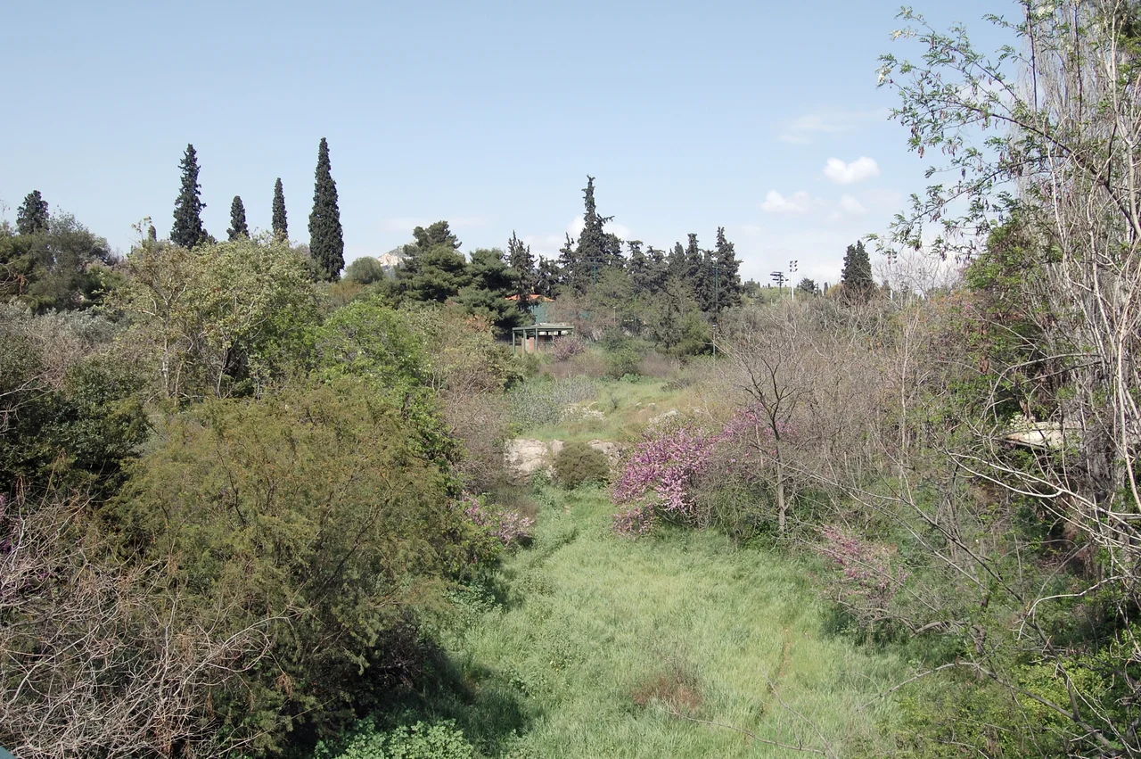

Ilisos
Plato set the scene carefully. In the dialogue *Phaedrus*, Socrates and his companion Phaedrus walk out from Athens along the banks of the Ilisos River, where the water is cool and plane trees shade the ground. They find a spot — a rocky outcrop near a stream, fragrant with wildflowers — and sit down to talk about love, rhetoric, and the soul. The river is not incidental to the conversation. It is the reason they are there, the thing that draws them out of the city into a space that feels, to the ancient Greek mind, properly sacred. The Ilisos no longer looks like that. Much of it flows under the streets of modern Athens, invisible beneath avenues named for other things entirely.
A Name Older Than the City
The river's name is almost certainly pre-Greek — it carries the ending *-sós* or *-ssós* that it shares with many ancient place names in Attica, linguistic survivals from the populations who lived in this region before the Greek-speaking world arrived. The Ilisos itself was understood in ancient religion as a demigod: the son, in one tradition, of Poseidon and Demeter, worshipped in a sanctuary on the Ardittos hill next to what is now the Panathinaiko Stadium. Plato wrote in the *Critias* that the river marked one of the borders of the ancient walls of Athens. Flowing outside the city walls, its banks were grassy and shaded — the kind of place where philosophers walked, and where at least one temple to a local hero named Pankrates gave its name to the modern suburb of Pagkrati.
A Landscape Buried by the City
As Athens expanded in the 19th and early 20th centuries, the Ilisos became a problem rather than a resource. Its water grew polluted, its course inconvenient. Engineers channeled it underground, covering its bed with streets that still trace its original twisting path through the topography of the land. Today the river flows beneath Mesogeion Avenue, under the neighborhoods of Ilisia and Kallithea, past the Panathinaiko Stadium — where it was bridged in the 19th century — and then turns toward the sea. One stretch remains above ground: near the ruined columns of the Temple of Olympian Zeus, the Ilisos surfaces briefly amid reed beds, alongside the Byzantine chapel of Saint Photeine of the Ilisos, a small church that sits on the ruins of an ancient temple to Hecate. Nearby, archaeological excavations in 2014 uncovered yet another temple, this one dedicated to Zeus, dating to the 4th century BC.
Sacred Ground, Layer by Layer
The banks of the Ilisos were not merely picturesque — they were dense with sanctuaries. Archaeological investigation has identified the site of a 5th-century BC Ionic temple of Artemis Agrotera on the hill known in antiquity as Agrai, from which the goddess was celebrated every year on the anniversary of the Battle of Marathon. An archon would preside over the sacrifice of goats, and Athenian youth would pass in procession. The Lesser Mysteries — held annually in the month of Anthesterion (February–March) as a preparatory rite for the Great Eleusinian Mysteries — were celebrated on this same hill. A rock outcrop with a carved relief of the god Pan marks yet another shrine. The density of sacred sites along this short stretch of river is extraordinary, a reminder of how thoroughly the Athenians wove their religious life into the physical landscape.
Where Socrates Sat
In *Phaedrus*, the precise spot where Socrates and his companion settle is described: a spring of cold water, a plane tree, a willow. Some scholars identify this with a shrine to the Nymphs and the river-god Achelous near the Ilisos. The description is specific enough to feel real. Whether it is an exact location or a literary idealization, the text has shaped how the ancient world imagined the river's banks — as a place for thought, for stepping outside the city walls into a quieter world. In 2019, the Greek government announced plans to unearth portions of the Ilisos, returning it to the surface of the city. The process is slow and the engineering formidable. But the idea of bringing the river back has a particular resonance in Athens, where the past is rarely as buried as it seems.
From the Air
The Ilisos flows through central Athens at approximately 37.9397°N, 23.6808°E, draining the western slopes of Mount Hymettus and running roughly northwest through the city before being rechanneled to the Saronic Gulf at Phaleron Bay. From the air, the course of the underground river is not directly visible, but its route can be traced along the curving street grid of Ilisia and Kallithea. The exposed reed-bed section near the Temple of Olympian Zeus is identifiable from low altitudes by the ruins of the temple columns. Athens International Airport (LGAV) lies approximately 25 kilometers to the east at 37.9364°N, 23.9445°E. Recommended viewing altitude over central Athens is 2,500–5,000 feet MSL. The Panathinaiko Stadium, where the river passes, is a distinctive all-marble structure visible from approach altitudes.
Nearby Stories
- Parnitha 3.4 km away
- Kea (island) 7.3 km away
- Sanctuary of Apollo Maleatas 11 km away
- Sousaki Volcano 12 km away
- Battle of Leuctra 14 km away
- Great Sand Beach 18 km away
- Agios Georgios (island) 23 km away
- Skyros 84 km away