.jpg)
Inis Oirr
If you have ever watched the title sequence of Father Ted, you have seen Inis Oirr. The camera pans across a rusted ship listing against grey rocks, and that ship is the Plassy - a 1940 Royal Navy minesweeper that was driven aground here in a March 1960 storm, dragged ashore by a second storm a few weeks later, and has been weathering on the eastern beach of this small Aran island ever since. Storms in 2014 shifted it again. The wreck has outlived the show that immortalised it.
Tail-End Island
The name is probably a clerical error. The traditional Irish name was Inis Thiar, which can mean west island but here meant something closer to tail-end island - last of the chain. Nineteenth-century cartographers wrote it Inis Oirthir, east island, which morphed over decades into the current Inis Oirr. The mistake stuck. The island is the smallest and most easterly of the Aran Islands, lying ten kilometers off the Cliffs of Moher in County Clare across a narrow strait of unpredictable Atlantic water.
The geology is the same fissured limestone pavement as the Burren on the mainland - flat slabs called clints separated by grooves called grikes, the grooves holding moisture and wildflowers that have no business surviving in this exposure. The population peaked at 532 during the famine years of the 1840s, when many on the mainland had nowhere worse to go. It fell to 257 by 1979. The 2022 census counted 343. Tourism is now the main industry and Irish is the principal language.
O'Brien's Castle
On the highest point of the island stands Caislean Ui Bhriain - O'Brien's Castle, sometimes called Furmina Castle. The tower house was built by the O'Brien clan in the fifteenth century, captured from them by the O'Flahertys around 1582, and demolished by Cromwell's forces in 1652. The site is usually free to enter. Around the ruined walls you can still trace the outline of Dun Formna, the much earlier ringfort the O'Briens partly recycled when they built their castle. From the top, on a clear day, the islands of Inis Meain and Inis Mor stretch westward and the Cliffs of Moher rise on the southern horizon.
A hundred meters south of the castle is An Tur Faire, the Watch Tower - a signal station built between 1806 and 1808 as part of a chain of similar towers around the Irish coast that exchanged flag signals against the threat of Napoleonic invasion. There are eight National Monuments-level archaeological sites on this island of three square kilometers: stone forts, early Christian churches, holy wells, a wedge tomb. The earliest known habitation layer at Cnoc Raithni, a burial mound on the north shore, dates to 1500 BC.
Saints, Sand, and a Buried Church
Teampall Caomhan, the Church of St Cavan, sits below the airfield with an entrance that opens below ground level. Wind-blown sand had buried the tenth-century church almost to its roofline by the nineteenth century. The ruin has been roofed in modern times to prevent it filling up again. Cavan died around 865 and is buried here. His pattern day mass used to be celebrated on 3 November; in the nineteenth century it was shifted to 15 June, presumably for better weather.
Nearby is the ruin of an eleventh- or twelfth-century church dedicated to St Gobnait. The legend says she fled here from a family feud, but an angel appeared and told her to return to the mainland and travel south until she saw nine white deer. She found the deer in Ballyvourney, County Cork, and founded her convent there. The beehive cell beside the church ruin is probably contemporary with the church rather than with the saint herself. Saint Enda's Well, marked on local maps as Tobar Eanna, is where a strange ritual still gets retold - three Sundays of seven stones and seven rosaries each visit, and if an eel manifests in the pool your tongue gains healing powers. Whether anyone has tested the eel in this century is unclear.
Currachs, Bodhrans, and the Bengal Connection
The Limerick Steamship Company bought the Plassy ship in 1951 and renamed it after the Plassey district of Limerick city. That district is named after Lord Clive, Baron Plassey, who took his title from the 1757 Battle of Plassey on the Hooghly River above Calcutta - and the village where that battle was fought, Palashi, took its name from the Pôlash tree, the flame-of-the-forest, whose orange-red flowers are the colour the rusting hull has weathered into. The wreck links a Bengal tree to an Aran shore by way of an empire and a sitcom.
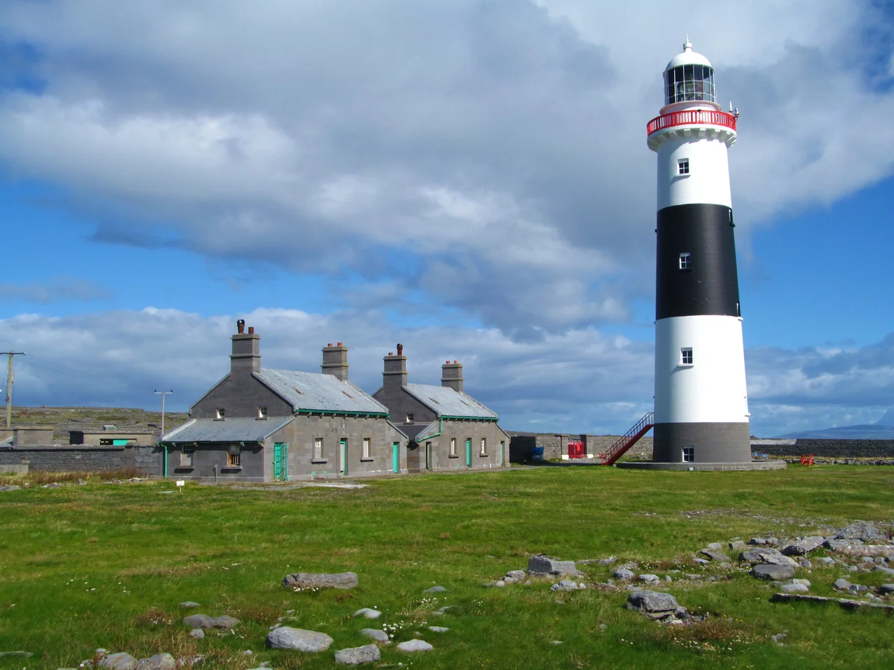
The island's living traditions are more local. The Craiceann Bodhran Festival in late June fills the island with drummers - craiceann means drumskin. August brings currach racing, the canvas-and-pitch rowboats traditional to the west coast. The Inis Oirr Lighthouse, lit in 1857, marks the eastern end of the Aran chain - replacing an older Inis Mor lighthouse that captains complained they could only locate by first finding the rocks they were trying to avoid. The seals that haul out on the bay west of the pier come in both species: common harbour seals with their puppy-dog noses, and the larger grey Atlantic seals with their Roman ones.
From the Air
Inis Oirr sits at 53.06 N, 9.53 W, in Galway Bay, the easternmost and smallest of the three Aran Islands. Connemara Airport (EICA) at Inverin is 31 km northeast - Aer Arann Islanders fly the route in 10 minutes daily, though small Britten-Norman BN-2 aircraft are routinely cancelled in high winds. Shannon Airport (EINN) is roughly 70 km southeast; Galway (EICM) is closer at about 45 km northeast. Recommended viewing altitude is 1,500 to 3,000 feet AGL. The island is small enough that the entire perimeter fits in a single visual sweep. Look for the Plassy shipwreck on the east shore, O'Brien's Castle on the highest interior ground, and the lighthouse at the southeast point. The Cliffs of Moher rise from the sea ten kilometers south across the strait. Weather here is North Atlantic - cloud bases often below 2,000 feet, frequent showers and reduced visibility.
Nearby Stories
- Acadamh na hOllscolaíochta Gaeilge 4.6 km away
- Coláiste Iognáid 5.3 km away
- Poulnabrone Dolmen 5.6 km away
- Kilkee 5.7 km away
- 1961 President Airlines Douglas DC-6 crash 15 km away
- Ardoileán 32 km away
- RMS Carinthia (1925) 40 km away
- Ballynavenooragh 57 km away