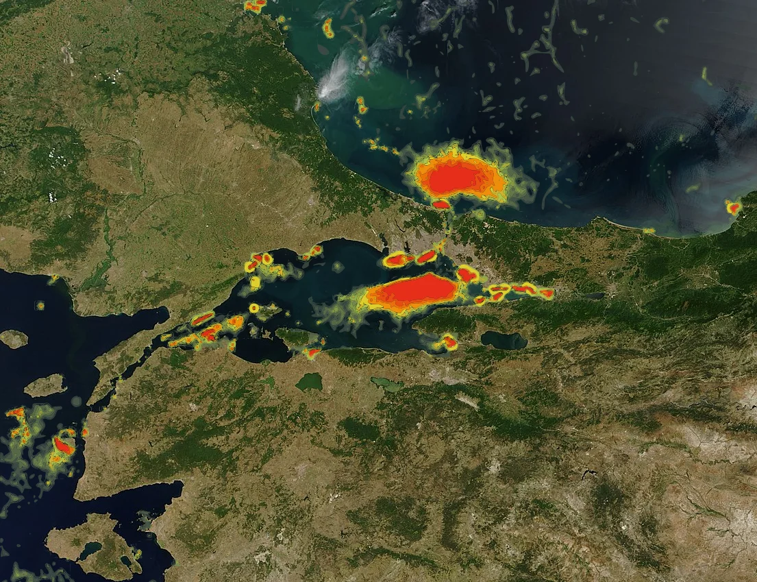

Istanbul Canal
The idea of cutting a second channel through Thrace, parallel to the Bosphorus, is not new. Sultan Murad III issued an imperial order for just such a project in 1591. Mehmed IV's advisors pressed for it again in 1654. Mustafa III tried twice in 1760. The canal that would link the Black Sea to the Sea of Marmara has been proposed at least seven times across four centuries of Ottoman and Turkish history — and has never been built. The modern version, announced by President Recep Tayyip Erdoğan in 2011 and formally launched in June 2021, is the most ambitious attempt yet. It is also the most contested.
The Problem the Canal Is Meant to Solve
On most days, dozens of ships queue at the northern entrance to the Bosphorus waiting for their turn to transit. The strait is narrow — as little as 700 meters at its tightest — and winding, and the traffic is extraordinary. Tankers, bulk carriers, container ships, and warships all compete for passage through a waterway that runs directly through the heart of a city of 15 million people. Traffic congestion leaves vessels waiting for days. Accidents, when they happen, are spectacular and costly.
The Istanbul Canal is designed to relieve this pressure. Projected to carry 160 vessel transits per day — roughly matching the current Bosphorus volume — the canal would run approximately 45 kilometers from the Black Sea coast south to Lake Küçükçekmece near the Marmara shore, passing through the districts of Arnavutköy, Başakşehir, and Avcılar. Ships up to 350 meters long and 49 meters wide would be able to transit. The canal would effectively make European Istanbul an island, bordered by the Bosphorus to the east and the new waterway to the west.
The Montreux Convention Question
There is a second argument for the canal — or against it, depending on one's perspective. The Montreux Convention of 1936 governs the Bosphorus and prohibits transit tolls while limiting the number and tonnage of warships from non-Black Sea nations that can enter the sea. Turkey has honored the convention for ninety years; it provides a legal framework that both constrains Turkish authority and gives Turkey a recognized role as guardian of the strait.
A new canal would not automatically be covered by Montreux. Turkey could, in theory, set its own rules for the Istanbul Canal — including fees and different rules for military passage. Critics, including 104 retired Turkish navy admirals who signed an open letter on the subject in 2021, warned that circumventing Montreux could destabilize the Black Sea region and harm Turkish security. Ten of those admirals were subsequently arrested, an episode that drew international attention. The government maintained that the canal was a commercial and infrastructure project. The geopolitical dimension, however, did not disappear.
What Would Be Lost
The environmental concerns about the Istanbul Canal are substantial and well-documented. A scientific assessment commissioned by the Istanbul Metropolitan Municipality identified multiple risks that the government's own Environmental Impact Assessment left inadequately addressed.
The first 16 kilometers of the canal's northern stretch would pass through alluvial soil prone to liquefaction in an earthquake — a serious concern in a region where seismic risk is already high. The canal's construction would threaten the water resources of the Terkos Dam and Sazlıdere Dam. Lake Durusu (Terkos), which supplies roughly a fifth of Istanbul's drinking water, would be eliminated by the canal route. The Marmara Sea's salinity and chemistry would change as less-salty Black Sea water flows south. The Yarımburgaz Cave, a significant prehistoric archaeological site, would be destroyed. The Küçükçekmece Bridge, a historical artifact, would have to be moved.
Beyond infrastructure: the project would require disposing of 53 million cubic meters of dredged sludge from Lake Küçükçekmece, a logistical problem the EIA report did not explain in detail. Agricultural and forest land along the route would be converted. An 80.4% opposition rate was recorded in a 2020 Istanbul survey on the project.
Construction Begins — and Slows
On June 26, 2021, Erdoğan attended a ceremony marking the start of construction on the Sazlıdere Bridge, which would cross the canal on its route south. The government called this the official beginning of Kanal İstanbul. The estimated cost was ₺75 billion, approximately US$10 billion, to be funded through a build-operate-transfer model with private investors, supplemented by the national budget if necessary.
By the time the ceremony took place, the project was already years behind its original 2023 target date — the 100th anniversary of the Turkish Republic. Critics, including analysts at Stratfor who in 2013 called that timeline 'not realistic,' had been vindicated by the delays. Istanbul's elected mayor, Ekrem İmamoğlu, remained openly opposed, arguing that earthquake-resilience upgrades for the city's millions of vulnerable buildings would be a more urgent use of equivalent funds. Whether the canal moves forward at the pace its proponents envision, stalls further, or is ultimately abandoned remains unresolved.
An Idea That Keeps Returning
What is striking about the Istanbul Canal is not any single aspect of the project but the persistence of the underlying idea. Sultans wanted it. Modern politicians have repeatedly revived it. The Bosphorus has always been both the reason Istanbul exists and a constraint on what Istanbul can become. The idea of supplementing it, controlling it differently, or routing around it exercises a particular hold on Turkish strategic imagination.
The canal, if built, would create a new island — the entire European side of Istanbul between the Bosphorus and the new waterway — with planned residential development along the canal banks, artificial islands built from excavated material, and a new container terminal on the Black Sea. Critics see real estate speculation as a hidden driver of the project. Supporters see infrastructure that could serve the city and the nation for a century. Both arguments have been made for four hundred years. The canal has not been built yet.
From the Air
The Istanbul Canal's planned route runs at approximately 41.34°N, 28.70°E as its central reference, cutting northward through European Istanbul from the Marmara coast near Lake Küçükçekmece to the Black Sea coast in the Arnavutköy district. The nearest major airport is LTFM (Istanbul Airport, ICAO: LTFM), located near the northern end of the planned canal corridor in Arnavutköy. From altitude, the Bosphorus strait is clearly visible as the existing waterway; the canal's route would parallel it roughly 30–40 km to the west. Lake Küçükçekmece and Lake Durusu (Terkos) are both visible from cruising altitude as distinct water bodies that the canal project would either traverse or eliminate. Recommended viewing altitude for the full route context: 8,000–12,000 feet.
Nearby Stories
- MV Struma 3.4 km away
- Polonezköy 3.4 km away
- Bathonea 13 km away
- Sea of Marmara 44 km away
- Battle of Constantinople (922) 48 km away
- HMAS AE2 81 km away
- Januarius MacGahan 101 km away
- Edirne 129 km away