
Sea of Marmara
Between the Black Sea and the Aegean lies a sea that belongs entirely to one country. The Sea of Marmara is an inland water entirely within Turkey's borders — connected to both its neighbouring seas but owned by neither, a hinge point where the continents of Europe and Asia almost touch. The ancient Greeks called it the Propontis: the sea in front of the sea, the water you crossed before reaching the Black Sea beyond. They had a word for what it was, but they did not yet know what it would become.
Named for Stone
The Propontis acquired its modern name from a single island on its southern shore. Marmara Island has been quarried for marble — *mármaron* in Greek — since Roman times, supplying stone for Hagia Sophia, for imperial sarcophagi, and for a thousand lesser monuments across the ancient world. Over time, the island's name followed its stone outward, until the surrounding water took the name too. Call it the Sea of Marble. The Propontis became the Sea of Marmara, and the island kept both its quarries and its etymology. The sea reaches a maximum depth of 1,370 metres, though its average is far shallower. At the surface, its salinity runs around 22 parts per thousand — saltier than the Black Sea, but only about two-thirds the salinity of most oceans. At the bottom, the water is far more saline, averaging around 38 parts per thousand, similar to the Mediterranean. Dense and cold, that deep water stays where it is, unmixed, a feature the Marmara shares with the Black Sea to its north.
Myth and Misfortune on the Propontis
Greek mythology assigned a dark story to these waters. A storm on the Propontis, according to the myth, blew the Argonauts back to an island they had recently left. In the confusion of the night, either Jason or Heracles killed King Cyzicus — the local ruler who had welcomed them on their first visit — mistaking the returning heroes for enemies. The Argonauts mourned and buried the king before sailing on. The ancient city of Cyzicus, which the myth attached to this shore, was eventually abandoned after a series of earthquakes. The earthquakes were not mythological. The North Anatolian Fault runs beneath the Sea of Marmara, and in August 1999 it produced the devastating Izmit earthquake — one of the deadliest natural disasters in Turkey's history. The November 1999 Düzce earthquake followed. In the interval between those two events, on 29 December 1999, a Russian oil tanker broke in two during a storm on the Marmara, spilling more than 1,500 tonnes of oil into the water.
Islands, Straits, and a Third of a Nation
Two archipelagos divide the Marmara's surface. To the north, the Princes' Islands — Büyükada, Heybeliada, Burgazada, Kınaliada, and several smaller outcroppings — sit within ferry distance of Istanbul's European and Asian shores, part of the city's extended geography. To the south, the Marmara Islands include the marble island that gave the sea its name, along with inhabited Avşa, Paşalimanı, and Ekinlik. Among the southern islands is Imralı, a prison island that since 1999 has held Abdullah Öcalan, the imprisoned leader of the PKK. The Marmara basin, despite its limited size, is home to roughly one-third of Turkey's total population. Istanbul dominates the north shore; Bursa, Izmit, and Bandırma anchor the south. That concentration of people has consequences for the water. For decades, waste entered the sea with little or no treatment. Many species have disappeared.
The Year the Sea Turned
In January 2021, a substance began appearing on the surface of the Sea of Marmara that Turks had long given a name to but rarely seen at this scale: *deniz salyası*, sea snot — a mucilage formed by marine microorganisms when the water is too warm, too polluted, and too nutrient-rich. It spread across the sea in thick, grey-white mats. It settled on fishing nets and coated shorelines. It lasted until June 2021, causing habitat loss, devastating the fishing industry, and making visible what years of pollution had been building toward invisibly. The mucilage outbreak became a turning point in Turkish public attention to the sea's health. What the Propontis had carried across three thousand years of human history — myths, marble, armies, submarines, oil tankers, relief ships — it was now carrying the consequences of those centuries. The Marmara remains a hinge point between two continents and two seas. It is also, unmistakably, a body of water under pressure.
From the Air
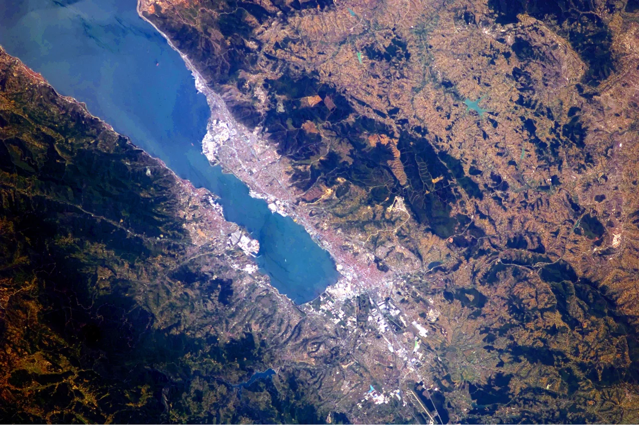
The Sea of Marmara is centered at approximately 40.75°N, 28.00°E and is visible in its entirety from high altitude — roughly 280 km east-to-west and 80 km north-to-south. At 20,000 ft in clear conditions, both the Bosporus to the northeast and the Dardanelles to the southwest are visible as narrow waterways connecting the Marmara to the Black Sea and Aegean respectively. The Princes' Islands appear as a cluster near Istanbul's southeastern shore; the Marmara Islands sit in the southern half of the sea. The North Anatolian Fault trace follows the sea's southern basin. Istanbul Airport (LTFM) lies on the European shore to the northwest; Bandırma Airport (LTBG) sits on the southern shore. The sea's distinctive layered salinity is not visible from the air, but its island geography makes it immediately identifiable.
Nearby Stories
- Battle of Cyzicus 7.5 km away
- Ganos 9.6 km away
- Kanuni Sultan Suleiman Bridge (Istanbul) 11 km away
- Biga Çayı 12 km away
- 1509 Constantinople Earthquake 30 km away
- Selymbria 30 km away
- Bursa 58 km away
- Uzunköprü Bridge 72 km away