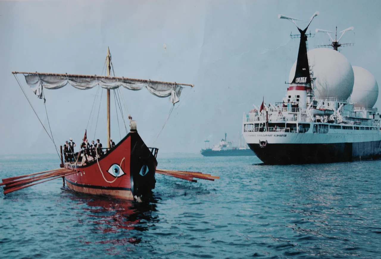

Ivlia (ship)
The hull was Durmast oak. The planking was Siberian larch. The oars — forty-eight of them, arranged at two levels — were beech. When the bireme *Ivlia* slid into the water at the Sochi Naval Shipyard in 1989, she looked more or less as an ancient Greek galley would have looked more than two millennia earlier. That was precisely the point. The scholars and shipwrights who built her had a question they could only answer by going to sea: were the ancient Greeks better sailors than the modern world gave them credit for?
Why a Bireme
The project began at the Odesa Archaeological Museum, where Professor Vladimir N. Stanko and a team of researchers had spent years studying ancient illustrations on vases and stone reliefs, comparing them against written sources and archaeological evidence for ancient ship construction. They chose to reconstruct a bireme — a galley with oars at two levels — because the evidence suggested it was the most widely used vessel in the northern Black Sea region during antiquity. The famous trireme, with three banks of oars, was built for combat: fast, powerful, but demanding in crew and maintenance. The bireme was the workhorse. It was the ship that carried colonists, traders, and explorers across the Mediterranean world. The technical design was carried out by specialists from the Nikolayev University of Shipbuilding, and the Black Sea Shipping Company provided the primary funding.
Into the Black Sea and Beyond
Starting from Odesa in 1989, *Ivlia* began tracing the routes of the ancient mariners. Over six expedition seasons between 1989 and 1994, the vessel covered more than 3,000 nautical miles, visiting over 50 European ports. She sailed the Black Sea, passed through the Dardanelles into the Aegean, crossed the Mediterranean, and entered the Atlantic. She participated in international maritime festivals: Colombo'92 in Genoa, Brest'92, Cancal'93, and Vieux Greements'94 in France. Sailing up the Seine, she reached Paris, where the Mayor of Paris, Jacques Chirac, came aboard. Over those six seasons, more than 200 crew members participated — citizens of Russia, Ukraine, Moldova, France, Greece, and Georgia — taking turns at the oars in waters the ancient Greeks had crossed in identical craft.
What the Sea Taught
The expedition's scientific program was extensive. Researchers studied the ship's seaworthiness, measured water salinity and contamination along the route, and tested hypotheses about ancient navigation. The results surprised some in the scholarly world. *Ivlia* performed well even in tailwinds of Beaufort 7 — strong enough to make a modern sailor cautious. This supported an argument that many scholars had resisted: ancient mariners were probably not the timid coastal-huggers of popular imagination. An unlit coast, in antiquity, was more dangerous than the open sea. Pirate threats lurked near shore. Ancient sailors, the team argued, were likely capable of open-sea crossings, navigating by stars, and using prevailing winds and currents with considerable sophistication. The biremes — not the combat triremes — were the vessels of exploration. It was almost certainly in biremes that the Carthaginian explorer Hanno sailed beyond the Pillars of Hercules, and Pytheas of Massalia made his legendary voyage toward the island of Thule.
The Boar's Head Ram and the Fire
*Ivlia* carried at her bow a bronze ram in the form of a wild boar's head — the aggressive ornament of an ancient warship, cast to break the hull of an enemy vessel at ramming speed. It was an authentic touch, based on the iconographic record. The ship was built to test history by living it, and for six years she did exactly that. Then the expeditions ended, and she was stored at the maritime museum in La Rochelle, France. The museum burned, and *Ivlia* was destroyed in the fire. The vessel that had proved the ancient world's maritime capabilities ended not in the sea but in smoke. What survives are the data, the publications, and the conviction — established through salt and wind and hard rowing — that the ancient Greeks knew far more about the ocean than we had given them credit for.
From the Air
The *Ivlia* project is associated with Odesa, Ukraine (the point of departure), but its connection to Athens lies in its subject matter: the ancient Greek maritime world that defined this coast. For Qualla's Athens context, the relevant coordinates are 37.9342°N, 23.6853°E — the Athenian harbor area of Phaleron Bay, into which the ancient Ilisos River emptied and where Athenian naval power was staged and celebrated. Athens International Airport (LGAV) lies approximately 24 kilometers to the east at 37.9364°N, 23.9445°E. The Saronic Gulf and Piraeus harbor are visible from approach altitudes; the ancient harbors of Munychia and Phaleron were situated close to what is now the port of Piraeus and the bay to its east. Recommended viewing altitude: 3,000–6,000 feet MSL for the coastal perspective that most resembles what ancient oarsmen would have seen approaching Athens from the sea.
Nearby Stories
- Parnitha 3.4 km away
- Kea (island) 7.3 km away
- Sanctuary of Apollo Maleatas 11 km away
- Sousaki Volcano 12 km away
- Battle of Leuctra 14 km away
- Great Sand Beach 18 km away
- Agios Georgios (island) 23 km away
- Skyros 84 km away