Jakarta MRT
For three decades, Jakarta's answer to gridlock was patience. Motorized vehicles grew at 9.5 percent per year while road length expanded at 0.1 percent. Four million commuters poured into the capital each workday from the surrounding Bodetabek sprawl, cramming into minibuses called mikrolets, aging MetroMini coaches, and motorcycle taxis that threaded gaps no car could fit through. The idea for a metro had existed since 1985, when B.J. Habibie -- then head of a technology agency, later president of Indonesia -- warned that Jakarta's roads would reach permanent gridlock. Studies were commissioned from the Germans, the French, the Japanese, and the World Bank. None led to construction. The city simply kept adding vehicles to roads that could not hold them.
A Thirty-Four-Year Wait
Habibie's 1985 warning set off a cycle that would repeat for decades: study, plan, stall. An international consortium formed in August 1995 -- Japanese, German, and Indonesian companies pooling expertise for a feasibility study. In 1996, President Suharto's administration approved a 14.5-kilometer, 17-station route from Blok M to Jakarta Kota, fully underground, with a price tag of two billion dollars. An MOU was signed in April 1997 with politically connected tycoon Bambang Trihatmodjo. Then the 1997 Asian financial crisis obliterated the rupiah. Suharto fell. The MRT plans evaporated with the economy. It took until 2000 for the project to resurface, this time through the Study on Integrated Transportation Master Plan for Jabodetabek, which reassessed routes and enlisted the Japan International Cooperation Agency. Even then, nearly a decade of additional studies followed before President Susilo Bambang Yudhoyono designated the MRT a national project and the first JICA loan was signed in November 2006.
Underground at Last
Construction finally began in October 2013, when Governor Joko Widodo -- who would soon become president -- laid the first stone for Phase 1. The line would run 15.7 kilometers from Lebak Bulus in the south to Bundaran HI in central Jakarta, with thirteen stations: seven elevated and six underground. The engineering was Japanese-funded and Japanese-designed, the trains built by Nippon Sharyo in Toyokawa, Aichi. Each six-car trainset measures 20 meters per car and runs on the CBTC signaling system with semi-automated operation. Governor Anies Baswedan named the trains Ratanggas -- Old Javanese for "chariots," drawn from Mpu Tantular's Kakawin Sutasoma, the same 14th-century poem that gave Indonesia its national motto, Bhinneka Tunggal Ika: Unity in Diversity. On March 24, 2019, President Widodo inaugurated the line. Within a month, 82,000 passengers were riding it daily. The 15.7-kilometer journey took under thirty minutes -- a distance that could consume two hours by road.
Growing Pains and Grand Plans
Phase 2 was announced the same day as the inauguration, extending the Red line north from Bundaran HI toward Kota and eventually Ancol. Land acquisition problems and the COVID-19 pandemic pushed the target completion to 2028. During excavation for Phase 2A, workers unearthed the buried tracks of Jakarta's old tramway -- a ghost of public transit past surfacing beneath the foundations of its successor. The ambitions stretch far beyond a single line. The transportation master plan envisions ten MRT routes totaling over 122 kilometers by 2035: a Red line running 26.7 kilometers north-south, a Yellow line spanning 84.1 kilometers east-west from Cikarang to Balaraja, and a Green outer ring line. Phase 3, the East-West Line, broke ground in September 2024 with JICA and Asian Development Bank funding totaling an estimated 160 trillion rupiah. A South Korean consortium led by Hyundai Rotem is financing Phase 4.
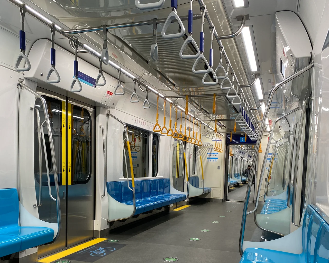
Riding the Ratangga
The experience of riding Jakarta's MRT is a study in contrasts with the city above. Underground stations are air-conditioned, quiet, and equipped with platform screen doors. X-ray machines and metal detectors greet passengers at every entrance. The fare starts at 3,000 rupiah -- about twenty cents -- and increases by 1,000 rupiah per station. Payment is entirely cashless: contactless smart cards, bank-issued electronic cards, QR codes through the MRT-J app linked to digital wallets like GoPay and OVO. During peak hours, women-only carriages operate from 7 to 9 AM and 5 to 7 PM. The system has had one notable incident: on May 30, 2024, a construction crane near Blok M station lost power due to electromagnetic induction from a passing train, dropping an iron beam onto the tracks. No one was injured. The entire line was halted, inspected, and returned to service the next day.
A City Rewiring Itself
Jakarta's MRT is not just a transit system; it is an argument about what kind of city Jakarta intends to become. Phase 2 is being designed around transit-oriented development, integrating stations with mixed-use neighborhoods rather than dropping them into existing sprawl. The Jak Lingko integrated payment card works across MRT, LRT, commuter rail, and the TransJakarta bus rapid transit system -- a single card for a city that until recently had no unified fare structure at all. The Railway Masterplan 2039 envisions fourteen rail lines under DKI Jakarta Provincial Government ownership, including six LRT routes and six Jakarta Urban Railway lines. For a city of ten million that spent thirty-four years arguing about whether to build a single subway line, the scope of the vision is either audacious or delusional. The 82,000 daily riders on Phase 1 suggest it may be the former. The trains run on time. They are clean, fast, and named after ancient chariots. Jakarta is learning to move underground.
From the Air
Located at 6.18S, 106.83E in Central Jakarta. The MRT's North-South Line runs from Lebak Bulus in the south to Bundaran HI, with elevated sections visible as raised guideways in the southern stretch and underground segments disappearing beneath central Jakarta near Merdeka Square. From the air, the elevated stations south of Blok M are clearly visible, as is the Lebak Bulus depot. Nearest major airport is Soekarno-Hatta International (WIII), approximately 25 km northwest. Halim Perdanakusuma Airport (WIHH) is about 12 km southeast.
Nearby Stories
- The King's Footprints in the River 2.8 km away
- Rawagede Massacre 6.4 km away
- The Cruiser That Wouldn't Stop Fighting 14 km away
- Four Minutes Over the Java Sea 14 km away
- The Scholar's Mosque 21 km away
- Through the Cidepong Hills 37 km away
- Ujung Kulon National Park 97 km away
- The Islands That Vanished from Sight 352 km away