Januária
The Spaniards came looking for gold in 1553 and found salt instead. Francisco Bruza de Espinosa and the priest João de Apicuelta Navarro worked their way up the São Francisco River and named their first camp Brejo do Salgado, the salty marsh, for the mineral taste of the water. Gold never materialized in quantities that made anyone rich. What came instead was sugar cane, and from the cane the settlers distilled a rum that, nearly five centuries later, still carries the reputation of being among the finest in Brazil. The town took the name Januária in 1833, in honor of Princess Januária, daughter of Emperor Pedro I.
A River, A Princess, A Name
Brejo do Salgado, the first settlement, began as a sugarcane mill with a chapel to Nossa Senhora do Amparo. By 1833 it had enough residents and economic weight to be elevated to a vila, a township, and the administrative seat was moved to the left bank of the São Francisco River. The new name honored Princess Januária Maria of Braganza, who in that same year had been named heir presumptive to her younger brother Pedro II. In 1860 Januária became a city. The surrounding area was vast, and through the twentieth century a slow process of subdivision carved former districts into new municipalities: Manga, Matias Cardoso, Itacarambi, Bonito de Minas, Cônego Marinho. The municipal boundary still encloses 6,691 square kilometers, ranking it among the seventy-five largest municipalities in Minas Gerais.
Cachaça, Cattle, and Corn
The economy runs on agriculture. Sugar cane remains the crop most associated with Januária's identity because the cachaça made here is prized across the country. Corn, manioc, beans, and rice fill the agricultural statistics. Mangoes, breadfruit, coconut, oranges, avocados, cashew, and bananas grow in scattered orchards. Cattle raising counts about 62,000 head, modest for a municipality of this size. Small industries produce rum, vinegar, cotton goods, shoes, and furniture. The climate is tropical with transition to semi-arid, hot enough that the vegetation includes patches of caatinga thornbush alongside the more open cerrado savanna. The soils along the river are good. Away from the river, agriculture depends on irrigation and the increasingly irregular rains.
The Cave of Janelão
Part of the municipality's territory falls inside Cavernas do Peruaçu National Park, which protects one of the most remarkable karst landscapes in South America. Inside the park is the Gruta do Janelão, a limestone cave so large that stalactites thirty meters long hang from the ceiling and sunlight streams down through a collapsed dolina, the 'janelão,' or great window, that gives the cave its name. Archaeologists have documented thousands of years of human presence here in the form of rock paintings on the cave walls and ceilings. The park is still largely unknown outside Brazil, which is another way of saying it has not yet been loved too much. A permit is required to enter. A guide is mandatory.
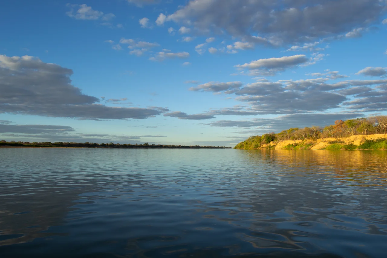
On the Left Bank
Januária's identity is bound to the São Francisco, the long river that stitches together the interior of northeastern Brazil. The river is navigable here, and paddle-steamer tourism still runs in limited fashion between Januária and Pirapora further upstream. A modern bridge has replaced the ferry that used to be the only crossing. The BR-135 highway connects the town to the rest of Minas Gerais, with Belo Horizonte 613 kilometers to the south. Januária Airport sits 5 kilometers northwest of downtown. On summer afternoons the cumulus stacks up over the interior and drops rain in walls that move across the grassland. In winter the river drops, the green thins, and the horizon clarifies.
Small Town, Large Map
The 2020 population was 67,852, with most of that total concentrated in the city center and the remainder spread across districts including Brejo do Amparo, Levinópolis, Pandeiros, Riacho da Cruz, São Joaquim, Tejuco, and Várzea Bonita. Januária serves as the center of a statistical microregion of sixteen municipalities and roughly 246,000 people. The fighter Wilson Reis was born here, a small export to the wider world. The river has carried other exports for longer. A bottle of Januária cachaça, on the shelf of a bar in Rio or São Paulo, is a direct line back to this riverbank and to the salt marsh the Spaniards found when they were looking for something else.
From the Air
Located at 15.49°S, 44.36°W on the left bank of the São Francisco River in northern Minas Gerais at 455 m elevation. Januária Airport (SNJN) sits 5 km northwest of the city, a small regional field used primarily by light aircraft. Recommended VFR cruising altitude 5,000-7,000 ft; the São Francisco River corridor provides strong visual navigation across the largely empty cerrado. Hot, dry climate with transition to semi-arid; summer (December-March) brings afternoon convective storms. Cavernas do Peruaçu National Park lies to the west and is visible as a distinctive karst landscape.
Nearby Stories
- Cavernas do Peruaçu National Park 25 km away
- Janaúba 73 km away
- Caminho dos Gerais State Park 101 km away
- Grão Mogol 139 km away
- Mambaí 149 km away
- Das Velhas River 158 km away
- Unaí 211 km away
- Posse, Goiás 219 km away