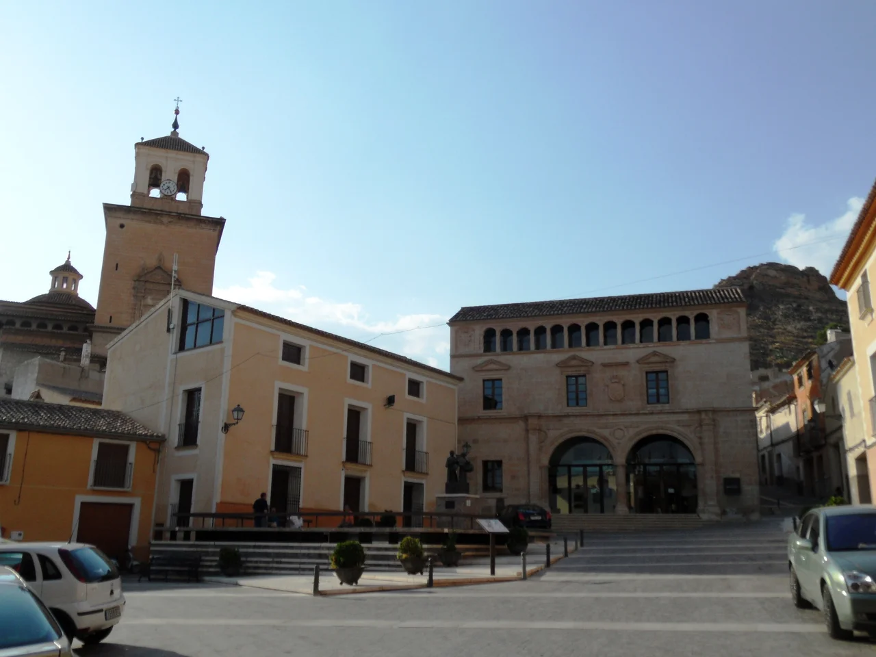

Jumilla
Someone was living on this ground roughly 450,000 years ago. That is the number archaeologists attach to the oldest human remains found at Jumilla, from the Lower Paleolithic, with more evidence from the Middle and Upper Paleolithic and later from the Epipalaeolithic layered on top. Few places anywhere can claim so unbroken a run of habitation. The town that eventually grew here, tucked into the arid northern corner of the Region of Murcia between Cieza and Yecla, still carries that long inheritance in its stones and its vines. Today more than 27,500 people call it home, but they are only the most recent tenants of a spot that human beings have found worth living on for longer than almost anywhere on the peninsula.
Half a Million Years of Neighbors
The deep past here is not an abstraction. Three kilometers from the modern town, at a site called El Prado, archaeologists uncovered the ruins of a Chalcolithic hamlet, home to some 300 people who lived in huts built from reeds and mud adobe. Move forward to the 5th century AD and Jumilla still had something to leave behind: El Cason, a paleo-Christian funerary vault built in the shape of a Greek cross, survives from late antiquity as one of the town's oldest standing monuments. Each era simply built where the last had lived, drawn back again and again to the same defensible high ground and the same reliable trickle of water in a landscape with no permanent rivers, only the seasonal creeks the locals call ramblas.
The Hill and Its Many Forts
The castle hill tells the whole story in miniature. Bronze Age settlers held it first, then Iberian peoples, then the Romans, each generation recognizing the same tactical prize. When Berber and Arab armies entered the Iberian Peninsula in 711 and the surrounding country fell under Muslim rule, a fortress rose here too, though built of materials that would not last. The medieval frontier ran straight through these hills. In the mid-13th century the ruler of the Taifa of Murcia, squeezed between the advancing troops of Castile and the emir of Granada, struck a bargain with the Castilian prince who would become Alfonso X, an agreement meant to protect the lives and property of the people living under him. The Gothic castle that crowns the hill today, its main tower still commanding the plain, was raised in 1461, the latest fort on a summit that had held one form of stronghold or another for three thousand years.
The Kingdom of Monastrell
Wine is what Jumilla is best known for now, and one grape rules the vineyards: Monastrell, the thick-skinned red the French call Mourvedre, which thrives in exactly the kind of hot, dry, stony ground that would defeat lesser vines. From it the region makes deep, powerful reds, including the Carta Roja label that carried Jumilla's name abroad. Vineyards share the land with olive groves and fruit trees, and alongside neighboring Yecla the district became one of the heartlands of the Murciana and Granadina dairy-goat breeds. The 21st century left its mark too: a vast photovoltaic solar farm spread across 100 hectares, its 120,000 panels billed on opening as one of the largest in the world, generating power equivalent to the needs of some 20,000 homes.
When August Belongs to the Streets
For much of the year Jumilla is a working town of cellars and orchards, but in August it turns itself inside out. The grape-harvest festival arrives with the patron saint's celebration, ten or eleven days of processions and revelry timed to the ripening fruit. The Moros y Cristianos parades restage, in costume and mock combat, the long medieval contest between Muslim and Christian rule that shaped these very hills, and a national folklore festival draws performers from beyond the region. Earlier in the year comes Holy Week, its solemn processions still centered on churches like San Anton, built in 1611 on a Greek-cross plan and now a museum devoted to the season's traditions. The same streets that hold half a million years of history fill, for a few weeks, with drums and color.
From the Air
Jumilla sits at 38.48 degrees N, 1.32 degrees W, on a dry inland plateau in the far north of the Region of Murcia, ringed by the Sierra del Carche, Sierra del Buey, and Sierra de la Pila. The clearest visual landmark is the Gothic castle and its square main tower crowning the hill directly above the town, with a broad mosaic of vineyards and olive groves spreading across the plain below and the geometric grid of the large solar array catching the sun nearby. A viewing altitude of 3,000 to 5,000 feet above the terrain shows the town, its castle hill, and the surrounding sierras together. The nearest major airport is Region de Murcia International (LEMI) to the south; Alicante-Elche (LEAL) lies to the east toward the coast. The semi-arid climate keeps skies clear and visibility long through most of the year.
Nearby Stories
- Monte Arabí 5.3 km away
- Castle of Banyeres 6.2 km away
- Agost 6.5 km away
- La Fonteta Phoenician Port 6.7 km away
- Al-Andalusian Palatial Complex of San Esteban 19 km away
- Castle of Alarcon 101 km away
- Castle of Belmonte 151 km away
- Cabo de Gata-Nijar Natural Park 154 km away