,_Hong_Kong.jpg)
Junk Bay
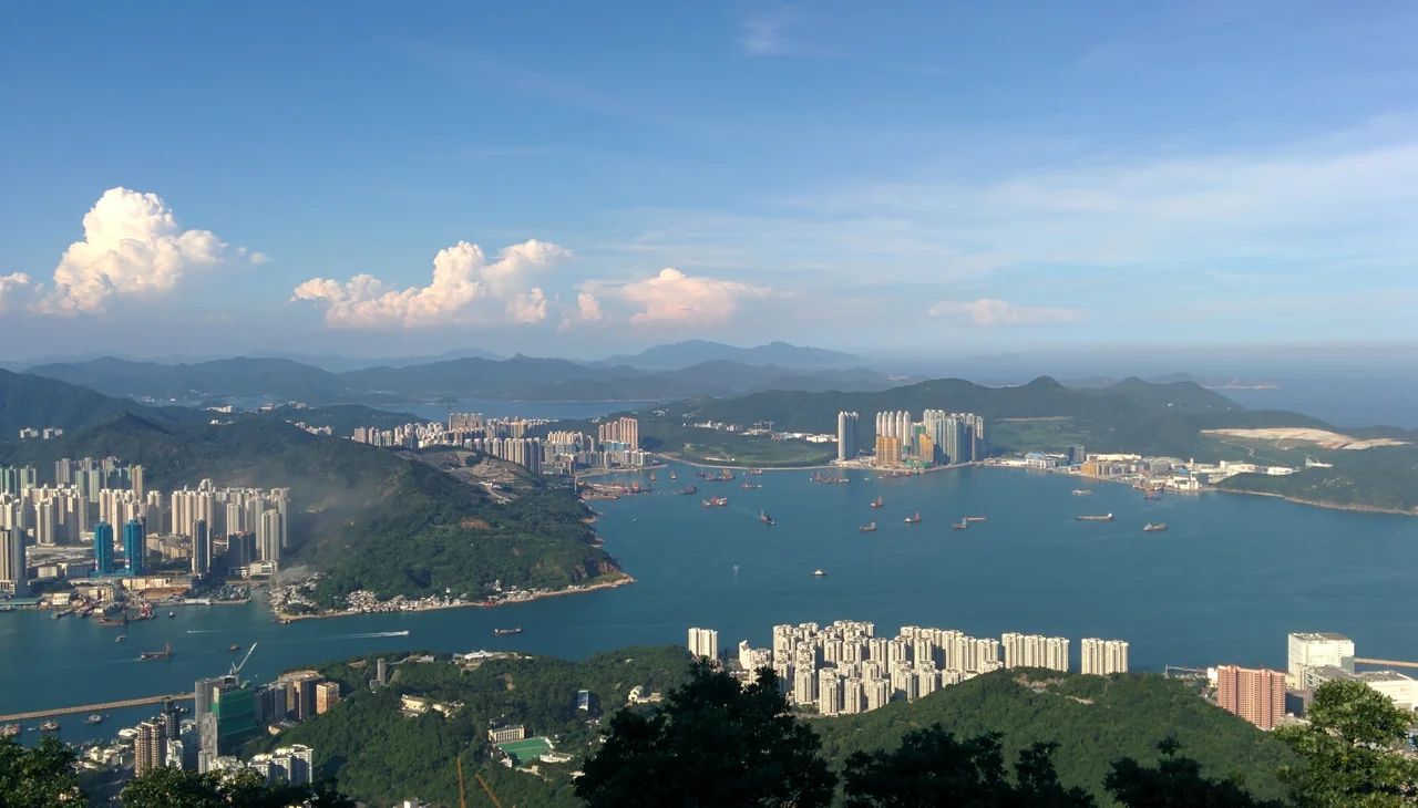
The English name sounds accidental, even a little unglamorous. Junk Bay: a bay full of junks, the flat-bottomed Chinese sailing vessels that once crowded these waters. But the Cantonese name carries more weight. Tseung Kwan O — the General's Bay — was named, according to one theory, for a Ming dynasty soldier who passed through. Another theory credits the 17th-century naval battles fought here against Japanese pirates. The exact origin is unresolved, and the locals seem to find the ambiguity fitting: a place named for power and conflict that has become, in the 21st century, one of the most ordinary and comfortable corners of Hong Kong, home to nearly 370,000 people living in high-rise flats on land that used to be seawater.
Fishing Villages to Market Town
Long before reclamation engineers arrived with their plans and machinery, people lived around this bay. Settlements appear in the historical record as early as the 13th century, and a Ming dynasty provincial gazette — the Genuine Record of Guangdong Province — already contained the place name Tseung Kwan O. Major villages weren't established until the late 16th century, but once they appeared, they thrived. Hang Hau grew quickly into a market town and became the most populated and prosperous settlement on the entire Clear Water Bay Peninsula, holding that position for several centuries. Other communities developed alongside it — Rennie's Mill (later known as Tiu Keng Leng), Yau Yue Wan, and the old Tseung Kwan O village itself. The bay was well-placed for maritime trade, sitting near the eastern mouth of Victoria Harbour. It was also, at times, a place of political refuge: after the Chinese Civil War ended in 1949, Kuomintang loyalists were settled at Rennie's Mill, which for decades operated as a semi-autonomous enclave before its residents departed for Taiwan in 1996.
The Long Work of Filling a Bay
Hong Kong's new town program — one of the most ambitious urban planning exercises in the world — created nine new towns across the New Territories in the latter half of the 20th century. Tseung Kwan O was among the most challenging, because the bay it would occupy is unusually deep. The Hong Kong government had identified the site as promising for decades, but kept deferring the project because of the sheer scale of reclamation required. When they finally committed to it in 1983, the Phase I plan called for a population of about 175,000. By 1988, the ambition had grown to 490,000. The landfill that underlies much of today's Tseung Kwan O New Town covers 1,790 hectares in total. It is worth pausing on that number: an entire district of a major global city, containing schools and shopping centers and parks and hospitals, sits on ground that did not exist in nature. The first landfill in the bay opened in 1978, years after Junk Bay received its English name — which means, as Wikipedia puts it with quiet precision, that the "junk" almost certainly refers to ships, not to the detritus deposited later.
A City Built for Living
Tseung Kwan O today has five distinct neighborhoods — Po Lam, Hang Hau, Tseung Kwan O, Tiu Keng Leng, and LOHAS Park — each served by its own MTR station. Four are on the Tseung Kwan O Line; Tiu Keng Leng station is the eastern terminus of the Kwun Tong Line, with interchange to the Tseung Kwan O Line. The population as of 2011 stood at around 368,000. Walk through any of them and you find the dense, functional urbanism that defines Hong Kong's newer districts: towers of thirty and forty stories, promenades along the waterfront, wet markets and chain stores in the lower floors of residential complexes. It is not a place that draws tourists in the way that Mong Kok or Sheung Wan do. It draws residents — people who want newer apartments, quieter streets, and reasonable MTR access to the urban core. There is a particular kind of dignity in a place that was designed for ordinary life and has delivered it at scale. Fat Tong Chau, a small island in the southeastern corner of the bay, is a reminder of the geography that existed before the engineers arrived.
What the Name Carries
Names accumulate meaning slowly, and sometimes the meaning they end up carrying has little to do with origin. Tseung Kwan O started as a bay, became a collection of fishing villages, served as a refuge for the politically displaced, and transformed into a planned city. The English name, Junk Bay, once conjured images of wooden-sailed vessels threading through these waters. Now it evokes something quieter: a bay that isn't really a bay anymore, overlooked by apartment towers and crossed by the MTR. But the Cantonese name persists, spoken daily by hundreds of thousands of people who may or may not know anything about the Ming general or the 17th-century pirates. A place can carry its history without advertising it. Tseung Kwan O does exactly that.
From the Air
Junk Bay lies at 22.29°N, 114.26°E in Sai Kung District, east of Kowloon. From 2,500–4,000 feet, the reclaimed urban districts of Tseung Kwan O New Town are clearly visible as a dense grid of high-rise towers fringing the bay's northern reaches, while the bay's southern portion opens toward the South China Sea. Fat Tong Chau island sits in the southeastern corner. Hong Kong International Airport (VHHH) is about 45 km to the west. The Tseung Kwan O–Lam Tin Tunnel cuts through the hills to the west, connecting this district to urban Kowloon.
Nearby Stories
- Shek Pik 1.7 km away
- Tung Ping Chau 4.8 km away
- Hong Kong 12 14 km away
- Wanshan Archipelago Campaign 16 km away
- Pearl River Delta 18 km away
- Battle of Penghu 478 km away
- Penghu Air Raids 487 km away
- Cape Maobitou 596 km away