
Jurby
Jurby's name comes from djura-by, the Old Norse for a deer farm or animal park, and the syllables have been worn down by eight centuries of Manx tongues into something softer. The earliest written form is Dureby, recorded in 1291; by 1588 it had taken its current shape. The same root produced Derby in England, but the lordly transplant of that name to the Isle of Man arrived much later, through the surname of the Stanley Lords of Mann at Derbyhaven. Jurby is older, quieter, and tied to the land in a way the borrowed name never quite captured. It is one of the seventeen parishes of the Isle of Man, set on the north-west coast in the traditional North Side, in the sheading of Michael.
Geography of the Flat Edge
The northern plain of the Isle of Man tilts gently into the Irish Sea here, and the highest points in the parish are coastal dunes barely 39 metres above the waves. Jurby borders Andreas to the east, Lezayre to the south-east, and Ballaugh to the south. The 2021 census recorded a parish population of 780, almost identical to 2016's 776 and slightly down from 2011's 797. People do not move to Jurby in droves; people stay. For the purposes of local government, the parish forms a single district run by commissioners, with John James Quayle serving as Captain of the Parish since 1999. Politically it sits in the Ayre and Michael constituency, returning two Members to the House of Keys.
The Airfield's Three Lives
Jurby Airfield was originally an RAF training base built during World War II, and it remained a training establishment through the 1950s, when officer cadets on short-term commissions arrived for three-month courses. Once that purpose faded, the parish reinvented the same patch of asphalt three different ways. Part is now an industrial and retail estate. The runways and taxiways have become the Jurby motorcycle race track, used during the island's intense racing calendar. The grassland around the strips has never been ploughed, which is why skylarks can still be heard there in summer when no machines are running. A large area carries statutory protection under the Wildlife Act 1990 as an Area of Special Scientific Importance. War, work, and wildflowers, layered on the same flat field.
Saints, Vikings, and Music
Jurby's first recorded church was a tiny 8th-century chapel dedicated to St Cecilia, the patron saint of music, and St Cecilia's Day on 22 November remained the parish festival for centuries. Several Viking carved crosses and gravestones survive within the church, and medieval objects have occasionally surfaced when new graves were dug. In medieval times the parish belonged to the Whithorn diocese in south-west Scotland, an arrangement that proved awkward when the English and the Scots were at war. The bishop once invited his Manx clergy across to visit and was rebuked by English authorities for fraternising with the enemy. The present St Patrick's Church was built during World War II with help from the RAF, and its churchyard holds war graves for British, Commonwealth, and Polish servicemen, most of whom died in training accidents.
The Museums in the Hangar
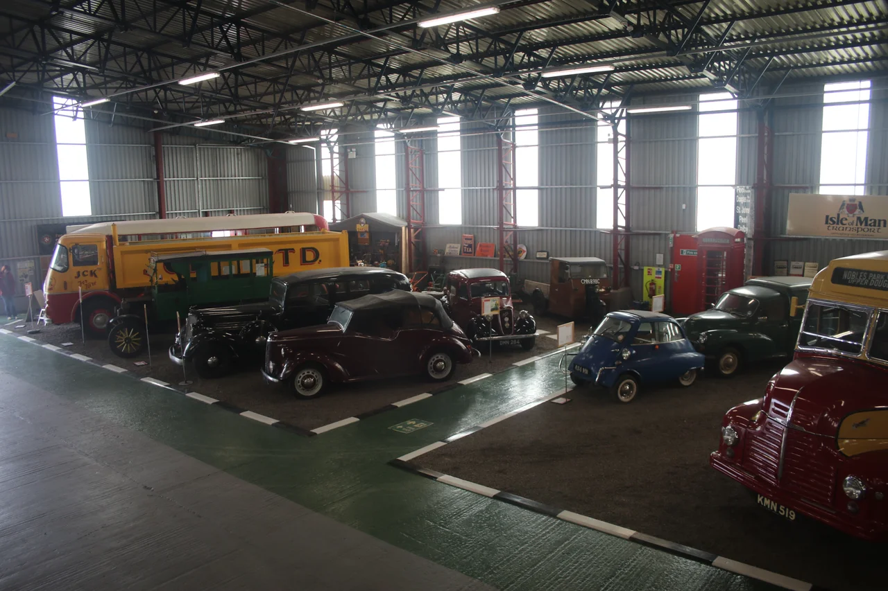
An old aircraft hangar now houses the Jurby Transport Museum, dedicated to the buses, lorries, trams, and locomotives that once moved people and goods around the island. Nearby, the Isle of Man Motor Museum was officially opened by the Lieutenant Governor on 22 May 2015. The two museums together turn the airfield into something of a transport memory bank. The parish was historically subdivided into five treens with names that still trip pleasantly off the tongue: Sertfell, Knoksewell, Dalyott, Slekby, and Le Soulby. Stand at St Patrick's churchyard on the headland and the views run south to Peel, north to Scotland, and inland across the rural north of the island towards the hills. It is a parish made of layers, easy to underestimate from a distance, hard to forget once you have walked it.
From the Air
The parish of Jurby centres on 54.353N, 4.508W (gcsv1). The nearest active airport is Isle of Man Airport (Ronaldsway, EGNS) about 20 nm south. The closest active general aviation strip is Andreas Airfield 3 nm east; the local gliding club operates from there. The old Jurby airfield itself remains visible from above as a triangular pattern of disused runways now serving as motorcycle racetrack and industrial estate. For a low flight over the parish, 1,500 to 2,500 ft AGL gives clear sight of St Patrick's Church on its headland, the dunes along the west coast, and the broad sweep of the northern plain. The Point of Ayre lighthouse stands 7 nm to the north-east and is visible in clear conditions.
Nearby Stories
- Kirkmaiden 3.2 km away
- Isle of Whithorn 4.1 km away
- Santon Railway Station 13 km away
- Solway Firth 16 km away
- St Bees Lighthouse 19 km away
- Portavogie 34 km away
- Walney Island 40 km away
- German submarine U-1024 55 km away