Kasai-Oriental
One-tenth of the world's industrial diamonds, by weight, come out of the ground here every year. The figure sounds fantastic until you visit Mbuji-Mayi, the provincial capital, and realize that the entire city is built on top of the largest diamond accumulation ever found - more concentrated, geologists say, than the famous deposits at Kimberley in South Africa. Kasai-Oriental is small by Congolese standards, about the size of a medium European country, and it has been shaped by stones that nobody eats.
A Province Dismantled and Remade
In 2015 the Democratic Republic of the Congo completed a long-promised reorganization of its provinces, and the old Kasai-Oriental was broken into three new provinces: Kasai-Oriental itself, Lomami, and Sankuru. The new Kasai-Oriental is a compact version of the old - essentially the Tshilenge district plus the independently administered city of Mbuji-Mayi. It corresponds closely to the territory of the short-lived Sud-Kasai, the secessionist state that existed from 1960 to 1962. The province has five territories: Kabeya-Kamwanga, Katanda, Lupatapata, Miabi, and Tshilenge. French is the official language, but Tshiluba is what you hear in the markets - one of the Congo's four national languages, spoken by about 6.3 million Luba across the Kasai region.
The Secession
When the Congo gained independence from Belgium in 1960, the country fell almost immediately into crisis. Ethnic violence pushed Luba communities out of the Kasai and neighboring Katanga. Belgian mining interests, eager to keep their concessions, encouraged the Luba leader Albert Kalonji to declare the province of South Kasai independent. The central government under Patrice Lumumba opposed the split. After being repulsed at first, Congolese forces occupied the province in September 1961. Several thousand people were killed during what the victors called the 'pacification' of South Kasai - a campaign that rolled on through the spring of 1962. The numbers remain uncertain; the grief does not. Mbuji-Mayi's population surged as displaced Luba arrived from every direction, choosing the Kasai over the roads.
The Diamond City
Mbuji-Mayi grew from a company town into a city of more than two million. The Societe Miniere de Bakwanga - still the dominant player - manages the industrial extraction, but artisanal mining has been part of the city's informal economy for decades, with tens of thousands of people scratching at the sandstone with hand tools. Industrial diamonds are not the glamorous kind; they go into cutting bits, drill heads, and grinding wheels rather than engagement rings. But the scale at Mbuji-Mayi is unlike anywhere else - a geological accident from volcanic kimberlite pipes that pushed the stones close enough to the surface that they can be found, literally, in the red clay under people's houses.
Life on the Diamond Field
The contradiction of Kasai-Oriental is the contradiction of the Congo. The province sits on fabulous mineral wealth and remains one of the poorest parts of the country. Mbuji-Mayi's infrastructure has lagged far behind its population. Electricity is intermittent. The roads outside the city turn to red mud in the rains. And yet the place has its own stubborn culture - Tshiluba music, Luba Catholic liturgy, the markets where diamonds are weighed on small scales next to dried fish and okapi-printed cloth. People who leave come back. People who stay build whole neighborhoods from what the ground yields. The largest diamond accumulation in the world has not made Kasai-Oriental rich. But it has made it particular, and it has made it persistent.
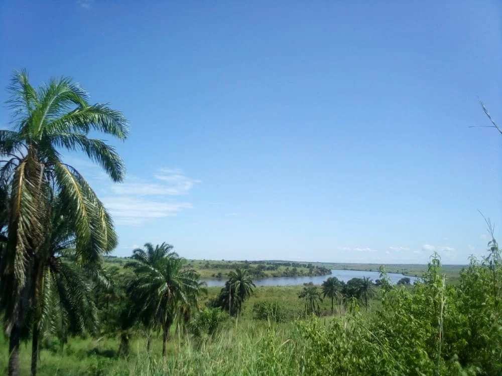
The Province from Above
From altitude Kasai-Oriental reads as a patchwork of savanna woodland and cultivated valleys, with rivers - the Sankuru, the Lubilashi, the Lubi - threading through in loops and oxbows. Mbuji-Mayi announces itself as a red-brown scar in the green, streets radiating from the river crossings. The outer territories are quieter, more rural, with villages along the roads and the occasional truck raising a plume of dust that stays in the air long after the vehicle has passed. Kimberlite pipes do not look like much from the air. But they are why the city is here, and why its skyline glitters after dark with the lights of a place that, against every prediction, has kept growing.
From the Air
Kasai-Oriental centers around 6.15°S, 23.60°E on the central Congolese plateau, at roughly 600-700m elevation. Mbuji-Mayi Airport (FZWA) has a paved runway of about 2,150m and serves the provincial capital with flights from Kinshasa, Lubumbashi, and regional destinations. The terrain is relatively flat savanna-woodland mosaic; the Lubilashi River is a useful visual landmark running through the city. Weather is tropical: wet season October-May with thunderstorms, dry season June-September with significant harmattan dust haze reducing visibility. Cruise altitude FL200-FL280 offers clear orientation.
Nearby Stories
- Lomami Province 26 km away
- Luba Empire 194 km away
- Lulenge 255 km away
- Lukuga River 295 km away
- Kisenge 484 km away
- Kipupu Massacre 601 km away
- Congo Basin 659 km away
- Chinyingi 829 km away