Lukuga River
When Henry Morton Stanley arrived at the Lukuga in 1876, he saw not a river but a large creek extending westward for a great distance. The lake level was low. Three years later, Joseph Thomson found a fast-flowing river at the same spot. By 1882, Hermann von Wissmann watched a wide and fast effluent pouring out of Lake Tanganyika, with the lake itself 4.8 meters below its highest watermark. The same river, on four visits across eleven years, had been three completely different things. The Lukuga is Africa's most sensitive hydrological instrument - a river whose flow depends on centuries of climate, not just this year's rains.
The Only Way Out
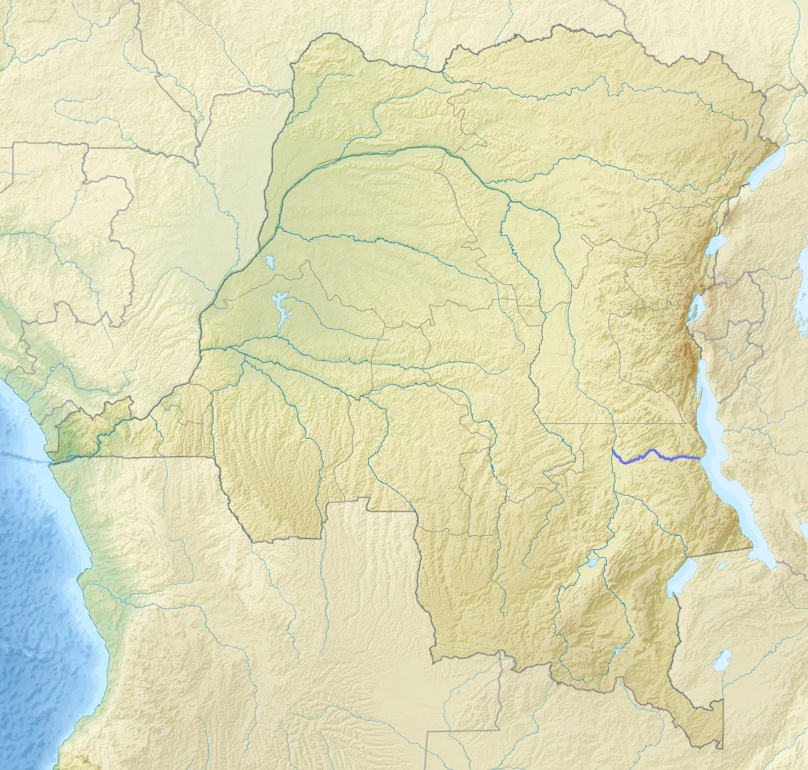
Lake Tanganyika is enormous - the second-largest lake in Africa by area, the deepest in the continent, and one of the oldest bodies of fresh water on Earth. Water pours in from its watershed. Most of it leaves the lake as evaporation under the central African sun. Only 18 percent leaves as liquid water, and all of that goes through a single outlet: the Lukuga. The river starts at Kalemie, on the lake's western shore, and slips through a gap in the highlands running along the northern edge of the Katanga Plateau. It flows roughly 350 kilometers westward through Tanganyika Province to join the Lualaba River between Kabalo and Kongolo. The Lualaba eventually becomes the Congo. The chemistry of the Lukuga's water carries the signature of its source - heavily mineralized, with unusual proportions of magnesium and potassium over calcium and sodium, caused by hydrothermal inputs from the Albertine Rift. You can trace the same pattern at the outlets of Lake Kivu and Lake Edward.
A River of Recent Origin
The whole hydrological arrangement is geologically young. Before the Virunga volcanoes erupted and blocked the northward drainage of Lake Kivu, the Kivu waters flowed toward Lake Edward. When that path closed, the water had to go somewhere - it went south, through the Ruzizi River, and into Lake Tanganyika. Before that change, Tanganyika may have had no outlet at all, losing water only to evaporation, its sub-basins perhaps separated. The Lukuga formed in response to the new overflow. This is why aquatic species from the Congo Basin can be found colonizing Lake Tanganyika - they followed the Lukuga upstream. The river flow peaks in May and bottoms out in November, tracing the seasonal rhythm of the lake. But over longer timescales, it responds to continental climate: wetter periods like the Neolithic Subpluvial around 4000 BC change its volume dramatically. Since 1965 the outflow has tended to increase even as the Congo system's total outflow has declined. The Lukuga measures climate in a way other rivers cannot.
Fire Kings and Secret Societies
Before Europeans drew maps of the region, the Lukuga's northern bank, together with Lake Tanganyika, the Luvua River to the south, and the Lualaba, formed a territory occupied by the Hemba people in the western part and the Tumbwe people in the more mountainous east. Tumbwe leaders called kasangas ruled various small states along the river. Around 1800, the Luba emperor Ilunga Sungu launched raids over the Lualaba that reached as far as Kalemie on the lake. Some Luba settled in the region, and the local population came under Luba influence during the subsequent reigns of Kumwimbe Ngombe and Ilunga Kabale. The Luba response to governing this distant frontier was the 'fire king' - a local ruler treated as near-equal to the Luba emperor, sending only occasional tributes. The Bamdudye and Bakasandji secret societies carried origin myths that legitimized the fire king's authority, and by the late nineteenth century the Holoholo people of Kalemie had adopted and adapted these traditions. Kyombo Mkubwa, a Hemba state, became the main Luba client. By the time Europeans arrived, a new force from the south - Msiri's son Simbi - had allied with the Hemba rulers and detached Kyombo Mkubwa from the Luba heartland. The political map of the Lukuga was already moving when Livingstone showed up.
The Sandbar Mystery
Around 1871 David Livingstone noticed a break in the hills through which something he called the 'Logumba' passed, and suggested it might be an outlet of Lake Tanganyika. Verney Lovett Cameron confirmed in May 1874 that it was the only outlet - though he could not find a guide willing to take him downriver to verify where it went. Stanley arrived in 1876 and saw the creek. A sandbar had formed at the river's mouth, silting the channel behind it. Thomson came three years later and found a large, fast-flowing river; the sandbar had broken. By the time von Wissmann arrived in 1882, the river was a wide torrent. What Stanley, Thomson, and von Wissmann were actually watching, without knowing it, was a natural lake-level cycle. When the lake rose high enough, it would punch through whatever sediment blocked the outlet. When the lake fell, the Lukuga would slow, silt, and sometimes stop. No Nile-like pattern of predictable annual flood applies here. The Lukuga is a gate that opens when the lake decides.
The Kayaker
In December 2010 the well-known South African kayaker and explorer Hendrik Coetzee was dragged out of his kayak on the Lukuga and killed by a crocodile. Coetzee had paddled many of Africa's rivers; he was experienced and aware of the risks. The Lukuga is home to hippopotamuses and crocodiles, and below Kalemie, pollution from upstream communities now joins these older dangers. The river reaches the Lualaba highly polluted, carrying industrial and human waste from a basin that has changed faster than its infrastructure. Coetzee's death is an individual tragedy and also a reminder of what this river still is: a wild outlet, geologically young, running through country that has not been tamed for tourism or gentled for anyone's convenience. The Lukuga was a creek in 1876 and a torrent by 1882. Whatever it looks like today, it will look like something different soon enough.
From the Air
Coordinates: 5.66°S, 26.92°E. The Lukuga is a clearly visible water feature running westward from Kalemie on Lake Tanganyika through a gap in the Katanga Plateau highlands. At cruise altitude the contrast between the dark lake, the river corridor, and the miombo plateau is distinctive. Nearest airports are Kalemie (FZRF) and Kongolo (FZRQ). VFR visibility is typically excellent during the dry season.
Nearby Stories
- Niemba Ambush 8.7 km away
- Lake Uniamési 12 km away
- Lulenge 93 km away
- Tanganyika Province 130 km away
- Luba Empire 198 km away
- Kipupu Massacre 246 km away
- Bujumbura 357 km away
- Kisangani 676 km away