
Katafyki Cave
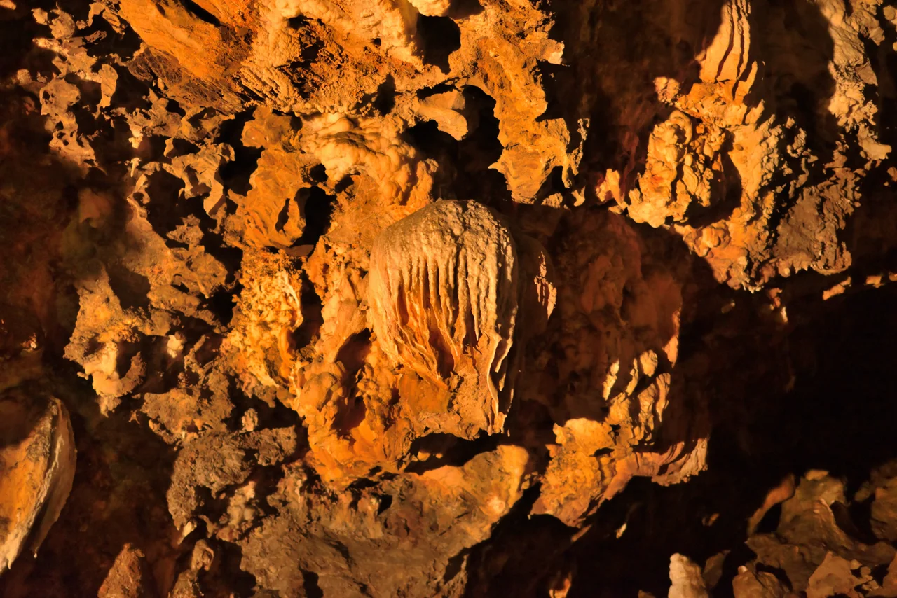
The village of Dryopida sits above the cave. Residents have always known it was there: the Greek name, Katafyki, means refuge, and over the centuries the cave has served as exactly that — a place to retreat to during pirate raids, a shelter in dangerous times, a space where the rock itself offered protection. Later, from 1835 to 1940, it became an industrial site, its passages widened by blasting, its hematite ore extracted by workers whose tools left marks still visible on the walls. Today visitors walk the same corridors, past remnants of rails and wagons, into chambers where stalactites have been given names: the jellyfish, the octopus, the teddy bear, the Tower of Babel.
What the Cave Contains
More than 600 meters of natural cave passage have been mapped at Katafyki. To that natural extent, the centuries of iron mining added a man-made gallery running some 2,000 meters — a substantial industrial excavation for a small Aegean island. The cave's passageways cover an estimated 3,500 square meters in total. Entering from within the settlement of Dryopida itself, visitors pass first through a 'small plateau,' then into a 'large piazza' — an open internal space where, within living memory, the people of Dryopida gathered to celebrate religious festivals after the Resurrection at Easter. Beyond the piazza, corridors branch to the right. Two of them lead to the stalactite hall, measuring 25 by 17 meters, where formations in shades of white, ochre, and rust grow from floor and ceiling alike. The rocks stratify visibly into shale, marble, and slate. Iron ore veins the walls.
A Mine Since Antiquity, Perhaps
Ancient literary sources mention metal mines on Kythnos, and it is possible that extraction at Katafyki goes back much further than the modern record confirms. The documented history of iron mining here runs from 1835 to 1940 — a span of just over a century. After 1910, foreign companies took over exploitation of the remaining deposits. By World War II, the mines were largely exhausted, and the young people of Kythnos who might have worked them were already leaving for Athens and elsewhere. The cave closed to public access at various points due to the ravines and drops that mining activity had left behind. In July 2015, after a two-year suspension by the Ministry of Culture on safety grounds, the cave reopened, now illuminated and accessible via a circular path that guides visitors through its passages at a maintained temperature of 17 degrees Celsius.
Blasting and Devotion
Two forces have shaped Katafyki's interior in opposite directions. Mining blasting destroyed much of the original stalactite and stalagmite decoration — formations that took tens of thousands of years to grow were removed in seconds by the demands of 19th- and early 20th-century iron extraction. What survived the mining then faced, to a lesser extent, the heat and smoke of the ritual fires that accompanied the Easter celebrations held in the large piazza. The combination gives the cave a layered character: ancient geology, centuries of shelter, a century of industrial use, periodic community ceremony, and now tourist infrastructure — rails still embedded in the rock, wagon remnants visible in niches, and a Tower of Babel stalagmite rising from the floor of a chamber that once echoed with the sounds of a mine at work.
Giorgos Martinos and the Science of Shelter
The cave carries a second name: the Giorgos Martinos Cave, in honor of the geologist who formally studied it. That scientific investigation documented the 'schratten' or rock curtains — the distinctive corrugated formations produced when water sheets down vertical rock faces rather than dripping from a tip — which make Katafyki notable in speleological terms. The geologist Fiedler also described the cave in the 1830s, in what appears to be among the earliest systematic accounts of its interior. The Municipality of Kythnos now manages the site. For a cave that spent much of the past two centuries being hollowed out by industry, Katafyki has found a second life as one of the more distinctive visitor experiences in the Cyclades.
From the Air
Katafyki Cave is located within the village of Dryopida on Kythnos, at approximately 37.382°N, 24.430°E. Kythnos lies in the western Cyclades, about 56 nautical miles southeast of Piraeus. From the air, Dryopida is identifiable by its unusual tiled rooftops — unlike the flat-roofed whitewashed villages typical of the Cyclades. The cave entrance sits at the edge of the settlement, invisible from above but accessible on foot from the village center. The nearest major airport is LGAV (Athens International Eleftherios Venizelos), roughly 70 km to the northwest. Kythnos has no airport; ferry service from Lavrio and Piraeus provides the only connection, with crossings running one to four hours.
Nearby Stories
- MS Express Samina 12 km away
- Hellenic Centre for Marine Research 13 km away
- HMHS Britannic 16 km away
- Greek Cruiser Elli (1912) 26 km away
- Sifnos 29 km away
- Hydra: Fire Ships and Stone Mansions 38 km away
- Greek Islands 43 km away
- SS Slamat 66 km away