
Kay Moor, West Virginia
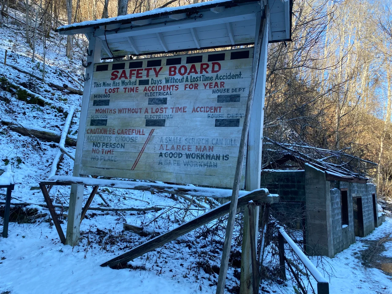
Most coal towns built on flat ground. Kay Moor built up a cliff. The mine portal sits on a narrow shelf called Sewell Bench, 560 feet above the river. The processing plant sits on the river bank at Kaymoor Bottom, where the Chesapeake and Ohio Railway runs along the canyon floor. Between them, a complex system of conveyors and rail incline carried coal down the cliff face from the seam to the loading tipple. Workers walked up. The town that grew around this vertical arrangement existed from 1899 to the early 1960s. Now it is one of the most evocative ruins in the New River Gorge - a stacked, gravity-driven coal operation slowly being eaten by the forest and preserved by the National Park Service.
An Iron Company's Coal Reserve
Abiel Abbot Low was a New York merchant and shipping magnate who in his later years invested in the iron industry. He served as managing director of the Low Moor Iron Company, based in Low Moor, Virginia, which needed coal and coke for its blast furnaces. In 1873 his company bought a tract along the New River Gorge that contained promising outcrops of the Sewell Seam. They did not develop it immediately. The property sat in reserve for 26 years while the gorge's other operators - Nuttallburg, Thurmond, the Chesapeake and Ohio - established the infrastructure. In 1899, the Low Moor Iron Company finally opened the Kay Moor mine, its name a combination of James Kay - the company employee put in charge of building the town - and the Low Moor Iron Company itself. The Sewell Seam delivered low-volatile, low-ash, low-sulfur smokeless bituminous coal - the very best fuel for coke ovens.
Stacking the Town
Because the seam ran in the bench above the river but the railroad ran along the river itself, the operators had to solve a problem of vertical logistics. They did so with three levels. At Kaymoor Top, on the plateau above the gorge, sat the management offices, the schoolhouse, and the residences of the higher-paid workers. At the Kaymoor Mine level, partway down the cliff on Sewell Bench, were the mine portal, the head house, and the homes of most of the miners. At Kaymoor Bottom, on the river bank, stood the coal preparation plant, the coke ovens, and the rail siding. Coal moved down by conveyor and incline; workers and supplies moved up and down by a haulage system known as the man-trip. Most of the town's residents were Black and immigrant workers, drawn to the gorge for steady wages by industry standards.
Decline and Closure
In 1925, the Low Moor Iron Company sold the Kay Moor operation to the New River and Pocahontas Consolidated Coal Company, a subsidiary of the Berwind-White Corporation of Philadelphia. Production continued through the Depression and World War II, but the postwar coal market shifted hard against smokeless bituminous coal. Diesel locomotives replaced coal-fired ones on the railroads, and the steel industry consolidated its sourcing. The mine closed in 1962. The Kay Moor population dispersed. The conveyors, tipple, and coke ovens were left to the gorge. In 1978, what remained was added to the National Register of Historic Places, and the entire site eventually came under National Park Service management as part of New River Gorge National Park and Preserve.
Walking the Ruins
Today Kay Moor is accessible to hikers on two trails. The Kaymoor Miners Trail descends steeply from Kaymoor Top - reachable from County Route 9/2 off US Route 19 - by stairs and switchbacks, then continues down to Kaymoor Bottom by another long set of stairs. The route is dramatic and demanding, with the gorge walls rising on either side. A second option, the relatively flat 2-mile Kaymoor Trail, runs along the Sewell Bench from a trailhead on County Route 82, reaching the mine level without the climb. The ruins at the mine level include the head house, conveyor foundations, and various buildings being slowly absorbed by hardwood forest. The lower town has more substantial standing structures. Across the river, the similarly preserved Nuttallburg complex offers another view of the same era. Both are testaments to the vertical, hard-labor industry that built the gorge.
From the Air
Kay Moor sits at 38.05 N, 81.06 W, on the western wall of the New River Gorge in Fayette County, West Virginia. Recommended viewing altitude is 3,000 to 5,000 feet AGL. The mine bench halfway up the gorge wall and the river-level processing complex are both visible from the air; the New River curves north past the site. Nearest airports are Raleigh County Memorial (KBKW) in Beckley about 18 miles southwest and Yeager (KCRW) in Charleston about 38 miles west-northwest. Best aerial visibility is late October through early April when leaves are off the trees.
Nearby Stories
- West Virginia State Capitol 4.7 km away
- Greenbrier County, West Virginia 13 km away
- Beckley, West Virginia 13 km away
- Clay, West Virginia 16 km away
- The Greenbrier 18 km away
- Webster Sycamore 26 km away
- Kanawha State Forest 26 km away
- Welch, West Virginia 40 km away