
Kenmare River
It is not a river. It is a bay - a long, narrow, drowned glacial valley between two peninsulas in south-west Ireland, cut by ice and flooded by the Atlantic when the seas rose. But on every official map and in every guidebook, it is called the Kenmare River. The reason is fishing rights. In the 1600s and 1700s, the Marquess of Lansdowne and his agents found it convenient to call this bay a river because rivers belonged to whoever owned the banks, while the sea belonged to everyone. So the maps were drawn with the word river on them, and the word stuck. The fish - and the salmon especially - became the marquess's. Three centuries later, the salmon are still here, the bay is still called a river, and the great map of Ireland still preserves a quiet act of seventeenth-century property law.
Between Two Peninsulas
The Kenmare River stretches roughly 35 kilometres from the town of Kenmare at its head to the open Atlantic at its mouth. The Iveragh Peninsula forms the northern shore, with its mountains and stone forts and the towns of Sneem and Waterville. The Beara Peninsula forms the south, with Eyeries and Allihies and Castletownbere. Most of the bay belongs to County Kerry, though a small slice of the south-western end is in County Cork. The bedrock is Old Red Sandstone, the rust-coloured stone of the Devonian period, laid down when this part of Ireland was a desert near the equator. The shape of the valley was carved out by glaciers and then flooded when the last ice age ended. What you see today is a ria - a drowned river valley - which is why it is so narrow, so deep, and so unlike any actual river you have ever stood beside.
Islands in the Bay
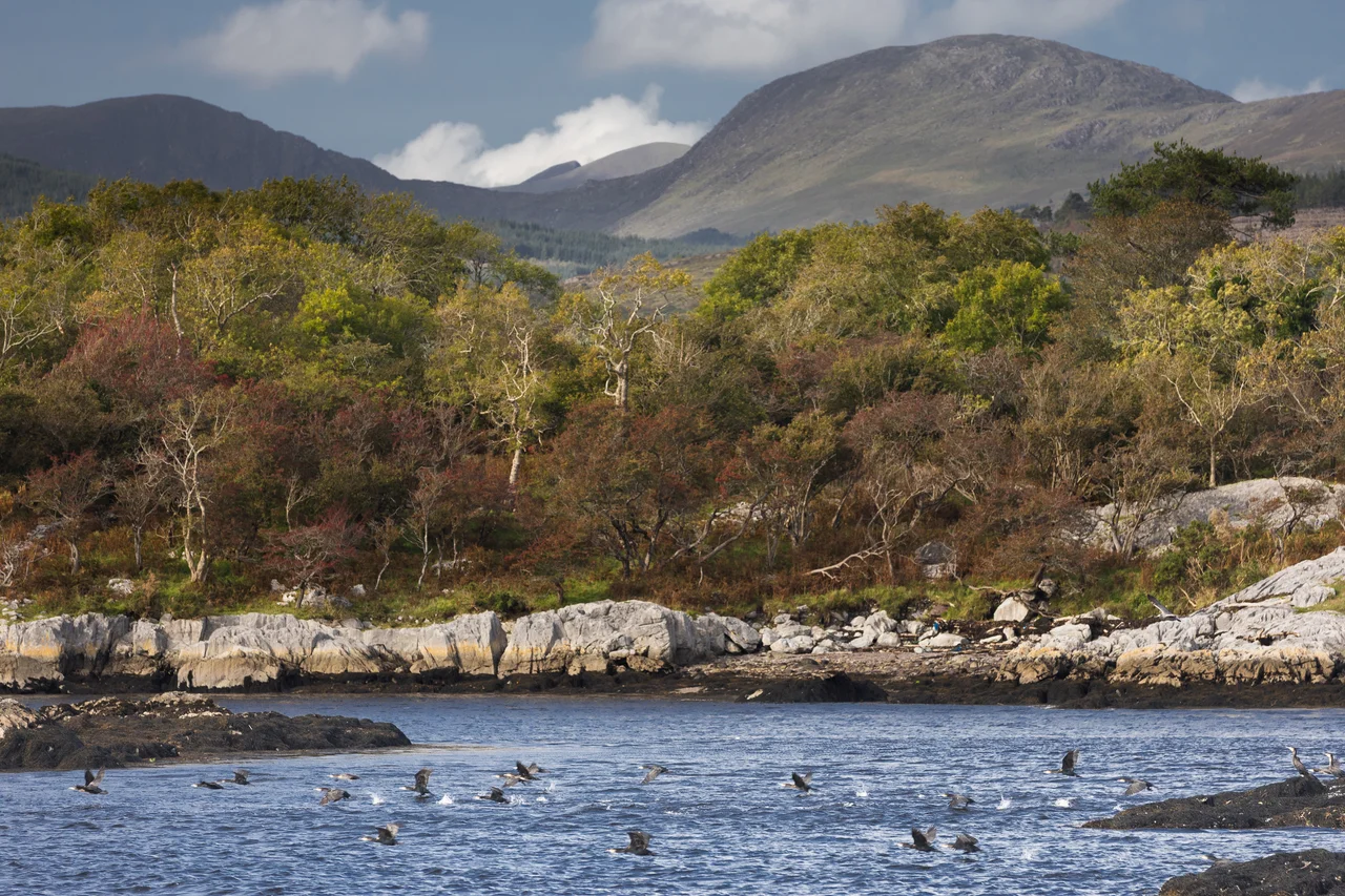
Scatter a handful of stones into a long puddle and you would get something like Kenmare Bay's geography. The Dunkerron Islands, Rossdohan, Garinish, Inishkeragh, Illaunamadan, Sherky, Inishfarnard, Illaunleagh, Illaunslea - the bay is freckled with them. Some are tiny rocks at low tide. Others have ruined houses, walled gardens, the remains of Victorian estates that the Atlantic and the Civil War mostly finished off. Rossdohan has the ruins of two burned mansions and a planted collection of tree ferns dating from the 1880s. Garinish has a private subtropical garden tended for 170 years. Kayakers paddle between them in summer, threading the channels where the cormorants fish and the seals haul out on the warmer rocks.
The Estuary of Scéine
Before it was the Kenmare River it was Inbhear Scéine - the estuary of Scéine - in the old Irish texts. The 11th-century Lebor Gabála Érenn (the Book of Invasions) names this bay as the landing point of Partholón, the mythological ancestor who led one of the earliest peoples to settle Ireland after the Flood. It is also where the Milesians later came ashore, naming the estuary after Scéine, the wife of their poet-bard Amergin who drowned during the crossing. Whether or not anyone actually landed here in the centuries the myth describes, the bay was clearly important enough in the medieval Irish imagination to be made the gateway to Ireland itself. Stand at Kenmare or Sneem and look west, and you can see why. This bay does feel like the entrance to a country.
Wild Salmon, Wild Coast
The Kenmare River is one of Ireland's most important habitats for wild salmon and sea trout, and for a long list of less famous creatures - the narrow-mouthed whorl snail, the lesser horseshoe bat, the common seal, the arctic tern, the burrowing anemone. Fishermen on the bay have been warning for years that sea lice from open-cage salmon farms have damaged the wild runs, and the salmon population now is a fraction of what it was a generation ago. Activists have also pushed back against industrial seaweed harvesting in the bay, arguing that the harvest disturbs the seabed and the species that depend on it. The Special Area of Conservation designation, which now covers most of the bay from Kenmare town to Lamb's Head on the Iveragh and Dursey Sound on the Beara, was originally opposed by some local landowners. It went through anyway. What protects the bay protects the people who fish it.
What the Lord Could Not Own
The Lansdowne lords got the salmon for a while. Their fishing rights and their nominal river survived through the colonial period and into the Irish state. But the bay never stopped being a bay. The Atlantic still pushes its tides in and out twice a day. The seals still arrive when the herring run. The cormorants still dry their wings on the Dunkerron Islands at low water. The name on the map is an old English fiction, but everything underneath it is older and stronger - the ice that carved the valley, the river of glaciers, the slow rise of the sea, the salmon returning to the streams. Kenmare River is what the lord could call it. Kenmare Bay is what it has always been.
From the Air
The Kenmare River runs roughly south-west to north-east at about 51.78°N, 9.94°W, with its mouth opening to the Atlantic between Lamb's Head (Iveragh) and Dursey Sound (Beara). From cruise altitude the bay is unmistakable: a long narrow inlet pointed inland between two mountainous peninsulas, dotted with small islands. Cruising altitude 3,000-5,000 ft gives the best view of the whole ria; for low-level work along the islands, 1,500-2,500 ft AGL. Nearest airfields: Kerry (EIKY) about 25 nm north-east of the bay's head, Cork (EICK) about 60 nm east. The bay funnels Atlantic weather inland, so westerly fronts arrive quickly - Valentia Observatory's reports cover this area directly.
Nearby Stories
- Farranfore–Valentia Harbour line 3.3 km away
- Heir Island 4.1 km away
- Inishvickillane 4.4 km away
- Kealkill stone circle 8.7 km away
- Headford Ambush 10 km away
- Dunlough Castle 13 km away
- SM U-68 27 km away
- Sao Miguel 1923 km away