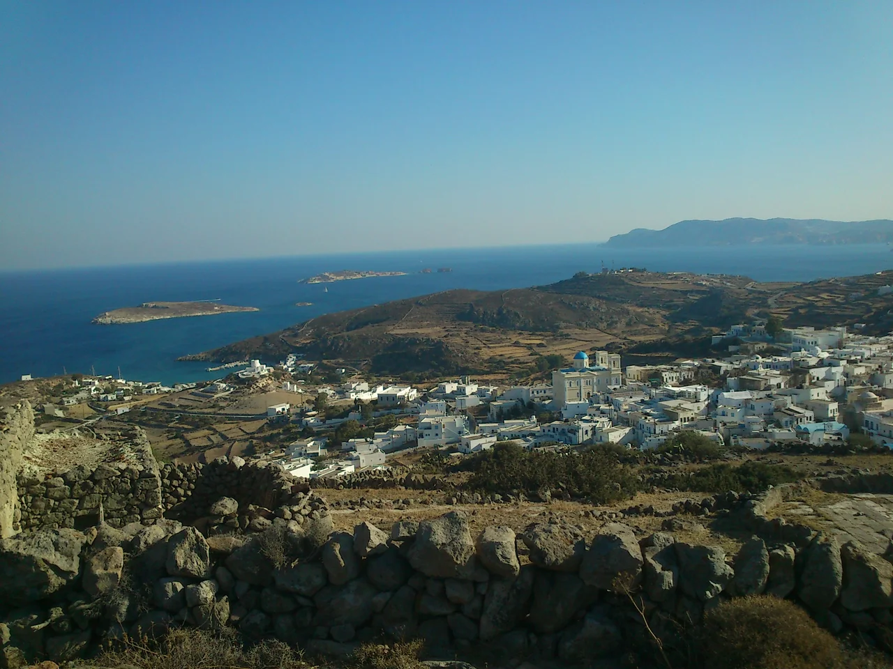

Kimolos
Theodore Bent arrived on Kimolos in December 1883 and found something the ancient world had prized for centuries: a white porous stone, easy to cut, that hardened with time. The ancients called it terra Kimolia — Kimolian Earth — and from it they made fuller's earth, used across the Mediterranean to clean and finish wool cloth. Bend noted the stone matter-of-factly, as if such things were ordinary. On Kimolos, they are. The island's silver-colored southern cliffs gave it its medieval name, Argentiera, and the substance those cliffs yielded made it, for a time, indispensable.
Chalk and Silver
Kimolos lies just 1 kilometer northeast of Milos, separated from its larger neighbor by a narrow channel. It is small — 36 square kilometers, roughly circular, about 7 kilometers in radius — and its highest point, Mount Paleokastro, reaches 364 meters. The island belongs to the same volcanic arc as Milos: acidic volcanic rocks, tuff-covered hillsides, geothermal fields, hot springs. But where Milos dazzles with its mineral spectrum of ochres and reds, Kimolos has a cooler palette. Its cliffs come in white and pale grey, the colors of chalk and silver.
The island's mineral wealth defined its ancient identity. The Kimolian Earth the ancients valued was a form of clay mineral — what we would now classify among the fuller's earth minerals — found naturally occurring in the island's volcanic deposits. It was traded widely. In the Middle Ages, when the island was ruled by Venetian lords, the silver-colored coast gave it the name Argentiera. The name Kimolos was already old by then: tradition holds that it derives from the island's first mythological resident, a figure also called Kimolos.
A Stone That Grows Its Own Shape
The most arresting natural feature on the island is a formation called Skiadi. In the middle of a small interior valley stands a huge mushroom-shaped rock, the product of centuries of wind erosion. The process is called ablation: wind-carried dust continuously abrades the rock's surface, wearing the softer lower layers more quickly than the harder upper ones. The result, accumulated across geological time, is a natural column that widens as it rises and flares into a broad cap — recognizable, inevitable, strangely satisfying.
Kimolos and Milos, along with the scattered uninhabited islands between them, sit within the Aegean volcanic arc. Polyaigos, the large uninhabited island to the east of Kimolos, is said to be the largest uninhabited island in the Aegean. It too belongs to the municipality of Kimolos, though its population remains at zero. Hot springs and a notable geothermal field beneath the island speak to the restlessness still simmering underground.
Between Athens and Sparta
Kimolos has been caught between larger powers before. In antiquity, the island was a contested point between Athens, which held Kimolos, and Sparta, which controlled neighboring Milos. The two communities were rivals across the narrow channel — culturally different (Milos was Dorian, aligned with Sparta), geographically intimate.
In the Hellenistic period, following Alexander's conquest, Kimolos and Milos took their dispute over the small islands between them — Polyaigos, Heterea, and Libea — not to war but to arbitration at Argos on the Greek mainland. The Argives ruled in Kimolos's favor. It was the kind of island diplomacy that the ancient world occasionally managed alongside its brutalities.
The Ottomans held Kimolos as part of the broader Cyclades until 1829, when it joined the newly independent Greek state. Today it is administratively part of the Milos regional unit. The Kimolos Port Authority answers to Milos Coast Guard. The island is small enough to be governed from elsewhere, but its residents — fewer than 1,000 in summer, perhaps 600 in winter, most of them elderly — maintain a community that has survived on its own terms for a very long time.
The Island That Stays Quiet
The main settlement, Chorio, sits on a hill in the island's southeast. Below it, the port of Psathi handles the ferry connection to Milos and Piraeus. There are other small settlements — Goupa, Prasa, Aliki, Bonatsa — scattered around the island's perimeter, each one small enough to walk in minutes.
Kimolos has so far avoided the kind of mass tourism that has transformed Santorini and Mykonos, and even the moderate crowds that reach Milos each summer. Part of this is proximity: Kimolos is accessible but requires a deliberate choice, a short ferry from Milos rather than a direct connection from Athens. Part of it is scale: there simply is not room for crowds. The population drops to a few hundred in winter, and even in summer the island is quieter than almost anywhere else in the Cyclades.
What remains is what has always been here: the chalk-white cliffs, the geothermal warmth underground, the mushroom rock standing in its valley, and the Aegean on all sides. Kimolos is the kind of place that rewards the traveler who arrives without expectations and finds, in the smallness of things, something irreplaceable.
From the Air
Kimolos sits at 36.80°N, 24.55°E, just northeast of Milos across a 1-kilometer channel. The nearest airport is LGML (Milos Island National Airport), approximately 15 kilometers to the southwest on Milos. From the air, Kimolos and Milos appear almost as a single landmass separated by a thin blue line. Kimolos is the smaller, rounder, paler of the two — its white-grey cliff faces distinguishable even from altitude. A low pass at 3,000-4,000 feet along the southern coast of Kimolos offers views of the silver cliffs and the narrow channel. The Meltemi northerly wind is reliable in summer; approach from the south for smoother air.
Nearby Stories
- Serifos 8.9 km away
- Despotiko 15 km away
- Duchy of the Archipelago 36 km away
- The Eruption of Thera: The Volcano That May Have Destroyed Atlantis 45 km away
- Hydra: Fire Ships and Stone Mansions 47 km away
- SS Slamat 69 km away
- Santorini: The Volcano That May Have Destroyed Atlantis 94 km away
- Battle of Cape Spada 98 km away