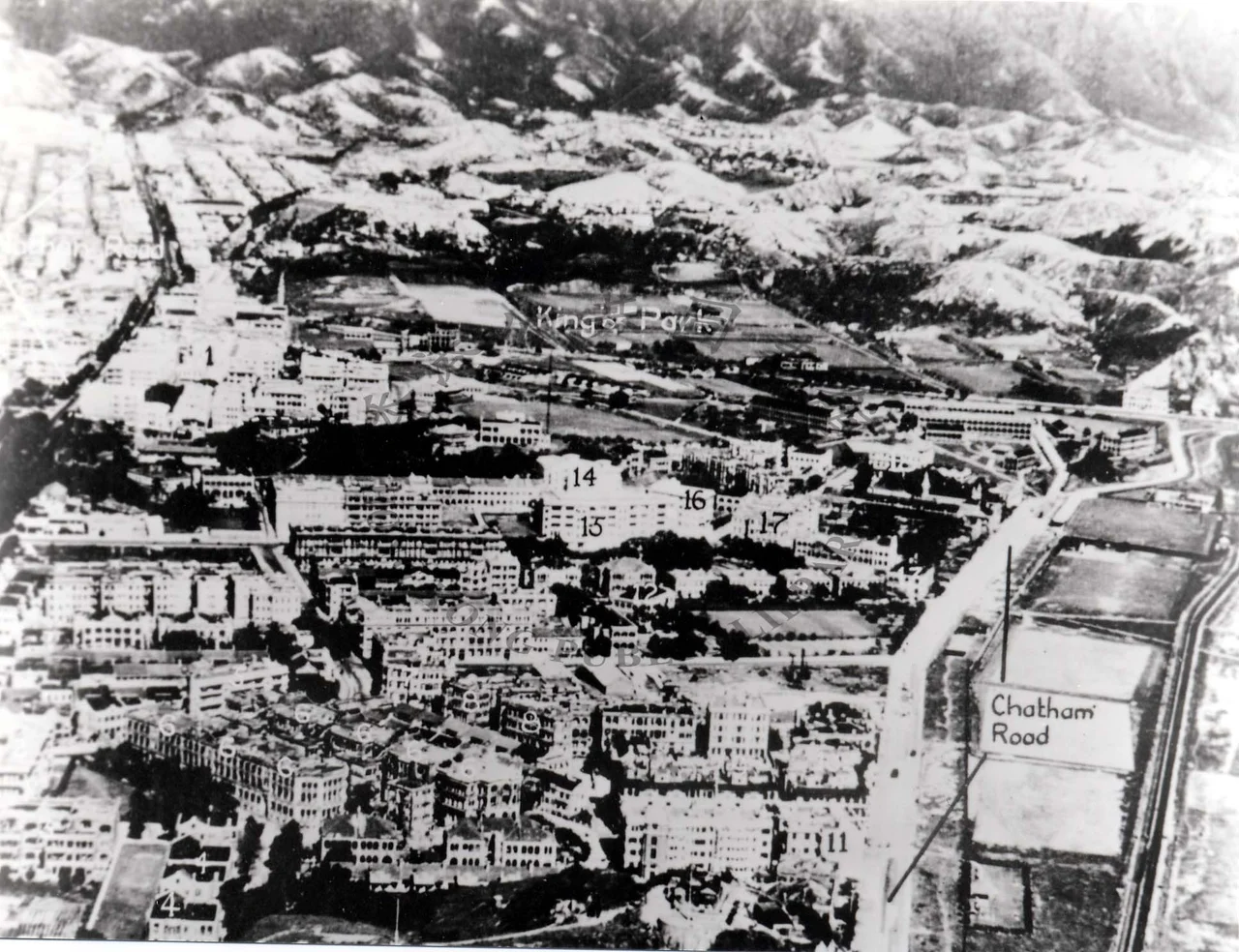

King's Park, Hong Kong
A 15-storey British military hospital once dominated the northern hill here, serving a garrison of more than 10,000 soldiers. In 1995, with the 1997 Handover approaching, the garrison shrank to around 3,000. The hospital closed. Its 7.4-hectare site was valued at HK$5.6 billion that year. In a city where such land values routinely result in demolition and tower blocks, what happened next at King's Park was unusual: a coalition of sporting associations lobbied hard for preservation, the sports fields around the hospital were largely saved, and the Kings Park Sports Association — anchored by the Hong Kong Rugby Football Union — took root. Not everything survived. But enough did that King's Park remains one of Kowloon's few genuinely mixed-use districts, where green space holds its ground between the hospital and the cricket club, the bowling green and the barracks.
A Hill with Many Purposes
King's Park occupies a corner of Yau Tsim Mong District, bounded roughly by Waterloo Road to the north, the East Rail line to the east, Austin Road to the south, and Nathan Road to the west. The topography divides the area into two distinct characters. The northern section is hilly — and it is on this hill that the more institutional presences cluster: the Hong Kong Observatory's meteorological station, the Hong Kong Red Cross Blood Transfusion Centre, and the Queen Elizabeth Hospital, one of the city's major public hospitals. The southern portion is flatter, and here the sports grounds spread out: King's Park Hockey Ground, King's Park Sports Ground, the Kowloon Cricket Club, the Kowloon Bowling Green Club, the YMCA Recreation Ground, and the United Services Recreation Club. Gun Club Hill Barracks sits at the southern edge, near Gascoigne Road. No commercial outlets are zoned for the area.
The Hospital That Became a Housing Estate
From 1967 until June 1995, the 15-storey British Military Hospital served the Hong Kong garrison. When it closed, its site did not become a park. By 1999, the 7.4-hectare plot had been sold and redeveloped into a private housing estate. What was saved from the same fate were the sports fields that had surrounded the hospital — the open green spaces that the sporting associations successfully argued should remain. A civil service residential estate called Wylie Court had already been built to the south of the hospital site in 1987; the Civil Service Club is nearby. In 1997, the King's Park Sports Association formed specifically to manage and protect those playing fields after the garrison's departure. The Hong Kong Rugby Football Union was among its founding partners.
Schools in the Shadow of the Hill
King's Park has accumulated a cluster of secondary schools that give the district a particular daytime energy. ELCHK Lutheran Secondary School, Methodist College, True Light Girls' College, Tung Wah College's King's Park Campus, and Wah Yan College, Kowloon — a Jesuit institution with its own long history — are all located within the district's boundaries. The area falls within Primary One Admission School Net 31, served by a mix of government and aided schools. On weekday mornings, students in uniforms stream toward the MTR and minibuses along Gascoigne Road, past the headquarters of the Hong Kong Girl Guides Association, which has occupied its Gascoigne Road site for decades.
Weather Watching Since Before the Handover
The Hong Kong Observatory has maintained a meteorological station on the King's Park hill for well over a century, and it is from this station that some of Hong Kong's most significant long-term climate data has been collected. The station sits high enough to get reliable wind and temperature readings away from the canyon effects of Kowloon's street grid below. In a city where the weather can shift from sunshine to typhoon warning in hours, having a reliable upland observation point matters. The data gathered here contributes to the Observatory's city-wide forecasting network and to the long climate records that track how Hong Kong's urban heat and rainfall patterns have shifted over decades of rapid development.
The Texture of a Neighborhood That Resisted
What makes King's Park interesting in the context of Hong Kong's urban history is precisely what it is not. It is not a commercial district. It has no shopping malls. The zoning keeps retail out. The result is a neighborhood whose character is defined by its sports grounds and institutional buildings rather than by consumption — which, in one of the world's most commercial cities, amounts to a quiet kind of distinctiveness. The cricket ground has been here since the colonial era. The bowling green is still active. On weekend afternoons, players in whites move across the grass of the Kowloon Cricket Club, and the sound carries up the hill toward the meteorological station, past the gates of the barracks, in a city that never stops building but has, in this one corner, chosen to leave some things as they are.
From the Air
King's Park sits at 22.3072°N, 114.1747°E in Yau Tsim Mong District, Kowloon. From altitude the open green sports grounds are visible against the surrounding urban density — a rare break in the rooftop pattern. The Queen Elizabeth Hospital complex and the Hong Kong Observatory station mark the hill to the north. Victoria Harbour is less than 2 km to the south. VHHH (Hong Kong International Airport) is approximately 26 km to the west. Recommended viewing altitude 2,000–4,000 feet from the south provides a clear view of the district in relation to the harbor and the Kowloon peninsula.
Nearby Stories
- Lok Ma Chau Loop 2.3 km away
- Portas do Cerco 2.3 km away
- Kweilin Incident 17 km away
- Wanshan Archipelago Campaign 34 km away
- Nanxiong Formation 115 km away
- Battle of Nanpeng Island 148 km away
- Heyuan 169 km away
- Cape Maobitou 632 km away