
Kowloon Peninsula
The name means 'nine dragons' in Cantonese — a reference, by one account, to eight hills surrounding the peninsula, plus the emperor who named them and counted himself among their number. That emperor was a child, a Song dynasty fugitive fleeing the Mongol advance in the 13th century, who sheltered briefly on this rocky peninsula before the dynasty collapsed anyway. The dragons remained. Centuries later, another imperial power arrived: the British, who in 1860 formalized their claim to the Kowloon Peninsula by the Convention of Peking, adding it to the Crown Colony of Hong Kong they had already held since 1842. What happened to those nine hills, those nine dragons, in the century and a half since, is the story of one of the most dramatic urban transformations in history.
Granite and Reclaimed Ground
The peninsula's bedrock is monzogranite — the same medium-grained rock that forms the Kowloon Granite formation underlying much of this corner of Hong Kong. Early maps show what the land looked like before modern intervention: flat, low-lying ground behind the beach at Tsim Sha Tsui Bay, with Kowloon Hill rising in the west. That natural topography is now buried under decades of reclamation. In the south and west, most of the new land was created before 1904. The Tsim Sha Tsui waterfront was completed by 1982. Then came the larger ambitions: since 1994, the former Hung Hom Bay was gradually filled in, and by 2019 it had been entirely extinguished — a bay that once reflected the sky simply ceased to exist, replaced by land. The West Kowloon Reclamation, completed largely by 1995 as part of the Airport Core Programme, pushed the shoreline further still. The peninsula you see today is substantially larger than the one the British acquired.
Where Empires Drew Their Lines
The Convention of Peking in 1860 established the boundary of British Kowloon with characteristic colonial precision: a line drawn east from the fort at the northernmost point of Stonecutters Island. For nearly four decades, that line was the edge of British territory, and everything north of it was Qing China. The situation changed in 1898, when Britain obtained a 99-year lease on the New Territories, pushing the effective boundary north to the Sham Chun River. In that same year, Hong Kong's colonial Legislative Council passed a resolution to preserve the land where some caves stood on the peninsula — an early gesture toward heritage protection in a city that would later become more systematic about it. The peninsula then covered five of Hong Kong's eighteen districts: Yau Tsim Mong, Kowloon City, Wong Tai Sin, Kwun Tong, and Sham Shui Po, each with its own character and history nested within the broader geography.
Refuge and Reinvention
In the 17th century, after the fall of the Ming dynasty, followers of the last Ming emperors found shelter in the Kowloon Peninsula, hiding from the advancing Manchu forces who would establish the Qing dynasty. They were not the first people to arrive here seeking shelter, and they would not be the last. The peninsula has repeatedly served as a destination for those escaping something: famine, war, revolution, poverty. The great waves of migration that built modern Hong Kong — from the mainland in the 1940s and 1950s, from the villages of Guangdong province across earlier decades — washed against this shore and stayed. They built the tenements that once rose so close to Kai Tak Airport's runway that arriving pilots could look straight into apartment windows. They created the density, the noise, and the compressed vitality that make Kowloon feel unlike anywhere else on earth.
The Lions and the Harbour
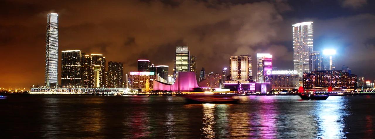
Look north from Tsim Sha Tsui and the hills frame the peninsula like a wall: Lion Rock, Beacon Hill, Tate's Cairn, Kowloon Peak. These peaks mark the boundary between the peninsula and the New Territories, between Old Kowloon and the rest. Lion Rock in particular has become a symbol — not just a geographical feature but an idea, the Hong Kong spirit of resilience and hard work that locals invoke when they talk about what makes the city what it is. The peninsula stretches from that mountain wall down to the southern tip at Tsim Sha Tsui, where the Star Ferry terminal looks across Victoria Harbour to Hong Kong Island. That view — the water, the skyline, the hills beyond — is one of the most famous in the world. It is also, depending on the light and the weather, one of the most beautiful. The nine dragons may be gone, their hills reshaped and built over. But something about this peninsula still earns the name.
From the Air
The Kowloon Peninsula sits at approximately 22.31°N, 114.18°E, forming the southern tip of the main Kowloon landmass. From the air, it is the densely built-up triangular peninsula on the north side of Victoria Harbour, with Hong Kong Island directly across the water to the south. The Lion Rock ridge is visible as the natural boundary to the north. Hong Kong International Airport (VHHH) is on Lantau Island, roughly 28 km to the west. The former Kai Tak runway — now the site of a cruise terminal and sports park — is visible on the eastern edge at lower altitudes. Recommended viewing altitude is 4,000–6,000 feet to take in the full peninsula and harbour panorama.
Nearby Stories
- Lok Ma Chau Loop 2.3 km away
- Portas do Cerco 2.3 km away
- Kweilin Incident 17 km away
- Wanshan Archipelago Campaign 34 km away
- Nanxiong Formation 115 km away
- Battle of Nanpeng Island 148 km away
- Heyuan 169 km away
- Cape Maobitou 632 km away