
Kyle of Lochalsh
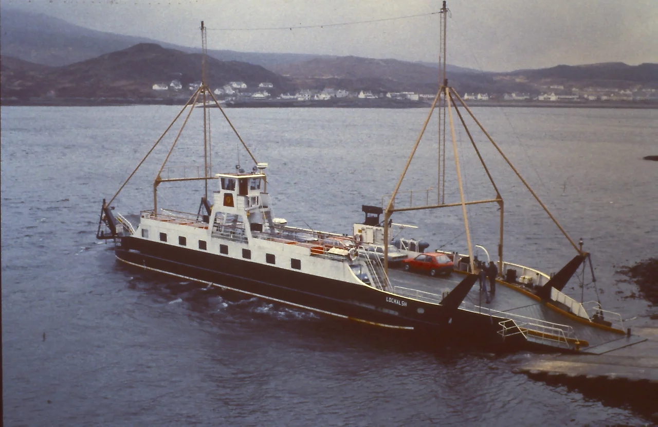
Ceolas, the Gaelic word for narrows. Say it once and you have the village's name, the strait it sits beside, and the reason it exists. Between Kyle of Lochalsh and Kyleakin on Skye, the gap of water is narrow enough that someone has been ferrying people across it since at least 1600. The narrows made the village; the village then resisted being made obsolete. When the bridge that finally replaced the ferry opened in 1995, it came with the most expensive tolls in Britain. The locals refused to pay them. It took ten years and a Scottish government buyout to win, and Kyle has been quietly, defiantly itself ever since.
Where the railway ran out of land
Kyle is what happens at the end of a Victorian railway line. The Kyle of Lochalsh Line from Inverness was completed in 1897, snaking 82 miles across the Highlands through Dingwall, Achnasheen and Plockton, and dead-ending on the water's edge at a stone pier. The point was to feed steamers to the Outer Hebrides. Trains still run to Kyle twice a day from Inverness, 2 hours and 40 minutes through some of the most cinematic scenery in Britain. There is a small staffed ticket office, open Monday to Saturday. The toilets keep the same hours. There is step-free access to the platform, which sits at sea level on the old ferry pier. When Michael Palin came here in 1980 filming Great Railway Journeys, he bought the platform sign and hung it on his garden wall.
The bridge revolt
By the 1980s the ferry queues had become absurd. In summer the village would choke with cars waiting for the next short crossing to Skye. Building a bridge was technically straightforward. The trouble was the politics. The Skye Bridge opened in 1995 under the Private Finance Initiative, with tolls set at five pounds per crossing each way, the highest in Britain. Documents later revealed the operator was charging roughly ten times the bridge's actual running cost. Residents on both sides formed SKAT, Skye and Kyle Against Tolls, and refused to pay. Some went to court. The campaign ran for nine years. At the end of 2004, the Scottish government bought out the operator and the tolls were abolished overnight. Today the bridge sweeps across in two graceful curves, first by the Carrich Viaduct to the small islet of Eilean Bàn, then arching to Skye. You can walk it. You can cycle it. It is free.
A quiet base for everything else
Kyle has, by its own admission, no real sights. No castle, no museum, no must-see. What it has is location. From here you are twenty minutes from Eilean Donan Castle on Loch Duich, ten minutes from Skye, an easy run to Plockton's palm trees and pastel cottages, walking distance to the Plock of Kyle's wooded viewpoints. Boat trips run in summer from Seaprobe Atlantis and Red Moon Cruises near the slipway, watching otters and seals in the narrows. The Skye Bridge Distillery west of the station makes gin and vodka. There is a Co-op for groceries, a Pizza Mia and a Chinese takeaway for dinner, a couple of hotels with bars. Kinlochsheil play shinty in the top tier, the Mowi Premiership, from April to October. The Bank of Scotland branch finally closed in 2025; a Community Banker visits a solicitor's office on Mondays. It is enough.
Eilean Bàn and the otter man
Halfway across the bridge you touch down briefly on Eilean Bàn, the White Island, a green oblong in the middle of the loch. A track leads to a small cottage where Gavin Maxwell, the naturalist who wrote Ring of Bright Water about his life with otters in nearby Sandaig, spent his last years. He died there in 1969. The cottage is now self-catering, sleeping four. The Kyleakin lighthouse beyond it is disused. The islet is private property, but the track is open. From the middle of the bridge you can see the whole sweep: Loch Alsh widening east toward Loch Duich, the Cuillin mountains of Skye to the southwest, the narrows below your feet where boats have crossed for four hundred years, where they no longer need to.
From the Air
Village at 57.28 N, 5.71 W on the mainland side of the Skye Bridge. The two-stage bridge (Carrich Viaduct plus main arch over Eilean Bàn) is the dominant visual feature. Nearest airport Inverness (EGPE) is about 75 nm east; Plockton airstrip (EGEO) sits just north. Approach corridors follow Loch Alsh east-west. The narrows are typically clear of weather when the Highlands are not socked in, but cloudbase can sit low against the surrounding hills. Look for the village's pale stone buildings spilling down toward the loch and the dead-end railway pier.
Nearby Stories
- Arisaig 5.3 km away
- Talisker distillery 9.7 km away
- Loch Torridon 11 km away
- Uig 12 km away
- Neptune's Staircase 16 km away
- Glen Affric 18 km away
- Corrieshalloch Gorge 34 km away
- Coll 39 km away