Lake Nasser
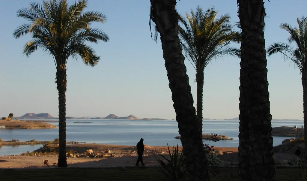
Before there was a lake here, there was a homeland. Nubian villages lined this stretch of the Nile as they had for centuries - mud-brick houses painted in bold geometric designs, date palm groves shading shared courtyards, cemeteries of saints that families had kept up for generations. When the Aswan High Dam closed in 1970, all of it went under. Tens of thousands of Nubians were forced to leave - relocated to hastily built settlements near Kom Ombo in Egypt or Khashm el Girba in eastern Sudan, far from the river and from the specific landscape their identity was rooted in. The lake that rose behind the dam was named for Gamal Abdel Nasser, the Egyptian president who championed the project. The people who lost their country to it are still living with that loss today.
A Reservoir in Two Countries
Lake Nasser is one of the largest artificial lakes in the world - about 550 km long, covering a surface area of roughly 5,250 square kilometers when full. Eighty-three percent of it lies in Egyptian territory. The southern portion, in Sudan, is called Lake Nubia by Sudanese officials, a deliberate alternative name that insists on the Nubian identity of the drowned land. Before its creation, Sudan opposed the project precisely because it would flood the northern strip of the country where most of Sudan's Nubian population lived. In the end Sudan lost most of that land anyway - and Nubian villages on both sides of the border disappeared under the rising water. The lake reaches its widest point near the Tropic of Cancer, a vast sheet of blue-green water in a desert that now bears more resemblance to a sea than to the river it replaced.
Ancient Ground, Gone Under
The lake's rise triggered one of the most ambitious archaeological rescues in history. UNESCO's International Campaign to Save the Monuments of Nubia coordinated a global effort to document and, where possible, relocate the treasures of Lower Nubia before they drowned. The temples of Abu Simbel were the most famous save - sawn into massive blocks and reassembled on higher ground, their giant seated statues still facing east to catch the dawn. The temples of Kalabsha, Wadi es-Sebua, and Amada were likewise moved. Faras cathedral's paintings were detached from their walls by Polish archaeologists and sent to museums in Warsaw and Khartoum. Other sites were documented and lost: the great Middle Kingdom fortress of Buhen, dug up and studied at speed, now rests underwater in the lake. The drowned landscape still holds countless sites that were never found before the water arrived - places like Jebel Sahaba, where prehistoric cemeteries were salvaged in months that should have been years.
Gain and Loss
The High Dam has given Egypt measurable benefits. The reservoir provides year-round water for irrigation, replacing the seasonal floods the Nile used to deliver and destroy in the same motion. Egypt's arable land increased by about 30% after the dam was built. The power station generates around 2.1 gigawatts - roughly half of Egypt's electricity when it opened in 1970, a significant share still today. Lake Nasser is home to 52 species of fish, dominated by tilapia and the huge Nile perch; thousands of fishing boats work the lake, supplying processing plants along its shores. Tourism has grown too - sightseeing cruises visit Abu Simbel and Kalabsha, and recreational anglers come for the perch. The ecological cost, however, is heavy. The annual sediment flow that built Egypt's agriculture over millennia is now trapped behind the dam; Egyptian farmers depend on mineral fertilizers to replace what the silt used to provide. The Nile crocodile's habitat downstream is degraded. Mediterranean fisheries off the Nile delta collapsed when the sediment and nutrient flow ended.
The Nubians Who Remember
More than fifty years after the displacement, the Nubian communities of Egypt and Sudan continue to press their case for recognition and return. Some Nubian families were resettled to land near the lake's shores; their old homes, the specific places where their ancestors are buried, remain underwater. Nubian cultural associations preserve language, architecture, music, and memory. Younger generations who have never lived in Old Nubia still identify with it. Meanwhile, upstream in Ethiopia, the Grand Ethiopian Renaissance Dam has been changing the calculus of the Nile again. Construction began in 2011; staged filling of the reservoir began in 2020, and by 2023 the project was about 90% complete. Egypt fears that reduced Nile flow could shrink Lake Nasser and the irrigation it supports. From the air, the lake is dazzling - a wide blue corridor in the ochre desert, with the temples of Abu Simbel visible on the western shore and the flooded lowlands of Nubia stretching for hundreds of kilometers in either direction. It is a monument to engineering and to loss, and both are part of its story.
From the Air
Coordinates 22.5°N, 31.86°E. The reservoir spans roughly 550 km from Aswan, Egypt to northern Sudan, centered near the Tropic of Cancer. Nearest airports: Aswan International (HEAS), Abu Simbel (HEBL), and Wadi Halfa (HSSW) in Sudan. Recommended viewing altitude 15,000-25,000 feet for the sweep of the lake and the Sahara Desert on either side.
Nearby Stories
- Nabta Playa 20 km away
- Buhen 26 km away
- Wadi Halfa Salient 43 km away
- Temple of Dendur 100 km away
- Bi'r Tawīl 147 km away
- Bir Tawil 156 km away
- Aswan Dam 180 km away
- Kharga Oasis 296 km away