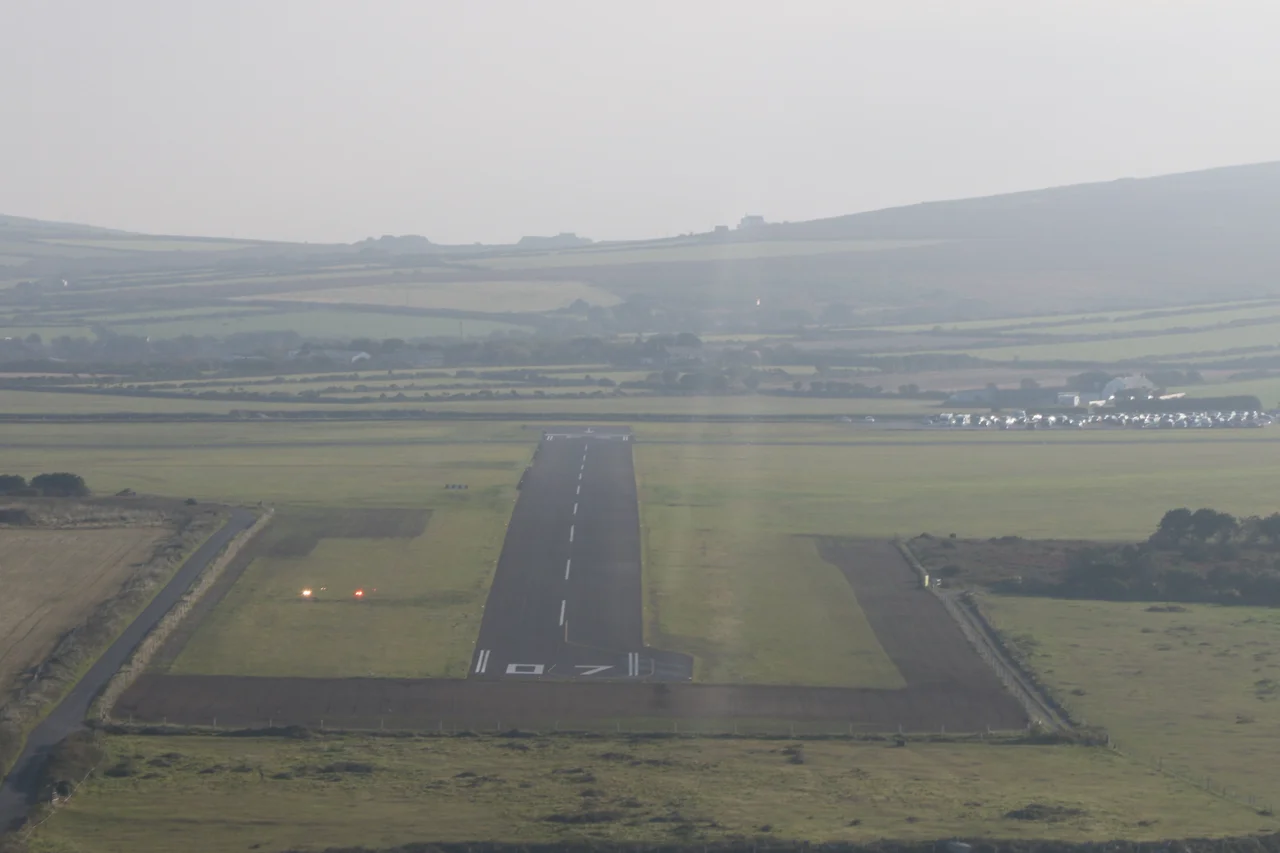

Land's End Airport
It is five nautical miles west of Penzance and almost nothing else. From the threshold of runway 12 you can see all the way to the Atlantic. Britten Norman Islanders sit on the apron in the morning light, their windows fogged with dew, waiting to make the twenty-eight-mile hop out to St Mary's in the Isles of Scilly. There are no jet bridges, no escalators, no automated announcements. There is a control tower, a small café, and a hangar that came down from Blackpool by lorry in 1937. Land's End - ICAO code EGHC - is the way you get to a place where roads stop mattering.
Cobham's Idea
The route was the dream of Sir Alan Cobham, the great between-the-wars aviator who saw the Scillies as the obvious case for British civil aviation. He started planning a Land's End to Scilly link in 1935. Cobham's company was soon absorbed by Olley Air Service, and a subsidiary called Channel Air Ferries actually built the airstrip and launched the service on 15 September 1937, flying twin-engined de Havilland Dragons. The wood-and-fabric biplanes carried eight passengers and a pilot at about 100 miles per hour. On St Mary's there was no airport yet, so the Dragons landed on the island's golf course - players ducking, presumably, when the engines came in low over the bunkers. A proper Scilly aerodrome opened in 1939, just in time for war.
Through Wartime
Most British civil flying was grounded between 1939 and 1945. The Scilly service was not. Great Western and Southern Airlines, the holding company by 1938, kept it running through the war, swapping the Dragons for slightly bigger de Havilland Dragon Rapides as the lifeline became more demanding. The islands were tiny, isolated, and entirely dependent on a sea passage that the U-boats made dangerous. The little biplanes droning out from Land's End were sometimes the only certain way to get a sick child to hospital on the mainland, or a soldier home on leave. On 1 February 1947, the route was nationalised: it became part of British European Airways. Twenty years later, in 1970, a Cornish-born flying school named Westward Airways took root at the airport and stayed for nearly four decades.
Grass and Mud
Until 2014, every runway at Land's End was grass. This worked very well for most of the twentieth century, but Cornish winters do not forgive grass aerodromes. In 2012-13 and again in 2013-14 the runways became so waterlogged that the airport simply closed for long stretches, with Skybus services diverted up the coast to Newquay. The islanders, dependent on the flights for everything from milk to medical appointments, began to lobby seriously. The European Commission approved an asphalting plan in May 2014; the cost was £2.6 million, half of it from European funds. The airport closed on 4 July and reopened on 29 July with hard surfaces under two of its runways. A new £1 million terminal had already opened the year before, in April 2013, complete with new baggage handling, an arrivals facility, and a new control tower. The grass aerodrome had become, properly, an airport.
Britten-Norman Country
The fleet that flies from Land's End today is small, sturdy, and unmistakably itself. Britten-Norman Islanders - high-winged, twin-engined, designed in the 1960s for exactly this kind of short island work - line up each morning for the 15-minute flight to St Mary's. Skybus operates them; Trinity House keeps a depot at the airfield for servicing the lighthouses scattered along the Cornish coast. Scenic flights swing out over Cape Cornwall, the Brisons, the cliffs at Botallack and Geevor, and circle back. Passengers reach the airport by shuttle bus from Penzance railway station, and the timetable is co-ordinated with the trains; you can book a single ticket for the whole journey from London Paddington.
The Edge of Britain
From the air, the place reveals itself best. The airfield occupies a flat patch of cropland on the high western plateau of the Penwith peninsula, a couple of miles inland from the actual Land's End headland. To the north the cliffs run past Sennen, Cape Cornwall, Botallack, Geevor, and Pendeen. To the south, beyond Sennen Cove, the ground tips toward the open ocean. There is nothing of any size west of here until Nova Scotia. It is one of the smallest airports in the United Kingdom still operating scheduled passenger services, and one of the most quietly important: without it, life on the Scillies as currently lived would not really be possible. The Islanders fly out, climb to perhaps 1,500 feet, and aim across that Atlantic gap toward a chain of granite islands the rest of Britain mostly forgets. Twenty-eight miles. Fifteen minutes. A century of flights, and counting.
From the Air
ICAO: EGHC. Located at 50.1028°N, 5.6706°W, 5 NM west of Penzance and 2 NM north of Land's End headland. CAA Private Use Aerodrome Licence (Number P568); daylight operations only. Two asphalt runways since 2014. The airfield sits at roughly 400 ft elevation on the Penwith plateau. Nearest diversion is Newquay Airport (EGHQ) 30 NM north. Typical traffic: Britten-Norman Islanders on the St Mary's (EGHE) shuttle, scenic flights, and Trinity House support flights. Approach is over open country from the east; the Atlantic horizon extends north, west, and south. Watch for sea fog rolling in from the southwest.
Nearby Stories
- Bartholomew Ledges Wreck 1.8 km away
- Carn Brea Castle 4.6 km away
- Battle off Lizard Point 12 km away
- Carnewas and Bedruthan Steps 18 km away
- King Charles's Castle 25 km away
- MV Cita 34 km away
- 1979 Fastnet Race 47 km away
- Trevose Head Lighthouse 55 km away