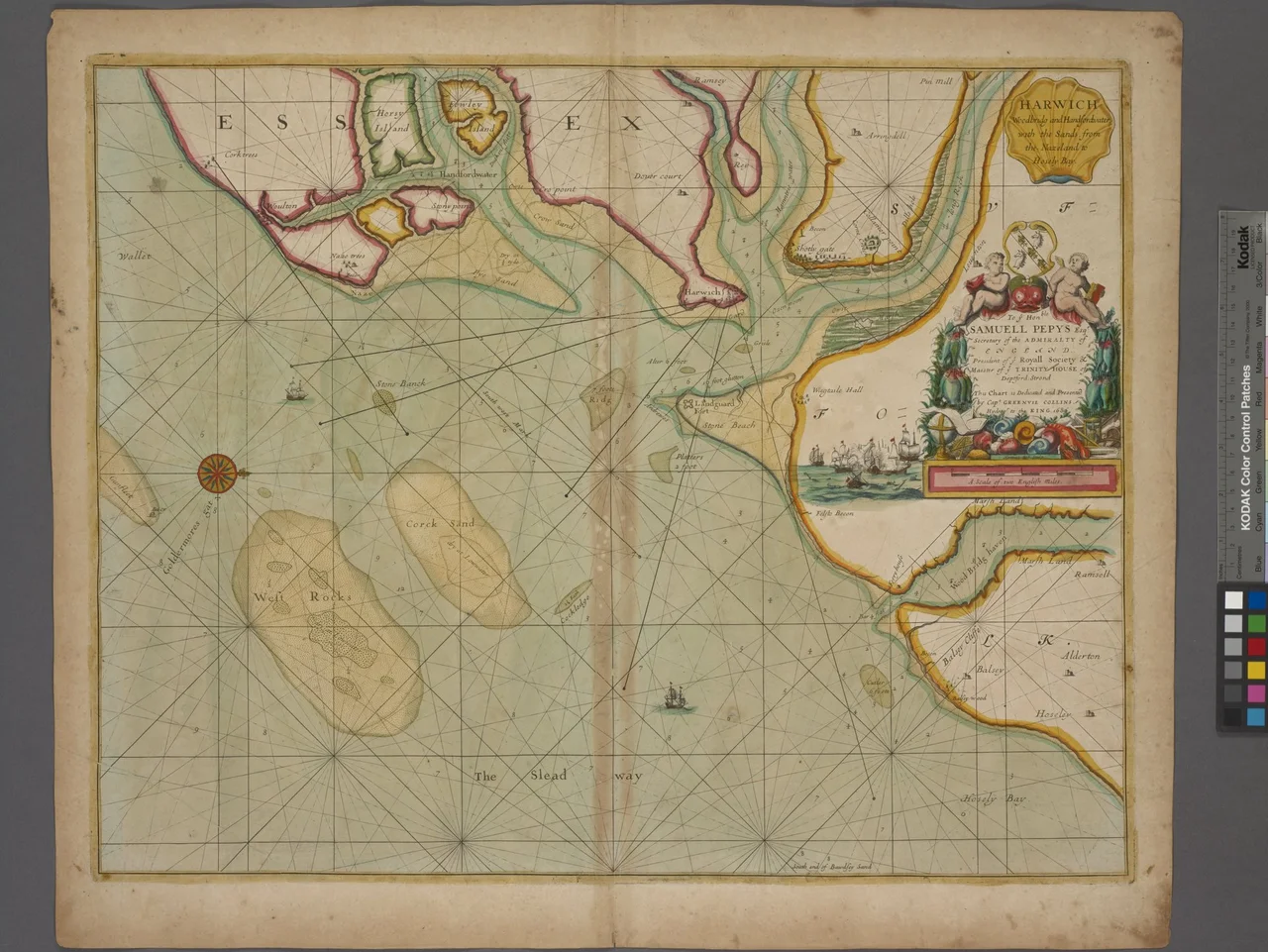

Landguard Fort
On 2 July 1667, Dutch admiral Michiel de Ruyter put 2,000 men ashore on Felixstowe beach in front of what is now Undercliff Road East and marched them toward Landguard Fort. The garrison numbered 400 musketeers - the Duke of York and Albany's Maritime Regiment, the unit that would become the Royal Marines - and 100 artillerymen with 54 cannons. They were commanded by Captain Nathaniel Darrel. The Dutch tried twice to take the fort and were thrown back. Darrel held. The Dutch withdrew. It was the last opposed seaborne invasion of England, and it happened here. The fort the Dutch failed to take is still standing.
Langer Fort to Landguard
Henry VIII's coastal defences in 1540 had included a few earthworks and a blockhouse at the mouth of the Orwell, called Langer Fort. King James I ordered a proper fortification in 1621 - a square fort with bulwarks at each corner. By 1667 it was the position that mattered. A Dutch invasion could land troops, take Landguard, then control the entry to the harbour and the route inland. De Ruyter, the same admiral who weeks earlier had sailed up the Medway and burned the British fleet at Chatham, was the right man for the job. But Darrel's marines and gunners were better positioned and dug in. The attack failed. It is commemorated every year at the fort as Darrell's Day.
Building and Rebuilding
A new fort battery went up in 1717. A completely new fort on an adjoining site was begun in 1745 to a pentagonal bastioned trace. New batteries followed in the 1750s and 1780s. The biggest change came in the 1870s, when the interior barracks were rebuilt to a keep-like design and the river frontage acquired a new casemated battery covered by an unusual caponier with a quarter-sphere bombproof nose. Several open bastions were enclosed. A mock ravelin block was built to house a submarine mining contingent. The result is layered architecture - Henrician, Stuart, Hanoverian, Victorian - all in one site, all still legible to a careful visitor walking the parapets.
Gainsborough at the Governor's Quarters
Around 1755, Thomas Gainsborough - then little-known and living at Ipswich - was commissioned to paint two landscapes for the Governor's Quarters at Landguard. The commission came from his friend Philip Thicknesse, the Lieutenant Governor. Damp at the fort eventually destroyed both paintings, but an engraving of one survives. In the Napoleonic Wars the fort caused the army repeated worry. In 1801 General Lord Cornwallis, Eastern District commander-in-chief, visited. After 1804 supply and ammunition stores were moved across to Harwich for safety. The badly-disciplined garrison once drank gin found on a captured smuggler's boat and four soldiers died, probably from alcohol poisoning. The historical record of a fort is rarely neat.
Operation Outward
During the Second World War, Landguard Fort became one of the launch sites for Operation Outward - one of the strangest British operations of the war. The plan was to attack Germany with free-flying hydrogen balloons carrying incendiary devices or trailing steel wires to short-circuit power lines. Between 1942 and 1944, many thousands of balloons were launched from Landguard and other coastal sites. The same period saw Landguard serve as headquarters for the coast artillery defending Harwich Harbour - 4 six-inch and 2 twin six-pounder guns by 1941, in concrete emplacements that still survive. It was also the Plot Room for heavy anti-aircraft defence of Harwich and Ipswich, the Naval Port War Signal Station controlling ship movements, and the remote control station for the harbour's defensive minefields.
After the Army
The army left in 1957. The fort sat empty for years. It was eventually consolidated structurally and passed to the care of English Heritage, who manage it with the Landguard Fort Trust to make it accessible to the public. Today you can walk the bastions, climb the keep-like barracks, look out across the harbour entrance toward Harwich and the ferries to the Hook of Holland, and see the same approach the Dutch took in 1667. The nearby Felixstowe Museum, in the old submarine mining establishment building between the fort and the port, tells the local story. The container cranes of the Port of Felixstowe rise just to the north - the latest fortification of an old strategic position, this time defending British supply chains rather than British soil.
From the Air
Landguard Fort sits at 51.94 N, 1.32 E at the southernmost tip of the Felixstowe peninsula, controlling the mouth of the River Orwell. From altitude, look for the pentagonal masonry fort just below the container stacks of the Port of Felixstowe; Harwich lies directly south across the harbour entrance. Nearest airports: RAF Wattisham (EGUW) 20 miles west, Stansted (EGSS) 55 miles west, Cambridge (EGSC) 65 miles west. The harbour entrance is one of the busiest in the UK; expect heavy ferry and container traffic.
Nearby Stories
- Ickworth House 3.6 km away
- Framlingham 7.9 km away
- Castle Hedingham 8.6 km away
- Battle of Assandun 8.6 km away
- Margate Surfboat 33 km away
- 1382 Dover Straits Earthquake 41 km away
- Four Days' Battle 48 km away
- Battle of Lowestoft 85 km away