.jpg)
Landsborough's Blazed Tree (Camp 67)
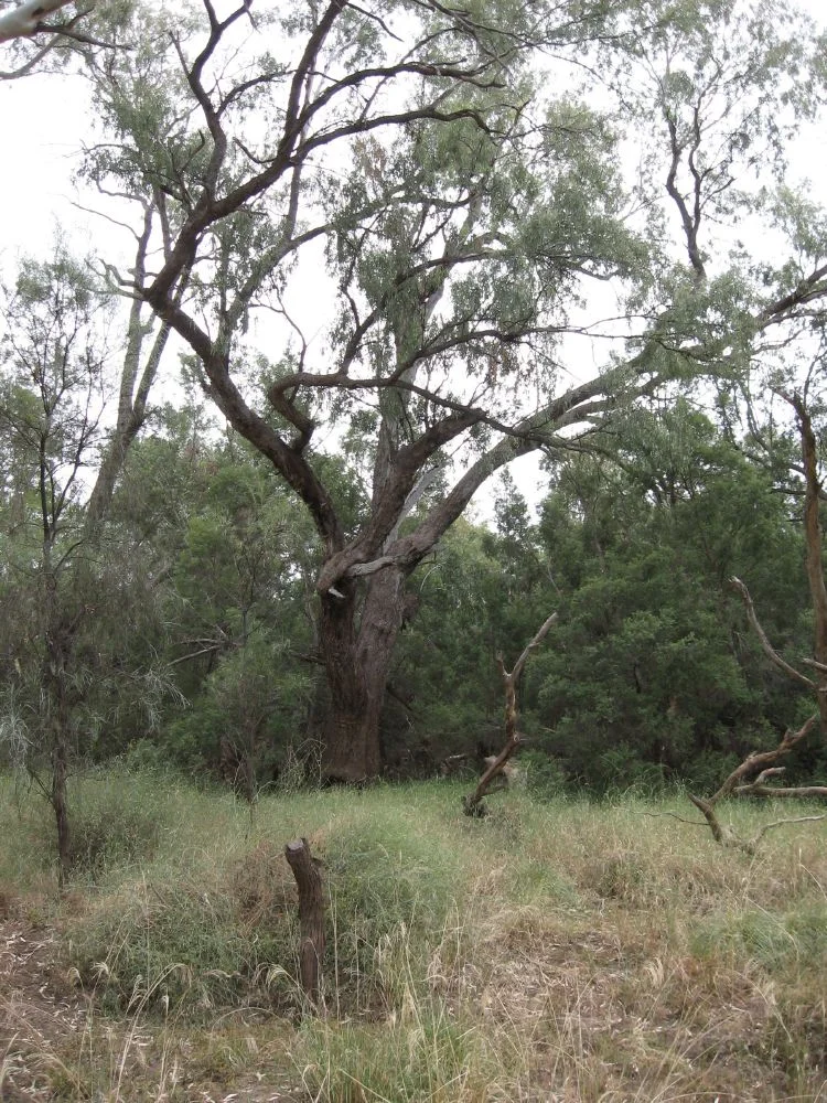
On the evening of 10 May 1862, a starving party of explorers made camp on a creek they hoped was the head of the Warrego River. Before they moved on, a man named Fisherman did the job that was his alone: he cut a mark into a coolibah tree. The chisel bit deep into the trunk, spelling out the expedition's initials, the camp number, and the date. That tree still stands on a creek levee about ten kilometres south of Charleville, and its blaze is still legible. It is one of the last physical traces of the first expedition to cross the Australian continent from north to south.
A Continent's Great Catastrophe
The journey began with a disaster that gripped the whole colony. In August 1860, Robert O'Hara Burke and William John Wills had set out from Melbourne to cross Australia from south to north, a venture lavishly funded and badly led. By June 1861 they were missing. Four official relief parties fanned out to find them, organised in Melbourne, Adelaide, Rockhampton, and Brisbane. William Landsborough led the Brisbane party. The son of a Scottish clergyman and a seasoned bushman who had opened up grazing country in the north, he sailed for the Gulf of Carpentaria in the brig Firefly, only to have it wrecked in the Gulf within days. Rescued, he established a depot on the Albert River and began searching south. The cruel irony was that Burke and Wills were already dead, perished at Cooper's Creek, though word had not yet reached the men hunting for them.
The Long Walk South
In February 1862, Landsborough turned his small party south to cross the continent overland, ignoring advice that his provisions were too thin. Six men set out with twenty horses: Landsborough; his second George Bourne; the cook Gleeson; and three others whose skill would decide whether anyone survived. Jemmy was a Native Police trooper from Deniliquin. Jacky came from the Wide Bay district and Fisherman from the Brisbane region, both Aboriginal guides. They averaged just over twenty miles a day, following river systems through country that was, for much of the way, surprisingly well watered. At each camp it was Fisherman who marked the trees. Landsborough later wrote that the importance of marking trees properly could not be overrated, that the marks must be clear and the directions unmistakable, a navigator's discipline carved into living wood.
The Knowledge That Kept Them Alive
The expedition's success rested on a debt that the era was slow to acknowledge. Again and again, Landsborough's own journal records local Aboriginal people leading the party to water, or Jemmy, Jacky, and Fisherman finding it when the country gave no obvious sign. The proof came when that knowledge failed. On 10 May, the day the Camp 67 tree was blazed, Landsborough struck out south-south-east without local guides. He found nothing. The horses went seventy-two hours without water and travelled 120 miles before the party staggered back to the Warrego. Jemmy, exhausted, rolled into the campfire in the night and was badly burned. They very nearly died in that empty stretch, and the lesson was plain: across the heart of the continent, the surveyors and squatters were strangers, and the people who had lived there for thousands of years held the map that mattered.
The Mark That Remains
On 21 May, following the Warrego downstream, the party reached a station and learned at last that Burke and Wills had died. Landsborough pushed on to Melbourne, arriving in October 1862, feted as the first man to cross the continent from north to south. His glowing reports of pastoral land set off a rush for country in the Gulf, though the ease of his crossing also drew whispers that he had cared more for grazing leases than for the lost men. The coolibah at Camp 67 has outlasted all of it. Its girth measures 3.7 metres, its canopy spreads more than thirteen, and the blaze, reading EXP N.L. C. 67 MAY 10 1862, now sits near ground level after a century and a half of flood-borne silt. Cut into a scar the tree's traditional owners had made first, it is one of only two such surviving blazes near Charleville, and it was added to the Queensland Heritage Register in 2009.
From the Air
Landsborough's Blazed Tree (Camp 67) stands at 26.49°S, 146.19°E, on a creek levee about 10 km south of Charleville, just off the Mitchell Highway in south-west Queensland. The site is on private freehold within the braided channel country that feeds the Warrego River system, so the single coolibah is not individually visible from altitude; navigate instead by the line of the Mitchell Highway running south from Charleville and the threadlike creek channels alongside it. The surrounding plains sit at roughly 290 to 300 metres elevation. The nearest airport is Charleville (ICAO YBCV, IATA CTL), about 10 nautical miles to the north; Cunnamulla Airport (YCMU) lies further south. Visibility over this open mulga and channel country is typically excellent. Recommended viewing altitude to follow the highway and creek corridor is 3,000 to 6,000 feet AGL.
Nearby Stories
- Dillalah 16 km away
- Cooladdi 22 km away
- Koroit opal field 99 km away
- Yapunyah waterhole 146 km away
- Augustus Charles Gregory 179 km away
- Carnarvon Gorge 204 km away
- Hornet Bank Massacre 290 km away
- Jimbour Homestead 461 km away