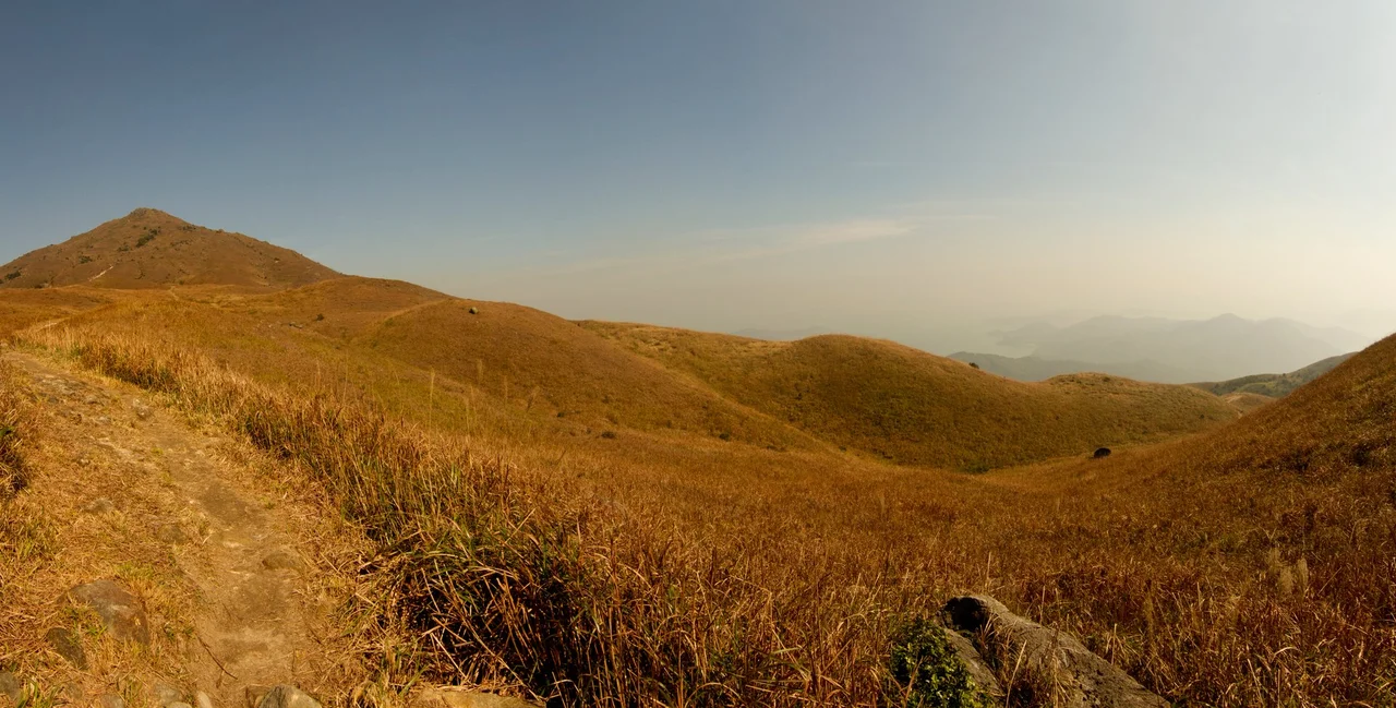

Lantau Island
In 1277, two young princes — the last heirs of the Song dynasty — sought refuge on an island west of what would become Hong Kong. The older boy had been declared emperor at nine years old, fleeing the Mongol army that had already shattered the court. He and his younger brother sheltered in what locals then called Gangzhou, resting in the bay now known as Mui Wo. Both boys would die within two years, the dynasty ending with them. The island absorbed that moment of dynastic collapse and moved on, as it has absorbed everything that followed: pirates, Portuguese traders, opium smugglers, British colonizers, and eventually, an international airport serving over 70 million passengers a year.
Older Than Any Dynasty
Before the emperors arrived, before the Portuguese trading posts of the 1510s, Lantau was already inhabited. Rock carvings at Shek Pik on the southwestern coast are thought to date back to the Bronze Age; a stone circle at Fan Lau is older still, probably Neolithic. The island has been called Tai Hai Shan, Tai Kai Shan, Tai Yi Shan, and Tuen Mun Island across the centuries — each name a palimpsest of whoever was recording it.
Portuguese traders established some of the first European settlements in the Pearl River area on Lantau in the 1510s, before being driven out around 1517 following military defeats at the Battles of Tunmen and Sincouwaan. Cornelis Matelieff de Jonge of the Dutch East India Company visited in 1607, sketching an official's compound that was later published in his travelogue. Long before the British became interested in Hong Kong Island, Lantau was already on European maps as a landmark on the sea route to Canton.
Pirates, Forts, and the Opium Coast
Lantau's mountainous terrain and deep valleys made it ideal for people who preferred to operate outside official sight. The pirate Cheung Po Tsai — one of the most formidable pirates in South China Sea history — used the island as a base in the 19th century. Galena, a lead-silver mineral, was mined at Mui Wo until the same era.
The British built Tung Chung Fort in 1817 specifically to thwart the opium trade and defend against the pirates working the coast. Six old cannons still stand within its granite enclosures. During the Second World War, Japanese forces occupied the fort, just as they occupied the rest of Hong Kong from 1941 to 1945. The island's wooded areas and deep valleys that once sheltered pirates then sheltered resistance fighters, who used them to organize ambushes and move supplies until the Japanese occupation ended. The fort was listed as a historical monument in 1979.
The Big Buddha and the Fishing Village That Refused to Change
On the Ngong Ping Plateau, 268 steps above the Po Lin Monastery, a 26-metre bronze Buddha sits facing north — once the world's largest seated outdoor bronze Buddha statue, consecrated in 1993. Walkers can reach it in two hours from Tung Chung; the Ngong Ping 360 cable car covers the 5.7-kilometre journey in 20 minutes. On clear mornings, the view from the Buddha's platform takes in the whole northern coast of Lantau, Hong Kong International Airport, and the South China Sea beyond.
Tai O, in the northwest, offers the opposite kind of spectacle. Over three centuries old, it is one of the last traditional fishing villages in Hong Kong, built on stilts over a tidal channel. Hundreds of *pang uk* — stilt houses — crowd the water's edge, accessed by footbridge. A fire in July 2000 destroyed a section; super typhoons have damaged others. Yet Tai O keeps its character: the smell of the locally produced shrimp paste, the sound of fishing boats returning, the waterways dividing the village as they always have.
Pink Dolphins and a Green Interior
More than half of Lantau consists of protected national parks, and the island's ecological health shows. Chinese white dolphins — called pink dolphins for the colour their skin takes in sunlight — swim off the coast in numbers that make Lantau one of the best places in Asia to see them. The Southwest Lantau Marine Park was established to protect their habitat.
Feral water buffalo roam the wetlands at Mui Wo and Pui O, descendants of working animals that were released when farmers mechanized. Oyster beds, lemon trees, and tangerine orchards define the rural south. Cheung Sha, Lantau's longest beach, curves along the southern coast. The 70-kilometre Lantau Trail circles the island in 12 stages, crossing all of this terrain — through country park, along ridgelines, past ancient villages, down to the sea.
The Airport That Changed Everything
Hong Kong International Airport opened on Chek Lap Kok — a small island off Lantau's north coast that was levelled and expanded through one of the largest land reclamation projects in history — in July 1998. Connected to the urban areas by the Lantau Link (which includes the Tsing Ma Bridge, one of the world's longest road-and-rail suspension bridges), the airport transformed Lantau overnight. The Tung Chung new town rose around the rail connection. Hong Kong Disneyland followed in 2005 on reclaimed land at Penny's Bay, a US$1.8 billion project covering 310 acres.
In the space of a decade, an island that had spent millennia as a place people passed through on the way to somewhere else became a destination in its own right — and the literal entry point to one of the world's great cities.
From the Air
Lantau Island lies at approximately 22.27°N, 113.95°E, about 30 km west of the Central business district of Hong Kong. At 147 km², it dominates the approach from the west. Hong Kong International Airport (VHHH/HKG) sits on the northern shore at Chek Lap Kok; the Tsing Ma Bridge and Lantau Link are unmistakable landmarks connecting the island to Kowloon. Lantau Peak (934 m) is the highest terrain feature, located in the centre-south of the island. Pilots should be aware of the Class B/C controlled airspace around VHHH extending well across the island. Recommended viewing altitude: 5,000–8,000 feet from the south or west for the full island profile; the Big Buddha at Ngong Ping is visible at lower altitudes from the northeast.
Nearby Stories
- Lok Ma Chau Loop 2.3 km away
- Portas do Cerco 2.3 km away
- Kweilin Incident 17 km away
- Wanshan Archipelago Campaign 34 km away
- Nanxiong Formation 115 km away
- Battle of Nanpeng Island 148 km away
- Heyuan 169 km away
- Cape Maobitou 632 km away