
Lantau Trail
The trail starts and ends in Mui Wo — a rural ferry town on the eastern coast of Lantau where Star Ferries still connect to Central — and makes a complete circuit of the island. Seventy kilometres, twelve stages, opened on 4 December 1984. That is the Lantau Trail in outline. What it actually is, walked in sections across a year or all at once in two gruelling days, is something harder to summarize: a journey through every version of Lantau that exists simultaneously. Farming village and world-class monastery. Protected wetland and ancient fishing harbour. Ridge-top silence and, somewhere below, an international airport serving tens of millions of passengers a year.
The Twelve Stages
Hong Kong has longer trails — the MacLehose Trail at 100 kilometres, the Wilson Trail at 78 kilometres — but the Lantau Trail's loop structure gives it a particular logic. Every kilometre leads somewhere new; nothing is retraced. The early stages (1 and 2) climb from Mui Wo south to Nam Shan and then southwest to Pak Kung Au, gaining elevation steadily. Stage 3 is where the mountain work begins in earnest, pushing up toward the Ngong Ping area and the approaches to Lantau Peak. By Stage 6, the trail drops to Tai O, the ancient stilt-house fishing village on the northwest coast, before swinging back along the wild southern shore through Sections 7 and 8.
The southern coast stages are the most isolated — long stretches between distance posts, cliffs above the sea, no roads nearby. The final stages (9 through 12) work back east along the lower southern slopes, through Shui Hau and Pui O, returning to Mui Wo along Lantau's gentler terrain. Distance posts spaced roughly 500 metres apart mark the entire route; route signs at every junction give direction, place names, and hiking times.
From Sunrise on the Summit to the Buddha Below
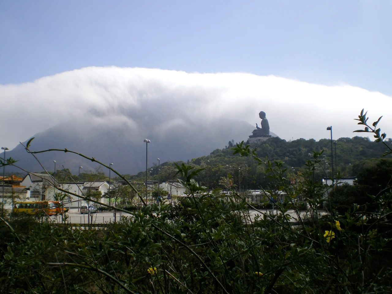
Stage 3 brings hikers to the area around Lantau Peak and the Ngong Ping Plateau, the elevated tableland that holds the Po Lin Monastery and the Tian Tan Buddha — a 26-metre bronze statue consecrated in 1993, once the world's largest seated outdoor bronze Buddha. Coming over the ridge on foot, having climbed from Pak Kung Au through the clouds, and arriving at the plateau to find this immense figure looking north across the valley is one of the more striking transitions on any trail in Hong Kong.
The Ngong Ping 360 cable car station sits nearby, importing tourists from Tung Chung in 20-minute gondola rides. For hikers on the Lantau Trail, the cable car station is a waypoint and potential exit — though the trail's rerouting around Sections 3 and 4 has created some navigational uncertainty near the station that is worth noting before setting out.
Tai O and the Western Shore
Stage 6 drops into Tai O — over 300 years old, still defined by its stilt houses (*pang uk*) built over tidal channels, still smelling of the shrimp paste and salted fish that have been produced here for generations. The contrast with the manicured Ngong Ping Plateau, a few kilometres back, is sharp. Tai O has been damaged by fire and typhoons but keeps rebuilding in the same form, in the same place, by the same logic: the sea is here, and the sea is what the village runs on.
West of Tai O, Stage 7 follows the island's wilder western coastline toward Kau Ling Chung. This section has been complicated by a land dispute: the trail passes through the Yi O area, where private landowners have closed a portion of Section 7, forcing hikers onto a diversion route. The closure is connected to an organic farm development that generated significant controversy — the developer was investigated for clearing ecologically sensitive land in a protected country park. The rare Romer's tree frog, endemic to Hong Kong, lives in the wetlands at Yi O. The diversion adds distance and skips terrain that was once among the trail's most remote.
What the Trail Is For
The Lantau Trail is not technically demanding in the way of alpine routes. Most stages are rated either 'easy walk' or 'fairly difficult'; only Sections 2 and 3, climbing to altitude, are graded 'very difficult.' What the trail demands is time and commitment to the full circuit. Done in sections over multiple visits, it reveals a Lantau most airport transit passengers never see: feral water buffalo standing in coastal wetlands; Chinese white dolphins visible from southern headlands on calm days; Bronze Age rock carvings at Shek Pik, weathered but still readable.
The trail opened the same year Hong Kong was preparing for the 1997 handover — a moment when the territory was thinking hard about what it was and what it would become. Lantau, the largest island but the least developed, was central to those conversations. The trail had the quiet effect of making the island's character legible: not just a construction site for the future airport, but a place with deep time and a landscape worth protecting.
From the Air
The Lantau Trail runs across Lantau Island, centred approximately at 22.249°N, 113.928°E. The trail's highest section approaches Lantau Peak at 934 m (3,064 ft) — a significant terrain obstacle. The full circuit covers an island 147 km² in area, approximately 30 km west of Hong Kong's Central district. Hong Kong International Airport (VHHH) operates on the northern shore; the trail runs well south of the controlled airspace envelope at its closest approach. From altitude, the trail's route is traceable by the ridgelines it follows: the high spine running east-west through the island's centre, and the lower coastal strips on the north and south shores. Recommended viewing altitude: 5,000–7,000 feet for full island context.
Nearby Stories
- Lok Ma Chau Loop 2.3 km away
- Portas do Cerco 2.3 km away
- Kweilin Incident 17 km away
- Wanshan Archipelago Campaign 34 km away
- Nanxiong Formation 115 km away
- Battle of Nanpeng Island 148 km away
- Heyuan 169 km away
- Cape Maobitou 632 km away