.jpg)
Leenane
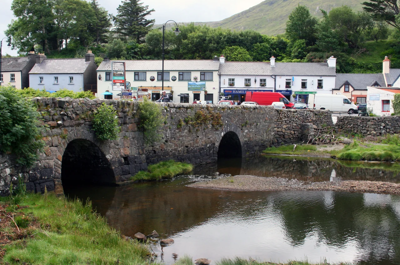
At the head of the valley behind Leenane rises a mountain that Irish-speakers call Magairlí an Deamhain, the devil's testicles. English mapmakers, looking at their maps and at their dictionaries, decided this would not do, and renamed it Devilsmother. The villagers of Leenane have always known what the mountain is actually called. The village sits at the head of Killary, the long narrow inlet often described as Ireland's only fjord, where saltwater pushes sixteen kilometres inland and the county boundary runs down the middle of the water. Population is about 200. Jim Sheridan filmed The Field here in 1990, and the dark hills above the village still look like a place where a man could die for a piece of land.
Where the Tide Fills
The Irish name is An Líonán, 'where the tide fills.' The geography behind that name is precise. Killary fjord is a narrow saltwater inlet that runs east from the Atlantic for about 16 kilometres, cutting deep into the mountains between Galway and Mayo. The tide enters with force, fills the cup at the head of the inlet where Leenane sits, and ebbs back out twice a day. The fjord is the county boundary: Leenane and the south shore belong to County Galway; Aaleagh and Clog on the north shore belong to County Mayo, though everyone treats them as part of the same village. The mountains drop straight to the water on both sides. The southern range, in Galway, is hard quartzite. The northern range, in Mayo, is Ordovician sandstone. The geology disagrees across the water.
The Field and the Cross
Jim Sheridan's 1990 film The Field, starring Richard Harris as a tenant farmer fighting to keep land he has worked for years, was shot in and around Leenane. Harris was nominated for an Academy Award for the role. The film made Leenane briefly famous, and the local landscape was the better for being seen as Sheridan saw it: hard, beautiful, indifferent to the people who lived in it. But the more solemn cinema of Leenane is not a film at all. North of the village on the R335, past Fin Lough, lies Doo Lough, the 'black lake,' hemmed in by mountains seven and eight hundred metres high. A Celtic cross at the north end of the lake commemorates events of 1849 in the Great Famine. Officials from the relief effort, who had failed to inspect the destitute at Louisburgh, ordered hundreds of starving people to walk twelve miles south to Delphi by 7 AM the next morning to claim their relief. Through a cold wet night, they walked. Seven died on the road. Nine more were never seen again. The exact death toll is not known. The cross is small. The lake is dark.
Maam Valley and Mweelrea
South of Leenane the glaciated U-shaped Maam Valley runs southeast toward Lough Corrib, carrying the Joyce River along its floor. Maam means 'a pass,' and the R336 road through the valley is a natural driving route, part of the Connemara Loop. The Maamturk Mountains rise at its head, scattered with prehistoric and early historic sites and patches of ancient woodland. In 2017 a new species of brittle-star fossil was found here and named Crepidosoma doylei. North of Killary fjord rises Mweelrea, 814 metres, the highest mountain in Connacht, its name from Cnoc Maol Réidh meaning 'bald hill with a smooth top.' It is exactly that. The quickest route up is from the west, near the end of the lane at Cloonamanagh. It is, in the honest words of the local guidance, 'a slog-in-a-bog however you approach.'
Hamiltons, Boats, and the Western Way
Leenane is small enough that one shop covers everything: Hamiltons is the village shop, post office, and filling station. Killary Fjord Boat Tours run 90-minute cruises out into the fjord between April and October, two or three times a day, threading between the steep walls of mountain. The Western Way, a long-distance walking trail that begins in Oughterard, climbs up through Maam, cuts west across the Maamturks into the Inagh Valley, and winds down into Leenane. From here it continues north across the county line at Aasleagh Falls, up the Erriff Valley, and on to Westport and eventually County Sligo. Bus Éireann route 423 runs every two hours from Westport, taking an hour to reach Leenane and continuing to Letterfrack and Clifden. There is no direct bus to Galway; you have to change at Clifden. As of May 2025 the village has 4G but no 5G. Kylemore Abbey and its gardens lie a few kilometres west, with Clifden and the Atlantic coast beyond.
From the Air
Leenane sits at 53.60°N, 9.68°W at the head of Killary fjord, which runs roughly east-west between Counties Galway (south shore) and Mayo (north shore). The fjord is unmistakable from the air, a narrow finger of dark water cutting deep into the mountains. Mweelrea (814 m) rises north of the fjord; the Maamturks rise south. Connemara Airport (EICA) is roughly 35 km southwest near Inverin; Ireland West Airport (EIKN) at Knock is about 60 km northeast. Atlantic systems funnel into the fjord, generating fast-moving cloud and rain; clear morning light over Killary is dramatic and uncommon. Aasleagh Falls and the entrance to the Delphi Valley lie immediately northeast of the village.
Nearby Stories
- Salthill 4.4 km away
- Ardoileán 4.7 km away
- Ross Errilly Friary 5.1 km away
- Westport House 8.8 km away
- Kiltimagh 12 km away
- Inishmore 16 km away
- RMS Carinthia (1925) 32 km away
- Blackrock Island, County Mayo 32 km away