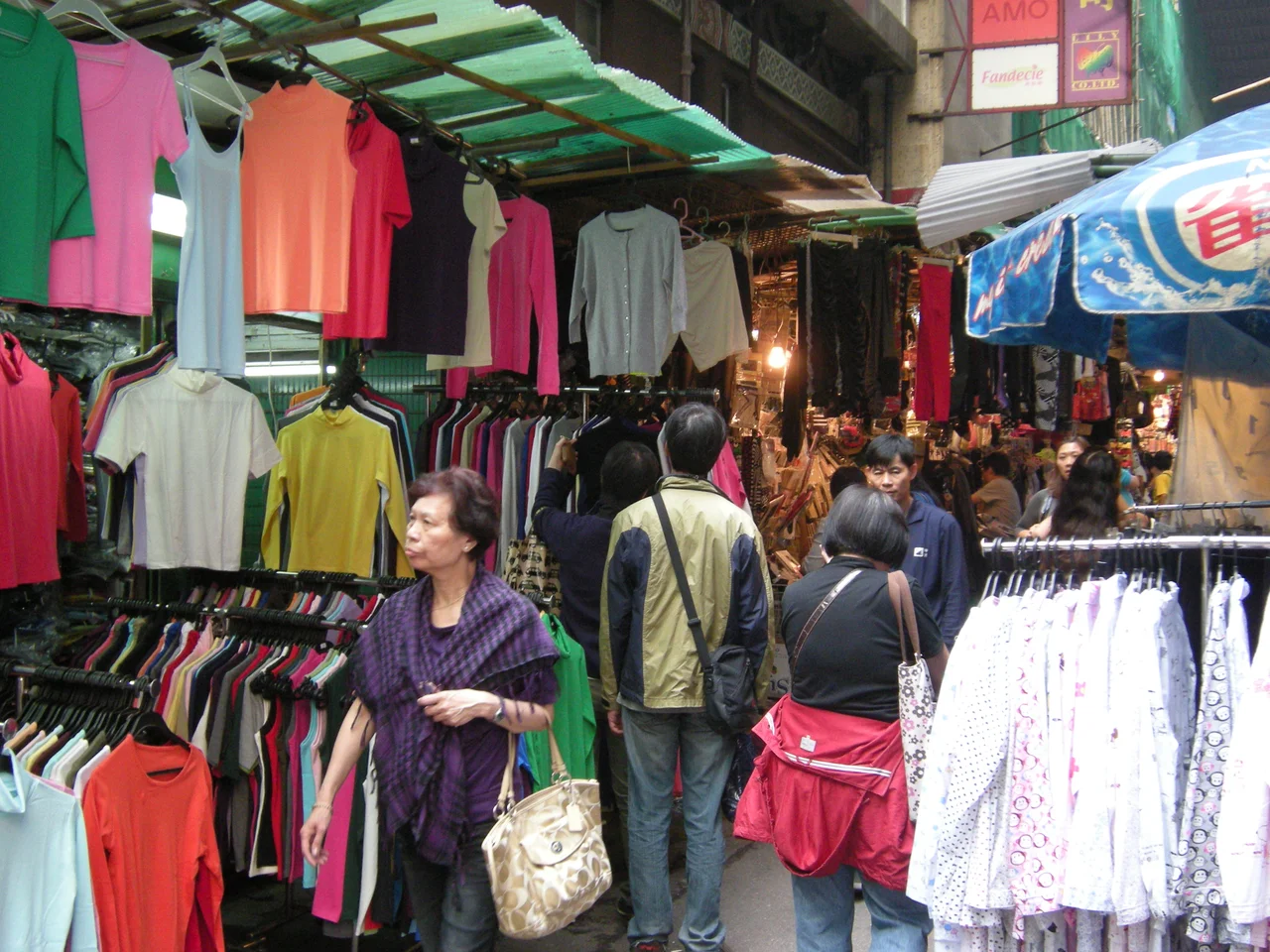

Li Yuen Street East
In 1894, a businessman from Taishan named Kim Li Yuen bought a piece of newly reclaimed land in Central Hong Kong and built houses on it. He paved a street and named it after himself. Over the following century, that street became a newspaper hub, then a garment market, then a tourist landmark — and throughout all of it, it remained one of the few places in the colonial city where a Chinese merchant's name was carved permanently into the grid.
The Merchant Who Left His Name
Kim Li Yuen came from Taishan, a county in Guangdong Province with a long tradition of overseas migration and foreign trade. By the 1890s, Hong Kong's colonial government was carrying out large-scale reclamation projects along the harbour, opening new land for development in the Central district. Kim purchased part of this reclaimed ground — practical, speculative, characteristic of how the territory's Chinese merchant class operated within the colonial economy. He developed the land, built a street, and named it after his given name: Li Yuen. Because the lane runs eastward, it became Li Yuen Street East, to distinguish it from the parallel lane to the west. It was the first street in colonial Hong Kong named after a Chinese member of the community, a distinction that required naming in the first place — a small act of permanence in a city that was being built largely in service of other people's ambitions.
Newspaper Street at Dawn
After World War II, Hong Kong's newspaper industry concentrated itself on Li Yuen Street East. The printing workshops and editorial offices that moved in gave the lane a new identity: it became known as "Newspaper Street." Every morning before the city was fully awake, workers carried stacks of freshly printed papers from the presses and out onto the lane for distribution across Hong Kong. The image that people who remember it describe is vivid: lines of workers moving through the narrow street in the early light, arms full of newsprint still warm from the rollers. It was a functional scene, not a picturesque one — the city's daily information supply being physically loaded onto backs and carts before being dispersed to the rest of the territory. The offices did not stay long. Hong Kong moved fast in the postwar decades, and the newspaper industry eventually relocated.
Central's Women Street
When the newspaper offices left, the street stalls came. Vendors selling clothes moved into the space, lining both sides of the narrow lane with racks of fabric and ready-made garments. As tourism in Hong Kong grew, the stalls diversified: clothes gave way to accessories, drapery, souvenirs, and everyday goods packed densely on either side of a passageway barely wide enough for two people to pass carrying bags. The lane picked up a new nickname — "Central's Women Street," modelled on the famous Ladies' Market on Tung Choi Street in Mong Kok, Kowloon. The comparison is apt in terms of scale and atmosphere, if not geography. Li Yuen Street East brings the market lane experience to the professional heart of Hong Kong Island, wedged between the towers of Des Voeux Road Central and Queen's Road Central, a few minutes' walk from the financial district.
The Lane Between the Roads
Part of what makes Li Yuen Street East work is its geometry. Des Voeux Road Central runs along the waterfront, Queen's Road Central runs parallel a block inland, and between them the lanes of Central form a dense pedestrian network that predates the MTR, the elevated walkways, and the reclamation that has pushed the harbour ever further north. Li Yuen Street East is one thread in that network — a single block long, connecting two major roads at angles that make it a natural shortcut. The stalls benefit from the foot traffic; the foot traffic benefits from the shortcut. The result is a lane that has been useful for over a century in constantly changing ways, adapting its function while keeping its address and, since 1894, its name.
From the Air
Li Yuen Street East runs through the Central district of Hong Kong Island at approximately 22.2828°N, 114.1564°E, in the dense commercial core between Des Voeux Road Central and Queen's Road Central. From altitude, Central is identifiable as the highest-density cluster of towers on the northern shore of Hong Kong Island, immediately south of Victoria Harbour. Hong Kong International Airport (VHHH) lies approximately 36 km to the west on Lantau Island. At 2,000–3,000 feet, the contrast between the tight urban grid of Central and Victoria Harbour to the north is the dominant visual feature of this approach corridor.
Nearby Stories
- Lok Ma Chau Loop 2.3 km away
- Portas do Cerco 2.3 km away
- Kweilin Incident 17 km away
- Wanshan Archipelago Campaign 34 km away
- Nanxiong Formation 115 km away
- Battle of Nanpeng Island 148 km away
- Heyuan 169 km away
- Cape Maobitou 632 km away