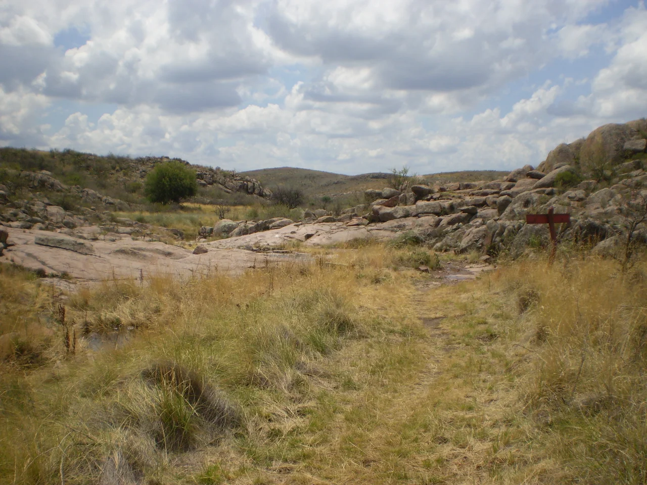

Lihué Calel National Park
Drive across central La Pampa and the land barely changes: flat, dry, scoured by wind, the color of old straw. Then a cluster of low hills appears on the horizon, and at certain hours, under certain light, they glow a deep reddish purple. The Mapuche named this place Lihué Calel, which can be read as "mountains of life," and the name is precise. These ancient granite ranges trap moisture the surrounding plain never sees, and in their shelter a startling diversity of plants and animals takes hold. The park covers 324 square kilometers and was established in 1977, but the life it protects, and the human marks it preserves, run far deeper into time.
Mountains That Make Their Own Weather
The hills of Lihué Calel are not tall, yet they change everything around them. These are old ranges of rhyolitic ignimbrite — volcanic pyroclastic rock that weathers into landforms resembling granite — and they create a more humid microclimate than the arid plain that surrounds them. That small mercy of extra moisture has extraordinary results. Roughly forty percent of all the plant species found in La Pampa Province grow within these modest hills. Among them are endemics found almost nowhere else: a pampean daisy, a legume named Adesmia lihuelensis for this very place, and the resinous yellow grindelia. After rain, water runs in temporary streams off the rock, gathering in pools and channels, and the slopes briefly flush with green before the dry air reclaims them. It is a desert garden hidden in plain sight, gathered around stone, and the contrast with the bleached plain beyond the park's edge could hardly be sharper.
The Valley of the Paintings
Tucked into the hills is a place called the Valle de las Pinturas, the Valley of the Paintings. Reaching it means a roundtrip of about twenty kilometers, the last stretch covered on foot, ending at a rock overhang. On its sheltered stone are geometric figures painted long ago, marks left by people who hunted and traveled this country more than a thousand years ago. Indigenous nations including the Ranquel and Pehuenche knew these ranges intimately, using the reliable water and high vantage points the surrounding flatland could not offer. Standing beneath the overhang, you are sharing shade with people who stood here more than a thousand years ago and chose, deliberately, to leave something of themselves on the rock. The paintings have outlasted everyone who made them, and they remain the park's quiet heart.
A Country Lost
These hills were not always a refuge of quiet. In the 1870s and 1880s, the Argentine state's military campaign known as the Conquest of the Desert swept across the pampa and Patagonia, breaking the Indigenous nations who had lived here for generations and seizing their land. The Ranquel and other peoples who relied on places like Lihué Calel were pushed out, killed, or scattered. The rock paintings endure as testimony to a way of life that the campaign worked to erase. To walk this park is to move through a landscape that was someone's home long before it was anyone's national park, and the silence of the hills carries that history.
Guanacos at the Edge of Sight
The animals that live here have learned to thrive on little. Guanacos, the wild relatives of the llama, graze the slopes and bolt at the first sign of intrusion. Gray foxes slip through the scrub, and maras, the long-legged Patagonian hares, freeze and watch. Rheas stride across open ground, and pumas, rarely seen, move through at dawn and dusk. The park also shelters animals under threat: the crowned eagle, the peregrine falcon, the yellow-cardinal, the strange pink fairy armadillo that swims through sand, and the Patagonian tortoise. In a province given over largely to farms and grazing, Lihué Calel remains a stronghold where the old pampa, and its wildlife, still holds on.
From the Air
Lihué Calel National Park lies at roughly 37.95 degrees south, 65.65 degrees west, in the center of La Pampa Province. From the air it is unmistakable: an isolated cluster of low, rounded hills rising abruptly from an almost featureless dry plain, casting long shadows in morning and evening light. The granite takes on reddish and purple tones that distinguish it from the pale surrounding steppe. The park sits about 230 km southwest of Santa Rosa, whose airport (SAZR) is the nearest sizeable field, roughly 120 km from General Acha, and 35 km from the small town of Puelches. Provincial routes thread toward the hills from the north. Bahía Blanca (SAZB) lies far to the east and Neuquén (SAZN) to the west. The dry air usually allows excellent visibility, though afternoon thermals over the heated plain can bring turbulence.
Nearby Stories
- Chimpay 114 km away
- Villa Epecuén 204 km away
- FaSinPat 208 km away
- The Works of Francisco Salamone 215 km away
- Neuquén 235 km away
- Facundo Astudillo Castro 236 km away
- Pigüé 279 km away
- Reserva Provincial La Payunia 306 km away