
Lin Ma Hang
The village is named for a fruit — Lin Ma, 蓮麻 — found in the mid-level streams that feed down from Robin's Nest hill. It is the kind of quiet, particular detail that belongs to a place that has been paying close attention to its own landscape for a long time. Lin Ma Hang sits in the Sha Tau Kok area of Hong Kong's New Territories, pressed against the Shenzhen River with China visible across the water. For most of its modern existence the village was locked inside the Frontier Closed Area, inaccessible without a government permit. The mines are flooded and silent. A small bridge that once let farmers cross into the mainland for their fields stands abandoned as of 2025. But the ancestral halls still hold their carved timber, the stream still supports half of Hong Kong's native freshwater fish species, and the Hanging Bell Flowers still bloom on Robin's Nest each winter.
Four Clans, One Valley
The people of Lin Ma Hang descend from four main clans: the Yip (葉), Lau (劉), Sin (冼), and Koon (官). They are part of the Four Yeuk — a traditional alliance of four villages including Loi Tung, Lung Yeuk Tau, Lin Ma Hang, and Tan Chuk Hang — whose ceremonial centre is the Hung Shing Temple at Hung Leng. In 1911, the census recorded 516 residents, 199 of them male — numbers that reflect a community large enough to maintain multiple ancestral halls, a village office with a "Gold List" recording every graduate, and a temple to Kwan Tai. Today the Yip Ancestral Hall is the most visited, its interior preserving a carved sedan chair once used for village weddings — an object so specific in its associations that it anchors the whole hall in human time rather than institutional history. The Residence of Ip Ting-sz holds declared monument status. Several other structures carry Grade II or Grade III historic building designations. A MacIntosh Fort on the ridge above the village, overlooking Shenzhen, reminds visitors that the hills here were once a military observation post as much as a farming landscape.
The Mine in the Mountain
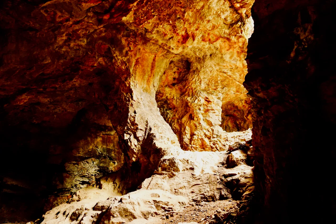
Lead ore was discovered at Lin Ma Hang in 1915, and a mine went into operation that year to extract lead-zinc ore from the hillside. It ran intermittently for over four decades — not continuously, but returning whenever conditions and prices warranted — before the government rescinded the mining lease in 1962 and the workings were permanently abandoned. Over that period, the mine produced 16,000 tonnes of lead metal and 360,000 ounces of silver. The tunnels are now flooded, their pillars intact underground in the dark. Bats have colonized the deeper reaches. The Lin Ma Hang Stream that drains the valley below was designated a Site of Special Scientific Interest in 2008, partly in recognition of what the mine's closure allowed to recover: the stream now supports 17 species of primary freshwater fish, representing 50 percent of all such species native to Hong Kong. Industrial extraction and ecological recovery share the same hillside, separated by sixty years.
The International Bridge
Just outside the gate leading from the village to Lin Ma Hang Road, a small bridge crosses into mainland China. It is called the international bridge — 國際橋 — and for decades it served a very specific purpose: allowing farmers on both sides of the border to reach their agricultural lots on the opposite bank. Users needed a special Cross Border Farming Permit, a document that acknowledged the practical reality that families whose land straddled a political boundary did not stop needing to work it simply because that boundary existed. The mainland border post is visible from the village gate. As of 2025, the bridge is abandoned; the farming arrangements that sustained it have apparently lapsed. What remains is the bridge itself, a small concrete span across a river that once marked the edge of two empires and now divides two systems, standing as a record of the ordinary human accommodations that borders require.
Opening Up — Slowly
Until January 4, 2016, Lin Ma Hang was entirely within the Frontier Closed Area, inaccessible to anyone without a government permit. The 2016 reclassification removed the village itself from the closed zone, but a section of Lin Ma Hang Road — the access route between Wang Lek and the village — remained inside the restricted boundary, meaning road access still required a permit. A parallel footpath, rough in places and with short steep sections, was built outside the closed area to allow permit-free access on foot. Green Minibus 59K from Sheung Shui Station connects the village to urban Hong Kong, and since early 2025 passengers on that service no longer need a permit to enter or leave. The village is also reachable by hiking down from Robin's Nest hill — an approach that rewards visitors with the Hanging Bell Flowers (吊鐘花) that blanket the basin in season, a detail locals have remembered long enough to give it a name.
From the Air
Lin Ma Hang sits at approximately 22.55°N, 114.18°E in the northeastern New Territories of Hong Kong, directly adjacent to the Shenzhen River. From the air, the village occupies a narrow valley between Robin's Nest hill (Hung Fa Leng ridge) to the south and the river to the north, with the built-up areas of Shenzhen visible just across the water. The Frontier Closed Area boundary runs nearby — look for the contrast between the relatively undeveloped Hong Kong side and the urban density of Shenzhen beyond the river. Nearest airport is Hong Kong International (VHHH), approximately 45 km to the southwest. Best viewed at 2,000–3,000 feet on a clear winter or spring day, when the Hanging Bell Flowers on Robin's Nest are visible as a reddish-pink flush on the hillsides to the south.
Nearby Stories
- Hong Kong Disneyland 4.1 km away
- Mount Guanyin (Dongguan) 7 km away
- 2024 Lixinsha Bridge Collapse 7.4 km away
- Portas do Cerco 12 km away
- Lotus Hill 15 km away
- Nanxiong Formation 78 km away
- Heyuan 130 km away
- Checheng Fu'an Temple 629 km away