.jpg)
Lion Mountains
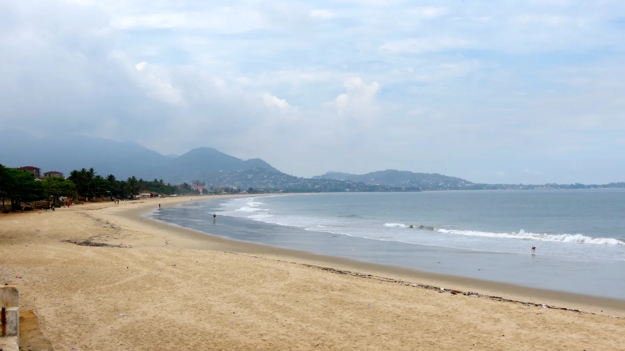
An entire country is named after this ridge of green hills, and almost no one who says the name knows it. Sierra Leone means "Lion Mountains" - and the lions in question are these, a 30-kilometer wall of forested peaks rising straight out of the Atlantic just southeast of Freetown. In 1462, a Portuguese navigator looked up at them from the deck of his ship, heard something in their shape or their storms that reminded him of a great cat, and wrote down a name that stuck to the whole coast, then the colony, then the republic.
The Name That Became a Nation
The navigator was Pedro de Sintra, charting West Africa for the Portuguese crown when he reached this harbor. He called the range Serra Lyoa, the Lion Mountains. Why a lion? The accounts disagree - some say the jagged coastal hills looked like a lion's teeth, others that the thunder rolling off the peaks during the rains sounded like a roar. Both are plausible to anyone who has stood beneath them in a storm. Later, Italian cartographers asked the explorer Alvise Cadamosto what the place was called, and he gave them the name in his own tongue: Sierra Leone. That spelling traveled into English and never left. Few nations can point to the exact landmark that named them. This one can - and you can see it from a plane window.
An Island of Mountains
What makes the Lion Mountains so striking is how alone they stand. They rise on the Freetown Peninsula, ringed by the sea on three sides and flat lowland on the fourth. There is no foothill to ease you into them and no neighboring range to share the horizon. The nearest mountains worth the name, the Guinea Highlands, lie some 200 kilometers inland, where the land finally begins to climb again. For the early European mariners feeling their way down a low, hazy coast, these were the only significant heights between Morocco and Cameroon - thousands of kilometers of shoreline with a single dramatic landmark in the middle. No wonder de Sintra reached for a name as large as a lion.
Green to the Summit
The highest point is Picket Hill, at 888 meters, and the slopes around it are cloaked in rainforest rather than bare rock. Since 1916 the range has fallen within the Western Area Forest Reserve, a protected zone with a longstanding hunting ban that has helped keep the canopy intact above a rapidly growing capital. These are not the gray, snow-streaked mountains of postcards. They are tropical heights, wet and dense and loud with birds, their ridgelines often wrapped in cloud where the moist Atlantic air piles up against the slopes. The same forest that pulls rain from the sky is what gives the whole peninsula its water - and what travelers below see as an unbroken green wall guarding the city's back.
Above Freetown
Today the Lion Mountains shelter Freetown the way they have sheltered every settlement here for centuries, their flanks holding villages, footpaths, and the chimpanzee-rich forest of the Western Area Peninsula National Park. From the water, they still do what they did for de Sintra: announce the land before anything else. Sailors, pilots, and returning Sierra Leoneans all watch for the same silhouette on the horizon - a low country suddenly piling up into peaks, the only ones for a thousand miles in either direction. The lion has been quietly presiding over its country since long before that country had a flag, a name, or a single citizen to speak it.
From the Air
The Lion Mountains run roughly 30 km along the Freetown Peninsula, centered near 8.282°N, 13.120°W, with Picket Hill the high point at 888 m (2,913 ft). Approach from the Atlantic for the classic mariner's view - a flat coast suddenly rising into forested peaks. Lungi International Airport (GFLL), serving Freetown, lies just across the estuary to the north. Maintain safe terrain clearance over the ridgeline; expect orographic cloud and afternoon buildups against the slopes during the May-November rainy season, when visibility near the summits drops quickly.
Nearby Stories
- Mabilafu 48 km away
- Turtle Islands 55 km away
- Sierra Leone 63 km away
- Bonthe 64 km away
- Îles de Los 95 km away
- Sandervalia National Museum 115 km away
- Loos Islands 126 km away
- Rocas Atoll 2595 km away