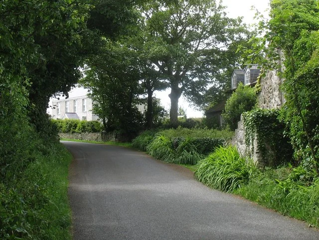

Llanfaethlu
On the night of 3-4 December 1863 a hurricane struck this stretch of Anglesey coast and wrecked fifteen vessels between Peniel Beach and Clipperau Point. One was the wooden schooner Elizabeth, out of Whitehaven, lost at Porth Penrhyn-mawr. The Holyhead lifeboat launched into the worst of it - taken out by harbour men and pilots after the regular crew had declined to go - and rescued 43 men from three other ships before the night was done. Llanfaethlu village sits inland from this coast: a quiet farming community of around 553 people at the 2011 census, with two prehistoric scheduled monuments, a Georgian country house and a parish church built on the site of an earlier monastery. But the five miles of cliff and beach to the west of the village hold the resting places of at least sixteen named wrecks. Anglesey's coast has always asked a high price of sailing ships, and Llanfaethlu has collected more than its share.
The Standing Stone and the Coins
Half a mile east of the village, beside the modern A5025 and close to Soar Baptist Chapel, stands the Capel Soar Standing Stone - a tapering slab 3.2 metres high and 1.7 metres wide at the base. It is a scheduled monument. On a headland near the coastal hamlet of Tre-Fadog, overlooking Port Trefadog, lies a second scheduled site: a small Iron Age hill fort with a single bank and ditch around a cliff-edge promontory. Roman activity surfaced in 1929, when a small hoard of coins was unearthed on a hill west of the church; some had been minted during the reign of Domitian, around 90 AD. The village's own foundation is much later. Maethlu the Confessor, an early Christian missionary, is thought to have established a religious settlement about three-quarters of a mile south of the present parish church. Two further early Christian burial sites have been found close by, at Hen Siop and at the lodge of Carreglwyd.
Carreglwyd and the Telegraph
Just to the north-west of the village rises Carreglwyd, a Grade II*-listed Georgian house at the heart of a country estate. Its core is seventeenth century; the present elegant Georgian face came in successive remodellings. Its hall, by official assessment, is 'especially fine.' Far less elegant in concept but pivotal in its day was the Llanfaethlu telegraph station, opened in 1827 as part of a visual signal chain stretching between Liverpool and Holyhead. Operators waved flag semaphore from station to station to relay news of arriving ships - cargo manifests, owners' instructions, sailings - so that the merchants of Liverpool could read what was happening at the harbour mouth in nearly real time. Bad weather of course swallowed the signals; the system was replaced by electric telegraph later in the century. For a few decades, though, this little Anglesey village was one of the speed nodes of British commerce.
The Cost of the Coast
Anglesey's coast, like much of the Irish Sea, is shallow, ringed with hidden rocks and exposed to gales from almost every quarter. The wrecks along Llanfaethlu's five miles tell a steady story. In February 1898 the 74-foot schooner Grace Phillips, owned by T Morgan & Co of Amlwch, was caught in a force-eight gale on passage from Milford Haven to Caernarfon and blown ashore at Porth Tywyn-mawr. In December 1886 the 122-foot barque Dagmar, carrying timber from New Brunswick to Liverpool, was driven onto the same beach by a force-ten gale; the Holyhead coxswain earned a silver medal that night for rescuing the Dagmar's crew along with the crews of three other vessels - 21 lives saved in a single day. In January 1852 the mail vessel Town of Wexford ran ashore at Porth Trefadog; the Holyhead lifeboat was towed out by a rival paddle-steamer and over several trips saved 43 lives. The 170-foot Norwegian barque Hypatia stranded south of Borthwen in November 1888; rocket apparatus on the beach got a line out, and all 13 sailors still aboard were landed safely with their baggage.
Clipperau and the Reedbed
At the southern end of the Llanfaethlu coast lies Clipperau Point, Creigiau Cliperau in Welsh, a headland that has caught ships driven south-west by gales for two centuries. The roll call of vessels lost on or near this single rock includes the Maeleta in 1883, the Antelope in 1886, the Alexandra in 1871, and the steamship Meath in 1892. Behind the coast, inland of Carreglwyd, the SSSI of Llyn Garreg-lwyd preserves a 17.7-hectare mire and fen with one of the largest reedbeds on Anglesey - a quiet, birdsung counter to the violence of the shore. Some six kilometres of the 200-kilometre Anglesey Coastal Path runs along this stretch within the Isle of Anglesey Area of Outstanding Natural Beauty. The path passes the wreck sites without marking them. Most are unmarked, since most are simply gone.
From the Air
Llanfaethlu village at 53.34 N, 4.55 W, on the west coast of Anglesey. The village lies about 1.5 km inland; the parish coastline stretches some 5 miles north-south, taking in Porth Trefadog, Porth Tywyn-mawr and Clipperau Point. The Georgian estate of Carreglwyd lies just north-west of the village. Nearest airports: Anglesey/Valley (EGOV) 5 nm south, Caernarfon (EGCK) 16 nm south-east. The coast here faces the Irish Sea directly and is exposed to westerly weather; visibility from the air is best after Atlantic fronts have cleared. The reedbed and mire at Llyn Garreg-lwyd lie inland east of Carreglwyd house, a faint linear feature in the otherwise improved farmland.
Nearby Stories
- Llandudno Lifeboat Station 3.8 km away
- Glynllifon 6.1 km away
- German submarine U-1024 9.4 km away
- Irish Sea Bridge 11 km away
- Ysbyty Ifan 12 km away
- Irish Sea 18 km away
- Celtic Array 18 km away
- Birkdale Palace Hotel 56 km away