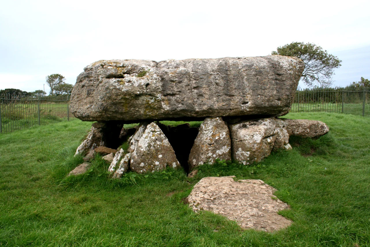

Lligwy Burial Chamber
The capstone weighs about 25 tonnes. It is 5.5 metres long and 4.5 metres wide, a single slab of local limestone roughly a metre thick, balanced on eight uprights so squat they look almost decorative until you realise that half of each upright lies buried in the earth. Beneath this monumental shelter, archaeologists in 1909 found the bones of between fifteen and thirty people - men, women and children of the Late Neolithic - laid alongside the shells of mussels and limpets and the bones of animals their mourners had eaten. The pottery they left behind was Grooved Ware, which dates the earliest burials to roughly four-and-a-half millennia ago. Later, Beaker people of the early Bronze Age returned and used the chamber again. The structure stands a few metres from a narrow road on the east coast of Anglesey, near the small village of Moelfre, with room for a single car at the verge.
How the Stones Got Here
Neolithic builders chose a limestone outcrop near the surface, levered up a slab the size of a small bedroom, and worked it onto the tops of eight uprights they had already set in the ground. Three of the uprights take all the weight; the other five barely touch the stone above them. A gap on the eastern side probably marks the original entrance, though no passage survives. Whether a covering mound or cairn ever rose around the structure is uncertain. The capstone's surface is grooved with channels gouged by rainfall over the millennia - which suggests the dolmen has stood exposed for most of its life, with no earthen barrow softening the rain. Some archaeologists argue that the open architecture of the chamber, with stones placed deliberately so that the capstone seems to float on air, may have been the original design. We tend to think of these monuments as failed cairns, but they may be something subtler - sculptural and theatrical from the start.
The People Inside
The 1909 excavation found the chamber's contents stacked in two layers, the lower older than the upper. Bones from up to thirty people lay among the pottery. There were also mussels, limpets and a quantity of animal bone. These are domestic items - the residue of meals - found alongside the dead. Either the mourners feasted at the tomb after each interment, leaving the remnants as offerings, or they returned periodically to mark anniversaries. The two pottery types tell a longer story still. Grooved Ware - distinctive, complex, banded with incised lines - belongs to the Late Neolithic, roughly 3000-2500 BC. Beaker Ware, the deep tulip-shaped drinking vessels associated with the spread of metalworking and changing burial customs across Europe, arrived around 2400 BC. Two cultures separated by perhaps half a millennium chose the same chamber for their dead. We have very few sites in Britain that record this transition so clearly.
What Remains
Today the burial chamber is a Scheduled Ancient Monument in the care of Cadw, Wales's historic environment service. The site is open free of charge throughout the year, closed only on Christmas Eve, Christmas Day, Boxing Day and New Year's Day. There are no interpretation boards on a heroic scale, no entrance fees, no guide; the chamber simply sits in its field, a few metres from a quiet road north of the village of Llanallgo. The Royal Commission on the Ancient and Historical Monuments of Wales maintains a thorough archive - photographs, aerial views, the original DOE records, and an extract from the June 1933 Archaeologia Cambrensis titled 'The Pottery from the Lligwy Burial Chamber, Anglesey.' The HeritageTogether project has used photogrammetry to build accurate 3D digital models of the structure. The chamber itself is unguarded and probably best visited that way.
Lligwy's Neighbours
Three quarters of a mile north of Llanallgo, Lligwy lies within Moelfre Community, which holds more scheduled ancient monuments than any other community on Anglesey - fourteen in total. Within a short walk of the burial chamber sit Din Lligwy, a Romano-British stone-built settlement of round and rectangular houses, and Hen Capel Lligwy, a ruined twelfth-century chapel. Together they trace some four thousand years of continuous human use of a small piece of east Anglesey coast: Neolithic farmers burying their dead, Romano-British families settling in stone, medieval Christians building a chapel for the same families' descendants, and today, a quiet caravan-park hinterland between a road and the sea. The Anglesey Coastal Path runs along Lligwy Bay just east of the chamber, where the sand turns gold at low tide and seals haul out on the rocks. The dolmen has watched the bay through every kind of human change.
From the Air
Lligwy Burial Chamber lies at 53.35 N, 4.25 W, on the east coast of Anglesey, about 1 km inland from Lligwy Bay and 0.75 mi north of the village of Llanallgo. From the air the chamber is small and best identified by its position - immediately east of an unclassified road off the A5025, with Din Lligwy hut group 400 m to the west and the sandy crescent of Lligwy Bay 700 m to the east. Nearest airports: Anglesey/Valley (EGOV) 17 nm west, Caernarfon (EGCK) 18 nm south-west. The east coast of Anglesey faces the Irish Sea and is generally less weather-exposed than the west; visibility from the air is usually good at low to moderate altitudes.
Nearby Stories
- Llandudno Lifeboat Station 3.8 km away
- Glynllifon 6.1 km away
- German submarine U-1024 9.4 km away
- Irish Sea Bridge 11 km away
- Ysbyty Ifan 12 km away
- Irish Sea 18 km away
- Celtic Array 18 km away
- Birkdale Palace Hotel 56 km away