
Lo Wu
In 1911, eight people lived in Lo Wu. The census recorded it as a village — a small settlement at the junction of two rivers in the northern New Territories, so close to the boundary with China that the 1898 Convention dividing the territory ran straight through the area. Whatever life existed there in those years required no checkpoints, no permits, no queues. Between 1898 and 1949, there was no border patrol at all; people moved freely between Hong Kong and the mainland as a matter of course. Today Lo Wu is where 85 percent of all overland passenger departures from Hong Kong to mainland China take place. The rail terminus, the immigration hall, the lines of travelers — all of it concentrated at a spot that once had eight residents and no reason to be remarkable.
The Name and the River
Lo Wu has two written names in Chinese. The modern form, 羅湖, uses characters meaning roughly 'net lake.' The older form, 螺湖, uses a homophone that means 'shell lake' — the same consonant, the same vowel, a different tone. The two names point to a place defined by water: Lo Wu sits at the junction of the Sheung Yue River and the Sham Chun River, the latter forming the natural boundary between Hong Kong and Shenzhen. The Sham Chun River has itself been engineered: in 1995, Hong Kong and Shenzhen jointly straightened a 3.2-kilometer stretch near Lok Ma Chau and Liu Pok, replacing meandering river bends with new, wider channels as part of a shared environmental improvement project. To the east of Lo Wu sits Sandy Ridge — Sha Ling to locals — one of Hong Kong's major cemeteries, occupying the hill that faces the border. The landscape here is shaped by what the border requires: control points, closed areas, restricted roads, monitored hills.
Mules, Artillery, and a Saddle Club
Before the immigration halls, Lo Wu had a British Army camp at the base of Crest Hill — so named for a regimental badge carved into its slopes. For years, Royal Artillery survey units occupied largely tented accommodation there, with one specific duty: maintaining an observation post on the summit of Crest Hill to monitor into the People's Republic. In February 1950, during a period of Kuomintang attacks on the mainland launched from Formosa, a Kuomintang aircraft flew illegally over Hong Kong and bombed the railway line to Guangzhou beyond Lo Wu. The camp was also home to British Army mules, used as pack animals for patrols along the border. After the withdrawal of British forces in 1994, a group of horse enthusiasts took over the camp and established the Lo Wu Saddle Club, which opened to members and the public. It remains operating today — a riding school where the first equestrian instruction in Hong Kong was once given, housed on land where the army used to keep mules for border patrol.
The Border Crossing and Its Numbers
The Lo Wu Immigration Control Point opened as the primary rail checkpoint between Hong Kong and mainland China and operates daily from 6:30 am to midnight. Of all passenger departures from Hong Kong overland to the mainland, 90 percent use the four land control points — Lo Wu, Lok Ma Chau, Man Kam To, and Sha Tau Kok. Lo Wu alone handles 85 percent of those departures, a concentration driven by the convenience of the MTR East Rail line, whose northern terminus sits directly at the crossing. The crossing's popularity has generated its own pressures: debates about extending to 24-hour service have focused on maintenance requirements, noise pollution, and the social implications of easier nighttime access. The facility handles more traffic because it can — it has the largest passenger-handling capacity of any Hong Kong land border point — but the infrastructure demands that capacity imposes are constant. The crossing, for the communities of Sheung Shui and Fanling nearby, has also reshaped retail patterns: cheaper goods and dining across the border have drawn purchasing power away from Hong Kong-side shops for years.
The Closed Area and What It Preserved
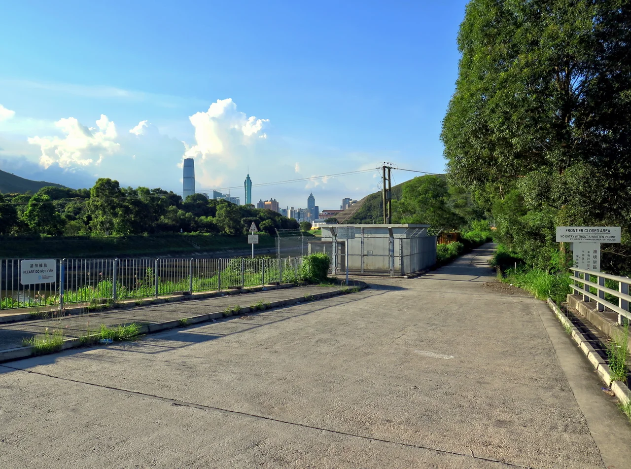
In 1952, Hong Kong established the Frontier Closed Area in response to illegal immigration and smuggling — a buffer zone along the full length of the border that required special permits to enter. Lo Wu fell within this zone, which meant the Hong Kong side of the crossing remained rural and undeveloped while the Shenzhen side of the river built itself into a major commercial district. The Luohu District of Shenzhen, directly across from Lo Wu, now hosts dense office development; Lo Wu village, on the Hong Kong side, remained isolated farmland, its access restricted, its development impossible. That enforced isolation produced an unintended conservation dividend: the closed area's 50-plus years of restricted access preserved fauna and flora that would otherwise have been built over. As the closed area has been progressively reduced since 2012, environmental groups have argued for the ecological value of the remaining buffer. Whether that argument prevails against development pressure at the border remains, as it has always been at Lo Wu, an open question.
From the Air
Lo Wu sits at approximately 22.53°N, 114.12°E at the junction of the Sheung Yue River and Sham Chun River in Hong Kong's North District, directly on the border with Shenzhen's Luohu District. From the air, the crossing is identifiable by the rail infrastructure of the East Rail line terminating at the border, the immigration control buildings, and the sharp contrast between the developed Luohu district on the Shenzhen side and the greener, lower-density Hong Kong side. Sandy Ridge cemetery is visible as a distinctive hillside to the east. The Sham Chun River traces the boundary between the two jurisdictions. This location straddles both Hong Kong (VHHH, approximately 40 km southwest) and Shenzhen (ZGSZ, approximately 30 km west) airport zones. Best viewed at 3,000–5,000 feet for a perspective showing both sides of the border simultaneously. Winter days with northerly winds offer the clearest visibility.
Nearby Stories
- Hong Kong Disneyland 4.1 km away
- Mount Guanyin (Dongguan) 7 km away
- 2024 Lixinsha Bridge Collapse 7.4 km away
- Portas do Cerco 12 km away
- Lotus Hill 15 km away
- Nanxiong Formation 78 km away
- Heyuan 130 km away
- Checheng Fu'an Temple 629 km away