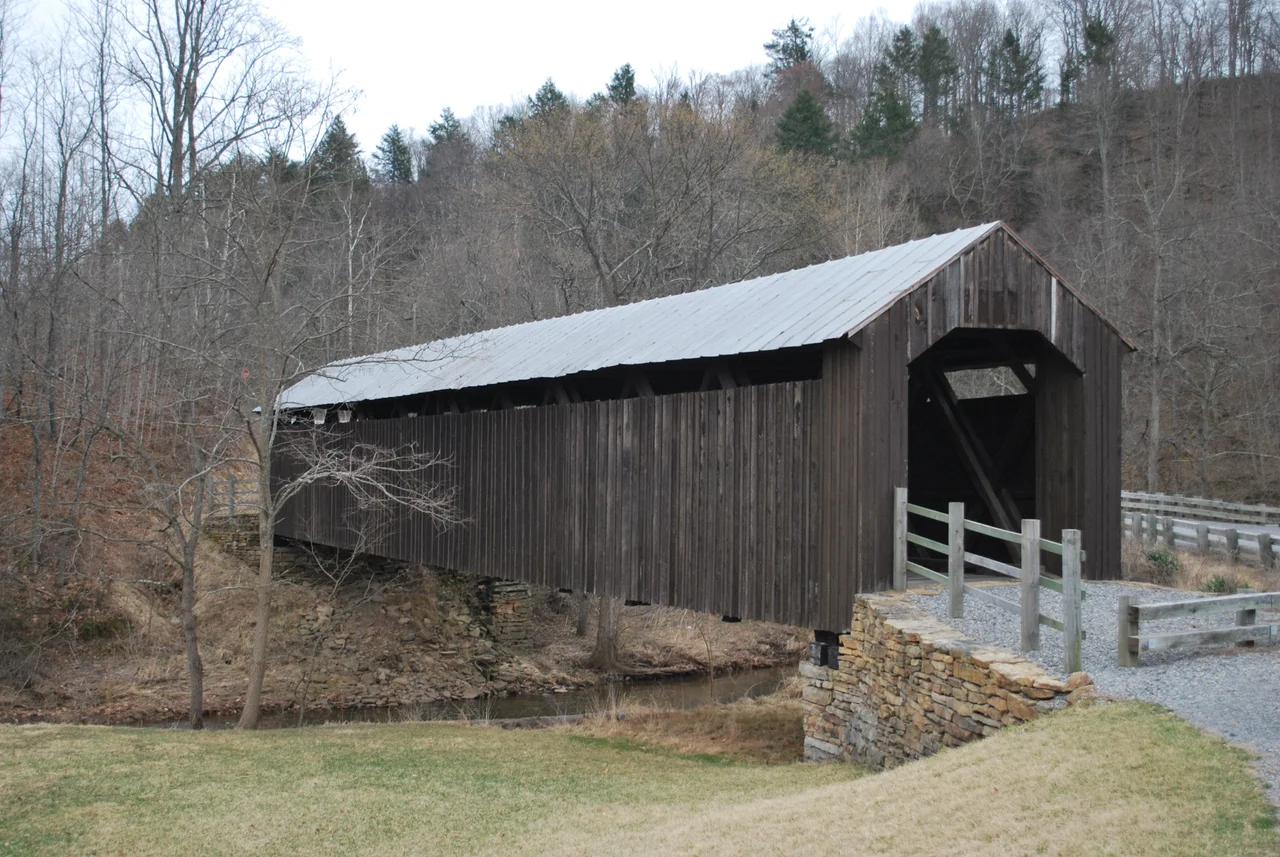

Locust Creek Covered Bridge
In 1870, a carpenter named R. N. Bruce signed a contract with Pocahontas County to build a covered bridge across Locust Creek. The contract was for $1,250 - in modern terms, somewhere between an honest week's wages and a new sedan. For that sum, Bruce produced 114 feet of timber bridge, 13.5 feet wide, framed with a Warren Double Intersection truss and roofed with hand-cut shingles. A century and a half later, his bridge still stands - rebuilt twice, retired from vehicle traffic, but unmistakably the same span, in the same spot, doing roughly the same job.
Why Covered
Covered bridges look quaint now, but the roof was practical engineering. Wooden trusses last decades when kept dry and rot in years when exposed to weather. The covering doubled or tripled the working life of the bridge - which was the difference, in rural West Virginia in 1870, between a structure your grandchildren could use and one you would have to rebuild yourself within a decade. The shingled roof did the work that paint and tar would do on later steel bridges. Inside the covering, the trusses stayed dry. Outside, the bridge could look like anything; what mattered was that the wood inside did not rot.
Twice Reborn
Bruce's 1870 bridge did not survive long. In 1888, it burned - whether by accident, arson, or lightning is no longer clear. Pocahontas County replaced it. In 1904 the replacement was itself heavily reconstructed by W. M. Irvine, who replaced the interior supports, trusses, side paneling, and roof. The bridge you see today is largely Irvine's work, with later patches and the major repair of 1968 when a new oak floor went in and the structure got a fresh coat of paint. Temporary supports added during the 1968 floor work were left in place by mistake, then quietly forgotten until they were removed during the 2002 renovation.
Retirement
By the 1980s, the bridge was working past its design life. Trucks and tractors had grown heavier than the 1870 carpenter ever imagined. In 1970, the structure was added to the National Register of Historic Places, which protected it from demolition but did not solve the engineering problem. In 1990, the state of West Virginia built a modern concrete bridge alongside the old span, diverting all vehicle traffic to the new crossing. The covered bridge became pedestrian-only. In 2002, a careful renovation removed the long-forgotten 1968 supports, restored the bridge to something close to its 1904 appearance, and turned it into the kind of small historic attraction that anchors a county-tourism brochure.
The Warren Double Intersection
The truss design Bruce used is a Warren Double Intersection - a variant of the Warren truss that the British engineer James Warren had patented in 1848. The Warren is a triangulated framework where diagonal members alternate in direction; the double-intersection version overlaps two sets of these diagonals to add stiffness and redundancy. It is not the most common covered bridge truss in West Virginia - the Burr arch and various Town lattice patterns are more frequently encountered - but Warren trusses appear regularly in the timber bridges of the 1860s and 1870s. The mathematics of the truss, once you understand it, is the same mathematics that holds up steel railway bridges and the trusses of barn roofs all across the Appalachian countryside.
The Last One
Pocahontas County once had several covered bridges. Locust Creek is the only one left. The others are gone - burned, washed out in floods, replaced by steel, removed for being unsafe. The same story has played out across the United States: in 1900, there were probably 14,000 covered bridges in the country. Today there are about 750. Their disappearance was almost complete by the 1960s, and what survives now is what local communities decided to keep. Locust Creek was kept because Pocahontas County chose to spend the money on the bypass bridge in 1990 rather than tearing the old one down. It is one of those quiet decisions that small communities sometimes make, and that visitors only notice later, when they step out of their car and walk onto a wooden floor that has been there longer than anyone's grandparents.
From the Air
Located at 38.08 degrees N, 80.25 degrees W in Pocahontas County, West Virginia, about 6 nm outside Hillsboro. The bridge crosses Locust Creek in rural farmland. From the air, the dark wooden span is visible against the surrounding fields, with the modern concrete bypass running parallel. Greenbrier Valley Airport (KLWB) is the nearest tower-controlled field about 23 nm south. Marlinton Airport (KMRT) is about 10 nm north. Recommended viewing altitude 3,500 to 5,500 feet MSL. Expect ridge-and-valley terrain throughout the area; valley fog common in mornings.
Nearby Stories
- Warm Springs Pools 2.1 km away
- The Greenbrier 2.2 km away
- Appalachian String Band Music Festival 11 km away
- Battle of Camp Allegheny 19 km away
- Webster Sycamore 22 km away
- Clay, West Virginia 25 km away
- Botetourt County, Virginia 27 km away
- Beckley, West Virginia 29 km away