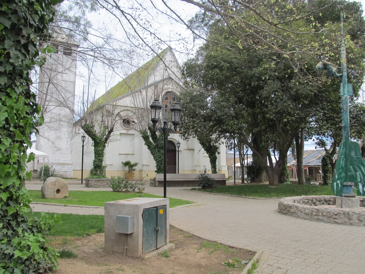

Lolol
The name means "land of crabs and holes" in Mapudungun, the language of the Mapuche who lived here long before any Spaniard rode into the Colchagua Valley. Say it aloud and it sounds almost like a joke - Lolol, the syllable doubling back on itself. But there is nothing accidental about what the town has chosen to keep. Behind low adobe walls and beneath wide tiled eaves, Lolol holds on to a Chile that has nearly vanished everywhere else: a country of horsemen, harvest festivals, and houses built from the very earth they stand on.
Houses Made of Earth
Walk the main street and you understand why the Chilean government drew a protective line around this place. In 2003, the historic center of Lolol was declared a National Monument in the category of Typical and Picturesque Zone, recognizing a townscape of continuous adobe facades, deep colonnaded corridors, and clay-tile roofs that have changed little since the 1800s. These are not museum reconstructions. They are working houses, descended from the great haciendas that the Spanish crown carved out of the valley in the 17th century and granted to its conquistadors. After Chile won independence in 1818, families raised mansions in the Lolol area, and a surprising number still stand - a rare unbroken thread of rural colonial building stretching back four hundred years.
Tierra Huasa
Lolol calls itself Tierra Huasa - country land, the realm of the huaso, the Chilean horseman whose broad hat and woven poncho are as iconic here as the cowboy is to the American West. This is rodeo country, but Chilean rodeo bears little resemblance to its northern cousin. In a crescent-shaped arena called a medialuna, two riders work in tandem to pin a steer against a padded wall, judged on precision and horsemanship rather than speed. Around it cluster the old country contests: the trilla a yegua suelta, where mares trample wheat to thresh the grain, and the carreras a la Chilena, straightaway horse races run two abreast. At the heart of the historic center stands the Church of the Holy Nativity of Our Lady of Mercy, watching over a town that still keeps the agricultural calendar. The church holds a painting by the noted Chilean landscape artist Alberto Valenzuela Llanos, a small treasure in an unassuming place. Each February the town swells for the Semana Lololina, a week of music, food, and country festivity that draws thousands.
The Ground That Moved
On 27 February 2010, one of the most powerful earthquakes ever recorded - magnitude 8.8 - tore through central Chile. Adobe is strong against time but vulnerable to violent shaking, and Lolol's heritage center was badly hurt. Walls that had stood since the 1800s cracked and collapsed. What happened next says something about the town. Rather than bulldoze and start over in concrete, residents, the Corporación Cultural de Colchagua, and government heritage programs chose to rebuild in earth - restoring the great majority of the damaged adobe structures using traditional forms strengthened with modern seismic reinforcement. Volunteers came from across Chile and beyond. The town that the quake nearly erased was, deliberately, rebuilt as itself.
Where the Valley Meets the Hills
Lolol sits at the western edge of the Colchagua Valley, where the gentle vineyard country begins to fold up toward the coastal range and the Pacific beaches near Pichilemu. Just southwest lies Santa Teresa de Quiahue, an old wheat-and-wine estate whose manor house was deliberately built up on higher ground to escape the recurring floods of the Estero Quichua; its oldest wing, too, was badly damaged in the 2010 quake. Every October, motorcyclists thunder along the traditional Lolol-Pichilemu route toward the sea for an interregional rally that has become a fixture of the local calendar. The reservoir north of town, the Tranque de Lolol, draws anglers, and the surrounding casas patronales draw travelers for long lunches of country food washed down with Colchagua wine, sometimes explored on horseback across the old hacienda lands. It is a quiet place - and quiet, here, is the point.
From the Air
Lolol lies at 34.73°S, 71.64°W, in the western Colchagua Valley of Chile's O'Higgins (Libertador General Bernardo O'Higgins) Region, roughly 25 km southwest of Santa Cruz and about 12 km inland from the Pacific coastal range. From the air, look for the compact grid of red-tiled roofs nestled in rolling vineyard and wheat country, with the coastal hills rising to the west toward Pichilemu. The nearest controlled airport is Santiago's Comodoro Arturo Merino Benítez International (ICAO: SCEL), about 150 km north-northeast; Rancagua's De la Independencia aerodrome (ICAO: SCRG) lies roughly 90 km northeast. Best viewed at lower altitudes in the clear, dry light of the central Chilean summer (December-February); winter brings rain between June and November.
Nearby Stories
- Battle of Mataquito 13 km away
- Rancagua 41 km away
- Pichilemu 43 km away
- Constitución, Chile 50 km away
- Uruguayan Air Force Flight 571 67 km away
- Altos de Lircay National Reserve 68 km away
- Santa Olga 84 km away
- 1687 Peru Earthquake 2173 km away