
Rancagua
Chileans tell a joke about Rancagua: that it doesn't exist - too ordinary, too easily passed on the highway between Santiago and the south. It is an unfair joke, and a revealing one, because in October 1814 the fate of an entire nation turned on this supposedly forgettable town. In the plaza now called Plaza de los Héroes, the heroes' square, a young general named Bernardo O'Higgins made a last stand that ended in disaster - and set in motion the war that would eventually win Chile its freedom.
The Disaster of Rancagua
By 1814, Chile's first independent government - the Patria Vieja, the "Old Fatherland" - was crumbling under a Spanish counteroffensive from Peru. On 1 October, royalist forces under Mariano Osorio surrounded a patriot army in the streets of Rancagua. Bernardo O'Higgins, outnumbered and short of supplies, refused to retreat. For two days his men held the central square against assaults from every side, beating off the encircling royalists while the buildings around them burned. When the position finally became hopeless, the survivors did not surrender. They mounted a desperate cavalry charge straight through the Spanish lines and broke out, fleeing across the Andes into exile in Argentina. The Disaster of Rancagua ended the Patria Vieja - but the men who escaped would return to finish what they had begun.
Copper Mountain
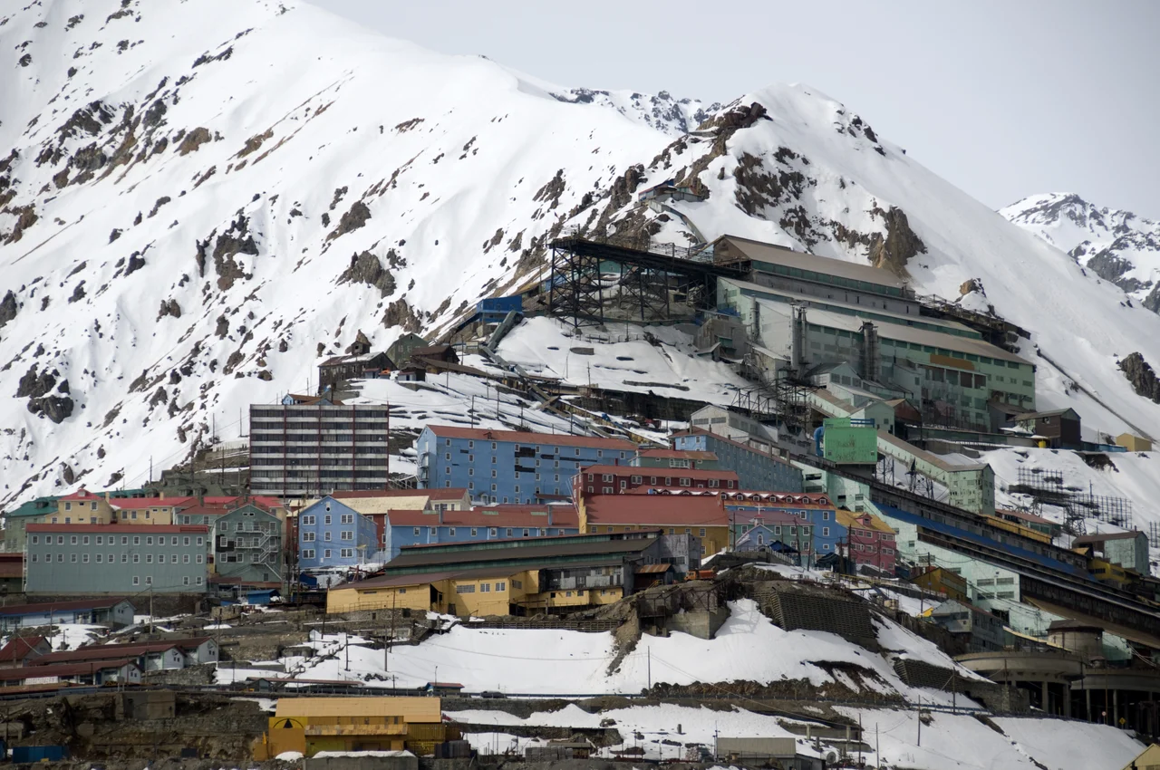
If independence is Rancagua's history, copper is its livelihood. High in the Andes east of the city lies El Teniente, the largest underground copper mine in the world, a labyrinth of more than 3,000 kilometers of tunnels that has shaped the regional economy for over a century. Clinging to the mountainside above it sits Sewell, the "City of Stairs" - a vivid, brightly painted company town built on slopes too steep for roads, where thousands of miners and their families once lived, climbing flights of wooden staircases between houses stacked up the hillside. Sewell was largely abandoned as mining modernized and its workforce moved down into the valley, but its survival earned it recognition as a UNESCO World Heritage Site. Tours climb from Rancagua to the ghost town and the mine that made it, a striking monument to the labor that built modern Chile.
Huaso Country
Rancagua is the capital of the O'Higgins Region and the proud heart of what locals call "huaso province," after the Chilean cowboy. The surrounding culture is a layered one - indigenous and European, with Andalusian, Basque, and Navarrese roots alongside French, Italian, German, and other immigrant communities who brought farming, brewing, and the winemaking that made the nearby Colchagua wine route famous. The city's life centers on the Paseo Independencia, a pedestrian spine of shops and cafes, and the Plaza de los Héroes at its eastern end. The Teatro Regional Rancagua anchors the region's cultural scene, and a homegrown football club, O'Higgins, carries the city's name and the liberator's into the national league.
Between the Mountains and the Hot Springs
Rancagua sits on the Cachapoal River about 85 to 90 km south of Santiago, close enough that it is steadily becoming a commuter town for the capital's professionals, yet still ringed by quiet country. East toward the Andes lie the Termas de Cauquenes, natural hot springs where travelers have soaked since colonial times, and the Reserva Nacional Río Los Cipreses, a national park of river canyons and cypress forest. To the west sprawl the vineyards of the wine route; further on, the village of Doñihue keeps alive the dying art of the handwoven silk chamanto, the elaborate poncho of the Chilean horseman. A regional dessert, the Torta Pompadour - a layered mille-feuille scented with banana - waits in nearly every bakery in town.
From the Air
Rancagua lies at 34.17°S, 70.74°W on the Cachapoal River in central Chile, capital of the O'Higgins (Libertador General Bernardo O'Higgins) Region, about 85-90 km south of Santiago. From the air, look for the city spreading across the valley floor between the snow-capped Andes to the east and the coastal range to the west, with the Cachapoal threading past and the El Teniente mining country rising into the mountains. Rancagua is served by its own De la Independencia aerodrome (ICAO: SCRG), on the west side of the city, used mainly for private and business aviation; the nearest major airport is Santiago's Comodoro Arturo Merino Benítez International (ICAO: SCEL), roughly 100 km north. Summers are dry with hot afternoons and excellent visibility; winters are mild but bring heavy rain in a handful of storms between May and August, with occasional light snow.
Nearby Stories
- Paine Memorial 18 km away
- La Frontera (Chile) 31 km away
- Uruguayan Air Force Flight 571 35 km away
- Lolol 40 km away
- Casa de Isla Negra 61 km away
- Pichilemu 63 km away
- Hotel Termas el Sosneado 69 km away
- Cerro El Plomo 78 km away