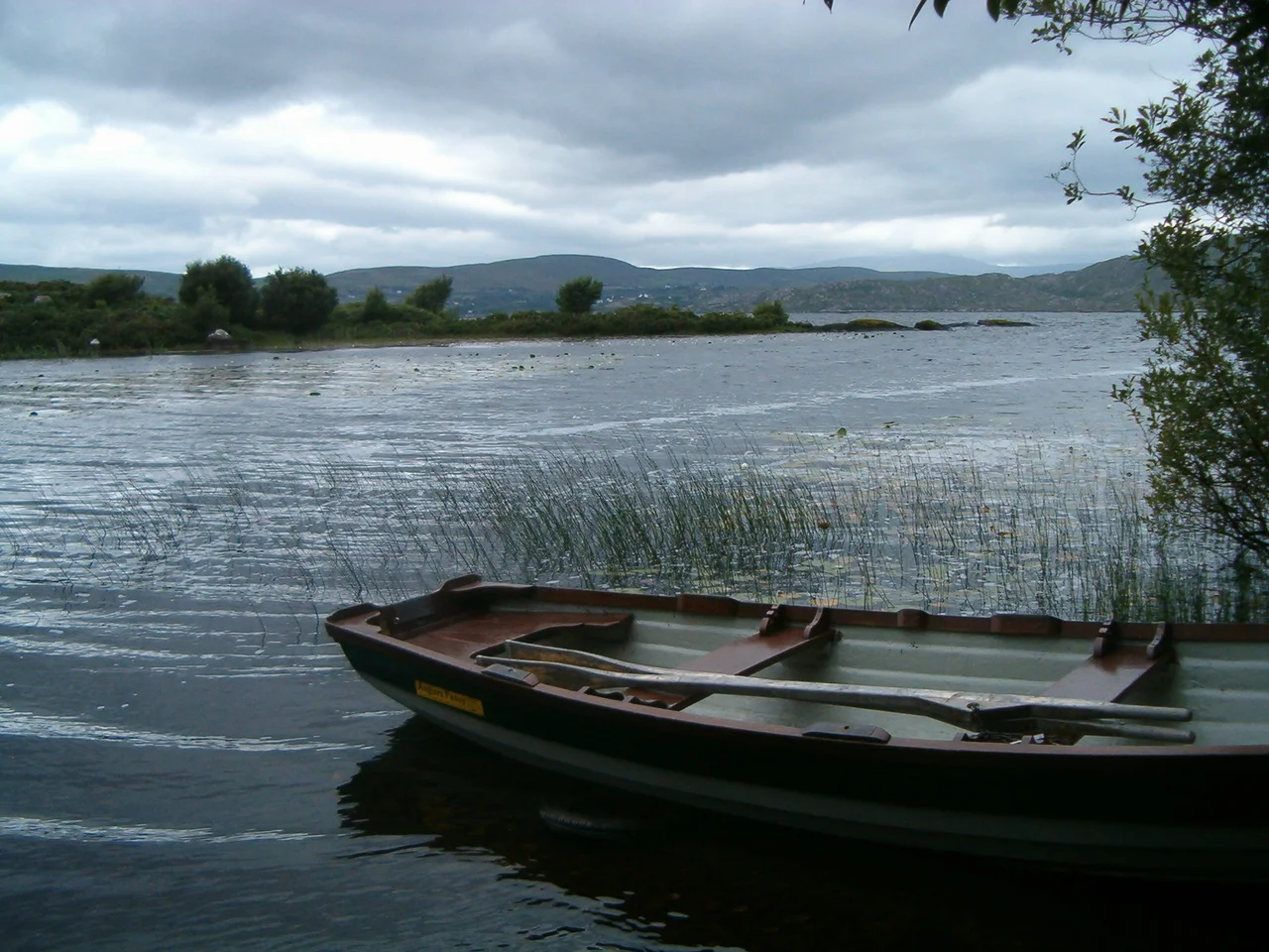

Lough Currane
Lough Currane is a Kerry lake with two sides to it. On the surface, it is a fly-fisher's lough - 2,500 acres of dark water, 3.5 miles long, with a population of wild Atlantic salmon and sea trout famous enough that anglers fly in from around the world to chase them. Below the surface, it is older. The lake fills a glacial basin scoured out at the end of the last ice age, drains west into Ballinskelligs Bay via the short Currane River, and contains an island called Church Island where a 7th-century saint built a monastery whose ruins are still standing. Stand on the shore at Waterville and look east across the water, and you are looking at most of Irish history compressed into one view.
The Lake and the Sea
Lough Currane is technically a freshwater lake, but it sits so close to the Atlantic that the connection is almost visible. The town of Waterville lies on a narrow isthmus between the lough's western shore and Ballinskelligs Bay, with the short Currane River - barely more than a stretch of running water - connecting the two. This nearness to the sea matters for the fish. Atlantic salmon enter from the bay, swim up the Currane River, and spawn in the lough's feeder streams. Sea trout do the same, except they go back and forth more often, and some grow enormous in the process. Specimen sea trout over 10 pounds - 4.5 kilograms - have been pulled from Lough Currane on a regular basis. Fishermen call the smaller summer sea trout 'Juners', after the month they tend to run in numbers.
St Finan Cam's Island
Church Island lies near the eastern end of the lough, and on it stand the ruins of an Early Medieval monastery. Tradition associates the foundation with St Finan Cam - 'Finan the Crooked', for reasons no one quite remembers - who lived around the 7th century and is one of the lesser-known but well-attested saints of Munster. He chose the island, the story goes, for the same reason monks always chose islands: solitude, defensibility, and a hard physical separation from the world. The Annals of Inisfallen record that a man named Amchad, described as 'the anchorite of God', was buried on the island in 1058. South of the lake is another small island called Inis Uasal - Noble Island - also dedicated to St Finan. The monastery's stone oratories and graves are still there, hard to reach without a boat, which is presumably how Finan would have wanted them.
Glenmore and the Stones
The townlands along the lough's southern bank - Cappamore, Eightercua, Gortnamackanee and others - are collectively known as Glenmore, the big valley. Eightercua is the site of a Bronze Age stone alignment, four standing stones aligned east to west, possibly 3,700 years old, possibly older. The combination is striking. From a single boat on the lake you can see a Bronze Age monument, an Early Medieval monastery, and a 19th-century village within a few minutes of each other. Irish landscapes do this sort of thing routinely. Layers accumulate, and nothing quite goes away.
The Decision to Stop Keeping the Catch
For most of the 20th century, Lough Currane was a place to come and take fish home. Sea trout especially - the bigger the better. Then, sometime in the 1990s and 2000s, the runs started to fail. Sea lice from open-cage salmon farms in the bays of south-west Ireland, including the Kenmare River and others further north, were widely blamed by fishermen and local activists for damaging the wild sea trout populations as the smolts ran out through infested coastal waters. By the late 2010s the lough's sea trout runs were a fraction of what older anglers remembered. In 2019 a by-law made Lough Currane a catch-and-release fishery in an attempt to give the stocks a chance to recover. As of 2024 the rule was still in place. The fish you catch you put back. It is a less satisfying day in the conventional sense and a more honest one.
Why People Keep Coming
The Ring of Kerry brings tour buses past Lough Currane every day in summer. Most of them do not stop. The lake is not on the standard postcard circuit - it does not have the immediate drama of the Skellig Islands or the photogenic violence of the cliffs at Slea Head. What it has is depth. The fishing is good. The history is layered. The view east toward the mountains is the kind of view Ireland sometimes throws out as if it had a surplus. Stand at Waterville in late evening, with the western light on the far hills and the lough turning silver-black, and the practical reason for staying becomes clear. Not everything has to be famous.
From the Air
Lough Currane sits at 51.825°N, 10.133°W, immediately east of Waterville on the Iveragh Peninsula. From the air the lake is unmistakable: an irregular dark patch of water roughly 3.5 by 2 miles, with the village of Waterville on a narrow isthmus between the lough and Ballinskelligs Bay to the west. Church Island appears as a small dot near the eastern end of the water. Cruise altitude 2,500-4,000 ft gives the best perspective of the lough's relationship to the bay and the surrounding mountains. Approach for closer views at 1,500-2,000 ft AGL. Nearest airfields: Kerry (EIKY) about 45 nm north-east, Cork (EICK) about 75 nm east. The high ground south and east of the lough rises to over 2,000 ft - mind the terrain on easterly tracks.
Nearby Stories
- Farranfore–Valentia Harbour line 3.3 km away
- Heir Island 4.1 km away
- Inishvickillane 4.4 km away
- Kealkill stone circle 8.7 km away
- Headford Ambush 10 km away
- Dunlough Castle 13 km away
- SM U-68 27 km away
- Sao Miguel 1923 km away