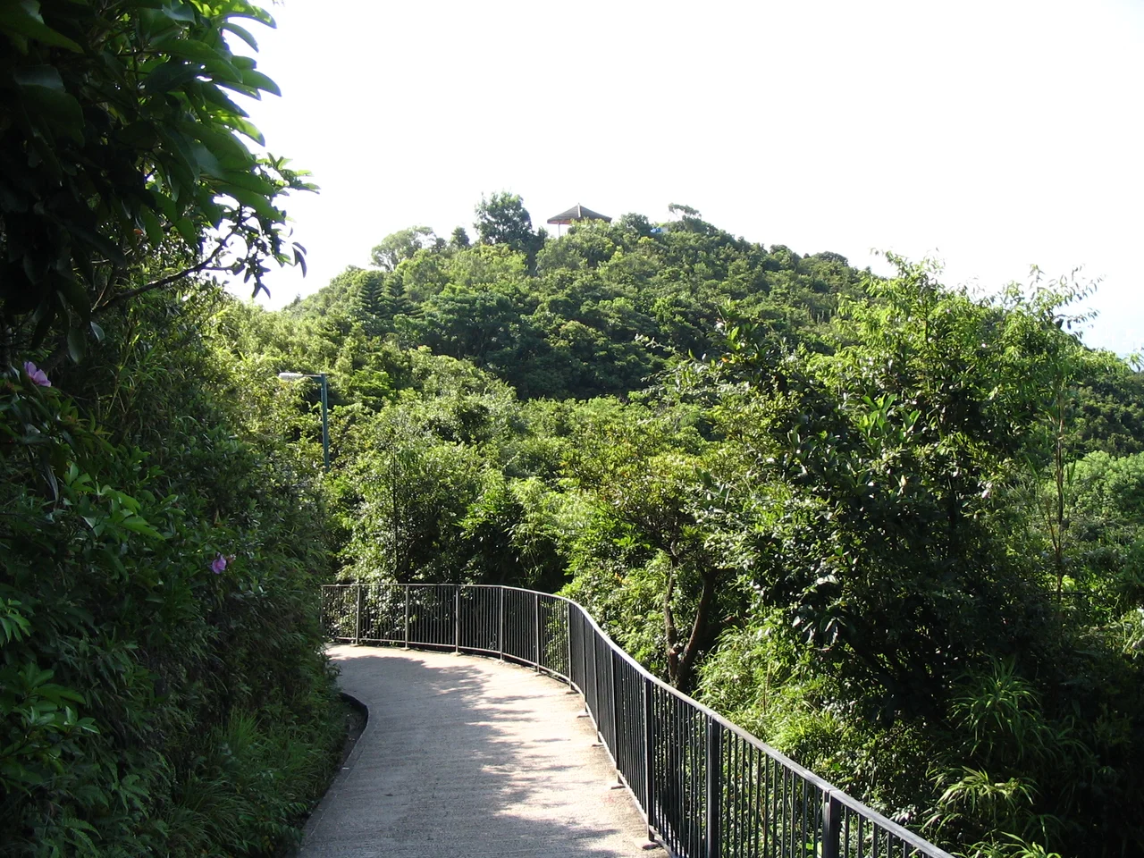

Lung Fu Shan
Dragon and Tiger Mountain. That is what Lung Fu Shan means — a name carrying the weight of two of Chinese culture's most potent symbols, assigned to a hill that rises 831 feet above the northwestern corner of Hong Kong Island. The peak itself is not the famous one. That honor belongs to Victoria Peak to the east, which draws the tourists and the tram. Lung Fu Shan sits in the Peak's shadow, quieter and less celebrated, occupying the middle ground between the dense residential stacking of the Mid-Levels below and the summit ridge above. The University of Hong Kong spreads across its northeastern slopes. A disused Victorian artillery battery crumbles into its upper reaches. The old boundary of the City of Victoria passes through its northern flank at the 700-foot contour, as if the colonial administrators knew exactly how far order could be expected to hold.
Between Peak and City
The geography of Lung Fu Shan is defined by what surrounds it. To the east, Victoria Peak — called simply 'The Peak' by anyone who lives in Hong Kong — marks the high point of the island's central massif. To the west sits Mount Davis, the lower promontory guarding the island's western tip, and to the south High West completes the arc. Lung Fu Shan occupies the sheltered northwestern slope within this chain, catching the mists that roll in from the Pearl River Estuary and holding them in the dense vegetation that covers its upper reaches.
The hill descends toward the Mid-Levels, which press upward in turn — a dense neighbourhood of residential towers clinging to the steep terrain between the financial district of Central and the summit above. The result is a layered landscape: financial district, luxury apartments, forested hillside, country park, peak. Each zone has its own climate and tempo.
The University on the Slope
The northeastern slope of Lung Fu Shan is where the University of Hong Kong built its main campus, along with its centennial campus. Founded in 1911, the university is one of the oldest in Hong Kong and occupies a remarkable piece of terrain — buildings cascading down steep hillside, connected by covered walkways and footbridges, with the forested upper slopes of Lung Fu Shan rising directly behind.
The relationship between the university and the country park above it is close in both geography and mission. The Lung Fu Shan Environmental Education Centre, operated in partnership with the university, runs citizen science programs and public education initiatives within the park. Students and faculty use the park's trails. The hill's forested slopes, protected as part of Lung Fu Shan Country Park since 1998, form a literal green backdrop to campus life — research subject and breathing space in one.
The Old City Line
The southern limit of the City of Victoria — the colonial settlement that would grow into modern Hong Kong — passed through the northern side of Lung Fu Shan at the 700-foot contour. Below that line, the colonial city: streets, commercial premises, government buildings, the ordered apparatus of British administration. Above it, the hill and its forested slopes passed beyond the city's formal reach.
This boundary is invisible now, absorbed into the continuous urban fabric. But the 700-foot contour still marks a rough transition on the hill: below it, the towers and roads of the Mid-Levels; above it, the trees and paths of the country park. The colonial administrators drew their line along terrain, and the terrain still holds it.
Pinewood Battery and Its Ruins
On the upper slopes of Lung Fu Shan, a cluster of overgrown brick structures marks the site of Pinewood Battery, a British artillery installation built between 1901 and 1905 as part of Hong Kong Island's coastal defence network. The battery was designed to command the western approaches to Victoria Harbour, its guns positioned to threaten any vessel attempting to enter the harbour from that direction.
It was decommissioned before the Second World War but did see action during the Battle of Hong Kong: the battery was manned by the 17th Anti-Aircraft Battery and came under heavy Japanese air and artillery attack on 15 December 1941, sustaining casualties before its personnel were evacuated. The jungle has been reclaiming it ever since. Today, the ruins sit within Lung Fu Shan Country Park, preserved with interpretive signage and visited by hikers who find the overgrown stairways and crumbling walls one of the more evocative sites on the hill.
What the Name Carries
Dragon and Tiger: in Chinese cosmology, these are forces in creative tension, symbols of power and vitality that balance rather than cancel each other. The dragon represents the east, water, and the emperor's authority. The tiger represents the west, mountains, and military strength. A hill named for both carries no small weight.
Lung Fu Shan holds that name with something close to modesty. It is not the highest point on the island, not the most dramatic, not the most visited. But it occupies real ground between one of the world's great universities and one of the world's great harbours, between a colonial military past and a subtropical forest present. The dragon and the tiger, in their way, are both still here.
From the Air
Lung Fu Shan sits at approximately 22.2799°N, 114.1350°E on the northwestern portion of Hong Kong Island. Approaching VHHH (Hong Kong International Airport) from the east, the island's northern face is visible — Lung Fu Shan is the prominent wooded ridge directly above the University of Hong Kong campus, set back slightly from the harbor shoreline. Victoria Peak rises to its east. Viewing altitude of 2,000–3,000 feet on a harbor transit provides clear sightlines to the hill's profile and the cascade of Mid-Levels buildings on its lower slopes. The Peak Tram's upper terminus at Victoria Peak, a few hundred meters east-southeast, serves as an orientation point.
Nearby Stories
- Lok Ma Chau Loop 2.3 km away
- Portas do Cerco 2.3 km away
- Kweilin Incident 17 km away
- Wanshan Archipelago Campaign 34 km away
- Nanxiong Formation 115 km away
- Battle of Nanpeng Island 148 km away
- Heyuan 169 km away
- Cape Maobitou 632 km away