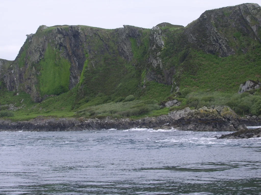

Lunga, Firth of Lorn
At low water Lunga is one island. At high water it is several. The Firth of Lorn rises and falls around its low ground and slices it into Rubha Fiola, Fiola Meadhonach, Eilean Iosal and Fiola an Droma - a chain of tidal islets connected and disconnected by the moon. To the south the Bealach a' Choin Ghlais, the pass of the grey dog, runs at eight knots in full flood, fast enough that an 1845 description warned no boat could be forced through. Lunga keeps its old Norse name - isle of the longships - but everything else here is Gaelic.
Where the Names Come From
Almost every feature on Lunga has a Gaelic name that means something specific about the landscape. Bidean na h-Iolaire, the island's high point, is the peak of the eagle. Camas a Mhor-Fhir, the main bay to the south, is the bay of the giant. Poll nan Corran, the only other anchorage, is the sickle-shaped pool. The northern islets translate as headland of the tidal island, middle tidal island, humble island, and drum-shaped tidal island. The Bealach a' Choin Ghlais, the strait that nearly defeats boats, is named for a dog. Legend says a Norse prince was lost in the southern whirlpool of Corryvreckan; his loyal dog reached land, searched for his master on Jura and Scarba, and finally tried to leap across to Lunga but missed his footing on Eilean a' Bhealaich and was swept under. The strait took the dog's name. Sometimes whole geographies are built this way.
Not the Other Lunga
There is another Lunga in the Treshnish Isles, west of Mull, famous for its summer puffins and its dramatic basalt stack called the Harp Rock. This is not that Lunga. This is the Lunga of the Slate Islands, less visited and stranger - geologically distinct from its neighbours, made of quartzite and Scarba conglomerate rather than the slate that gave the archipelago its name. To the north sit Belnahua and Fladda; to the northwest, Eilean Dubh Mor and the Garvellachs; to the west, only the Dubh Artach lighthouse stands between Lunga and the open Atlantic. The 1549 Description of the Western Isles of Scotland by Donald Monro described "Lunge" as three miles long, two parts of a mile broad, with a parish church and good land for store and corn, possessed by MacLean of Duart, in feu from the Earl of Argyll.
A Quietly Shrinking Census
The recorded population of Lunga reached its high point in 1794 with twenty-nine people. By 1891 only fifteen remained. By 1931, five. The graves of the islanders are in the churchyard at Kilchattan on Luing to the north. The island was not permanently inhabited through most of the 1960s and 1970s, and the 2011 census recorded no "usual residents." In 1969 Torquil Johnson-Ferguson opened an adventure centre at Rubha Fiola, the northernmost headland, that ran until 2013 - rock climbing, canoeing, and sea-kayaking expeditions for groups of school-age children, using the nearby islets as natural play structures. The rest of Lunga, where only three houses stand, is given over to grazing. There is a salmon farm in the sheltered waters off the southeastern shore, and a few prawn and scallop fishermen work the surrounding seas.
Underwater Country
The waters around Lunga are part of the Firth of Lorn Marine Special Area of Conservation, and the seabed here is dense with life that fast tides protect. The seafan anemone Amphianthus dohrnii, rare in British waters, finds refuge in the sheltered hollows near the salmon farm. Kelp forests of Laminaria hyperborea dominate the rocky bottoms where currents slacken. In deeper, calmer pockets the feather star Leptometra celtica and the tall hydroid Lytocarpia myriophyllum form fields of marine ferns. On the surface, otters fish the rocks, red deer graze the upper grass, and grey seals haul out on the skerries. Minke whales, bottlenose dolphins, and harbour porpoises pass through. Golden eagles and white-tailed sea eagles cruise the cliffs. The Slate Islands cluster, viewed as one ecosystem, is as biologically rich as anywhere on Scotland's west coast - precisely because so few people have stayed long enough to change it.
The Bumpy Ride
Almost no one comes to Lunga today on purpose. The boat trips that thread the islands are usually heading somewhere else - to Corryvreckan, to Mull, to the Garvellachs - and treat Lunga as scenery on the way. Sea kayakers know it as a campsite with consequences: the Grey Dog needs slack water to be crossed safely, and slack water lasts about fifteen minutes. The island's raised beaches, lifted high above current sea level by post-glacial rebound, give Lunga an oddly terraced look from the sea. At Rubha Fiola the cliffs are climbable. At Camas a Mhor-Fhir the giant gives shelter. And in between, when the tide turns, Lunga briefly becomes whole.
From the Air
Lunga lies at 56.217N, 5.7W in the Firth of Lorn, between Scarba (south, separated by the Grey Dog tidal race) and Belnahua (north). From altitude the island shows its distinctive disintegrating shape - especially at high tide - with the northern chain of islets (Rubha Fiola, Fiola Meadhonach, Eilean Iosal, Fiola an Droma) visible as separate green bodies. The Slate Islands cluster spreads to the north (Belnahua, Easdale, Seil, Luing) and the dark whirl of Corryvreckan sits south between Scarba and Jura. Oban (EGEO) is the nearest airport, about 30 km north-east. Photograph at 3,000-4,000 ft to capture the relationship between Lunga and the surrounding tidal architecture.
Nearby Stories
- Fingal's Cave 1 km away
- Bonawe Iron Furnace 3 km away
- Torosay Castle 7.7 km away
- Jura Distillery 12 km away
- Strachur 13 km away
- Erraid 15 km away
- Bruichladdich Distillery 15 km away
- Rothesay Castle 15 km away