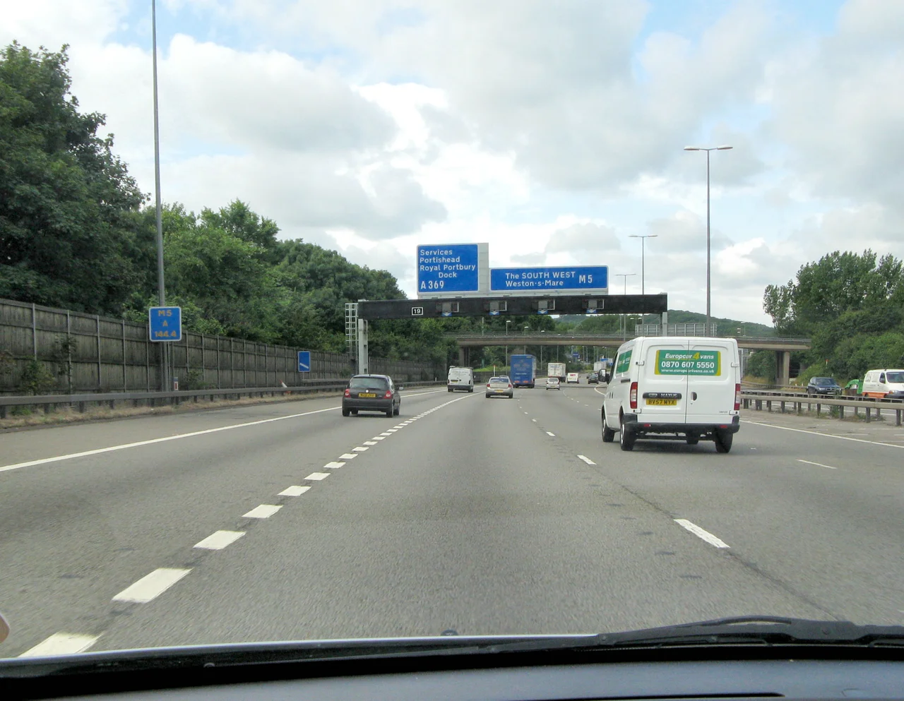

M5 Motorway
Friday afternoon in July, somewhere in Worcestershire, and the M5 begins to bunch. Caravans appear in the inside lane. Roof boxes ride the outside. By the time the traffic reaches the Avonmouth Bridge - that long, ungainly span where the motorway kinks and the lanes drop and the lorries slow to a crawl - the queue has its own weather system. This is the road Britain takes to the seaside, and like most British holidays, the journey is half the point and twice the suffering. The M5 runs from a junction near West Bromwich, north-west of Birmingham, all the way south-west to Exeter, hugging the western flank of England as it goes.
A motorway, shadowing an old road
The M5 quite closely follows the route of the A38, the older trunk road it was designed to relieve. The two diverge politely around Bristol: the A38 plunges through the city centre and slips past Bristol Airport, while the M5 keeps its distance, skirting both with access from junctions 18, 19 and 22. The relationship between the two roads is the relationship between modern Britain and its older self - parallel paths, mostly civil, occasionally meeting again at the next town. Junction 15, where the M5 collides with the M4, is a four-level stacked interchange called Almondsbury. It is one of those places where the country's road network briefly resembles a printed circuit board, lifted into the air.
The Avonmouth bottleneck
Between junctions 18 and 19, the motorway crosses the Avonmouth Bridge - a structure that has acquired the unenviable reputation of being the road's most reliable traffic jam. The carriageway narrows at each end of the bridge. The deck kinks in the middle. Heavy lorries lose momentum on the slope, and the long climb up the Gordano hills beyond converts the bridge approach into a slow-motion exercise in lane-change diplomacy. In the early 2000s, the bridge was widened to eight lanes. Soon after, the climbing sections between junctions 17 and 20 became seven-lane split-level carriageways, with four lanes uphill and three coming down. For a brief, head-spinning period during construction, this stretch held the title of Britain's longest contraflow - nine miles of cones and concrete barriers threaded across split-level hillsides.
Brent Knoll and the willow man
South of Weston-super-Mare, between junctions 21 and 22, the M5 passes a strange, solitary hill rising abruptly out of the Somerset Levels. This is Brent Knoll, an Iron Age hillfort that looks, from the motorway, like a green pudding upturned on a flat plate. Beyond it the road crosses the western edge of the Mendip Hills. South of junction 23, a figure called the Willow Man stands beside the carriageway - a giant woven sculpture by the artist Serena de la Hey. Once striding boldly across the field, the Willow Man has weathered the years badly: he has lost his head and his arms, and now keeps watch over the motorway like a friendly scarecrow that has had a rough century. Drivers raise children pointing at him.
Fog, fire, and four-vehicle pileups
The M5 has the unhappy distinction of being one of the most fog-prone motorways in the country. The section between junctions 16 and 18 was lit in around 1973 as part of a national programme to illuminate the eighty-six miles of UK motorway most vulnerable to fog. The danger is real. On the evening of Friday 4 November 2011, in wet, foggy conditions near junction 25 at West Monkton, near Taunton, a chain-reaction collision involving over fifty vehicles claimed seven lives and injured fifty-one others. Fires broke out as fuel ignited. The road surface itself was destroyed by the heat. The crash happened near a firework display, and the inquest into what role smoke and pyrotechnics had played in the disaster preoccupied the country for years. One person was charged under health and safety laws and acquitted.
The traffic that made the road
By 1964, the M5 was planned to end at East Brent, the village beside Brent Knoll. The Somerset county surveyor argued in his annual report that the motorway should go further - past Exeter, into Devon. He won the argument. The road that resulted has become inseparable from the West Country's summer economy: the coaches to Torbay, the caravans to Cornwall, the families making the great migration from the Midlands towards the surf. Locals know to avoid it on Friday afternoons in school holidays. Drivers who must take it on those days have learned to bring snacks, water, and patience. The M5 is, in this sense, a national institution - the country's longest, slowest, most affectionately resented road to the sea.
From the Air
M5 motorway near Bristol at 51.4891 N, 2.6928 W. Best viewed from cruising altitude at 5,000-8,000 ft following the corridor between Birmingham and Exeter. Visual landmarks include the Almondsbury Interchange (M4/M5 stack), the Avonmouth Bridge crossing the Severn estuary, the isolated cone of Brent Knoll, and the Willow Man sculpture near junction 23. Nearest airports: Bristol (EGGD) just west of the route, Gloucestershire (EGBJ) to the north, Exeter (EGTE) at the southern terminus.
Nearby Stories
- Cosmeston Medieval Village 1.4 km away
- Glastonbury Festival 3.5 km away
- Tintern Abbey 3.6 km away
- Quantock Hills 4.8 km away
- Ebbw Vale Steelworks 10 km away
- New Wardour Castle 12 km away
- Windmill Hill, Avebury 16 km away
- Cotswolds 18 km away