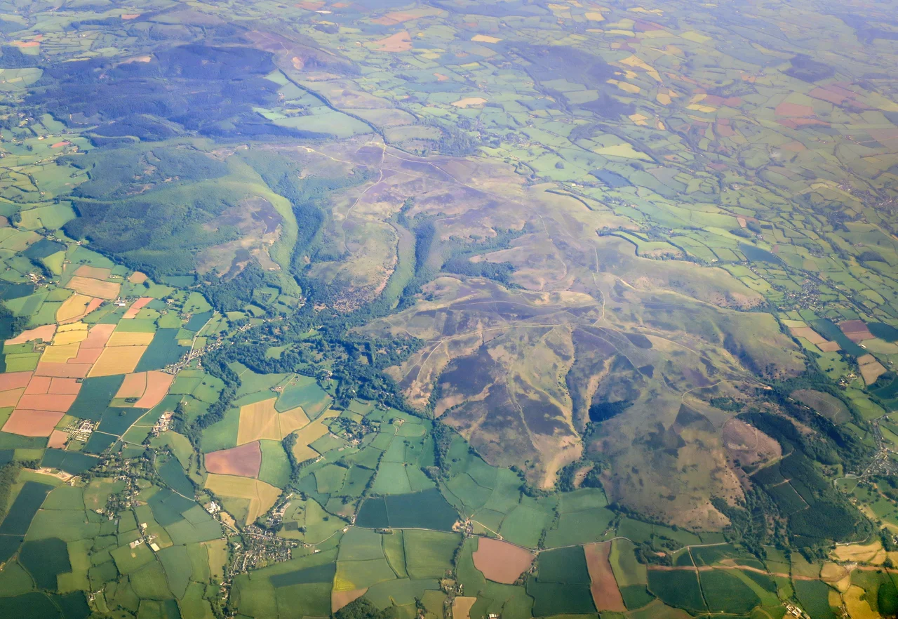

Quantock Hills
In the summer of 1797 William Wordsworth, his sister Dorothy, and a younger poet named Samuel Taylor Coleridge began walking the same combes and ridges almost every day. Coleridge lived in a small cottage at Nether Stowey; the Wordsworths had rented a much grander house called Alfoxton three miles away. They walked, they argued, they read each other's drafts aloud under the oak trees, and by the time William and Dorothy left twelve months later, English poetry had been quietly turned inside out. The Lyrical Ballads they produced - with Coleridge's Rime of the Ancient Mariner, written during these walks, as its centrepiece - is usually treated as the start of English Romanticism. It was all written here, on these heathy Somerset hills.
A Rim of Hills
Quantuc is the Celtic word for a rim or circle, and a ton is an Old English settlement; the Quantocks are literally 'the settlement by the rim of hills'. The ridge runs about fifteen miles from the Vale of Taunton in the south north-west to the Bristol Channel at Kilve, never very high - the summit at Wills Neck stops at 1,261 feet - but high enough that on a clear day from its top you can see Glastonbury Tor, the Mendips, the Gower Peninsula in Wales across the Bristol Channel, the Brendons, Exmoor, and the Blackdowns. It is also one of the older worked landscapes in England. Bronze Age round barrows still hump the skyline. Iron Age hillforts crown several of the spurs. Roman silver coin hoards have come out of West Bagborough. The hills were already old when the Saxons gave them the name they still carry.
Alfred's Herepath
In the 870s, while a young King Alfred was hiding from the Vikings in the marshy hideout at Athelney to the south-east, he ordered the building of military roads called herepaths to link a network of beacons and forts. The herepath that crossed the Quantocks ran from the ford on the River Parrett at Combwich, past the Cannington hillfort, up the line of the present-day Stowey road to Crowcombe Park Gate, then along the ridge south to the Triscombe Stone. The road was a regulation sixty-six feet wide between deep hedge-laid banks, and remarkably you can still walk it today. The avenue of trees that grew up from those banks survives in places as one of the oldest continuous routes in England. Eight centuries later, in 1685, the same hills witnessed the bloody aftermath of the Monmouth Rebellion - supporters of the doomed Duke were hanged in the villages at Nether Stowey and Cothelstone. The Quantocks have always been at the edge of bigger events.
The Walking Poets
When Coleridge moved into the cramped cottage at Nether Stowey in 1797 he was twenty-five, broke, married unhappily, and brilliant. He persuaded Wordsworth and Dorothy to take Alfoxton House nearby; their three-way friendship over the next year was one of the most productive collaborations in English literature. They walked the hills constantly, sometimes thirty miles in a day, talking out their poems as they went. Coleridge wrote The Rime of the Ancient Mariner, Kubla Khan, Christabel, and Frost at Midnight in this single year. Wordsworth was drafting the early lyric poems that would establish his ear for ordinary English speech. Dorothy kept the journal that fed both their imaginations - her descriptions of nightingales, hedgerow flowers and the particular look of the combes after rain make their way directly into the brothers' verse. The local authorities, suspicious of the radicals, sent a government spy after them, who concluded they were probably harmless. The Coleridge Cottage at Nether Stowey is now a National Trust property; the fifty-one-mile Coleridge Way walking trail starts at its front gate.
First of Many
On 7 February 1956 the Quantocks were designated an Area of Outstanding Natural Beauty - the very first such designation in England under the National Parks and Access to the Countryside Act of 1949. There was no special reason it had to be first; it just was. The 6,194 acres of heathland, oak coppice, ancient ridgeway and Site of Special Scientific Interest established a model that has since been applied to forty-five other landscapes across England. The hills are still mostly working land - sheep, cattle, forestry plantations, small farms - and there is no single owner. They are managed by an alphabet soup of councils, the National Trust, the Forestry Commission, the Friends of Quantock, and the unbroken local tradition of the Quantock Commoners, whose ponies and red deer still drift through the heather as they have for centuries. The carved bench-ends inside Crowcombe Church, dated 1534, show Green Men and a two-headed dragon fighting local farmers - a reminder that the older imagination is never far from the surface here.
From the Air
The Quantock Hills run roughly NNW-SSE from the Vale of Taunton at 51.02 north to the Bristol Channel coast at 51.19 north, centred near 51.15 degrees north, 3.23 degrees west in Somerset. From the air the ridge appears as a long heathered spine rising out of softer farmland - distinctly different in colour and texture from the Somerset Levels to the east. Wills Neck (1,261 feet) is the highest point. Cruising altitude 2,500-4,000 feet gives a clear view of the whole ridge and its relationship to Exmoor (to the west), the Mendips (to the east), and the Bristol Channel (to the north). Bristol International (EGGD) is about thirty-five nautical miles northeast; Exeter International (EGTE) about thirty nautical miles south. South-westerly Atlantic weather brings frequent low cloud and rain.
Nearby Stories
- Ottery St Mary 6.9 km away
- Barry Dock Lifeboat Station 9 km away
- The Tribunal, Glastonbury 11 km away
- Okehampton Castle 13 km away
- Tyntesfield 14 km away
- Appledore Lifeboat Station 23 km away
- Maiden Castle, Dorset 27 km away
- The Mumbles Lifeboat Station 28 km away