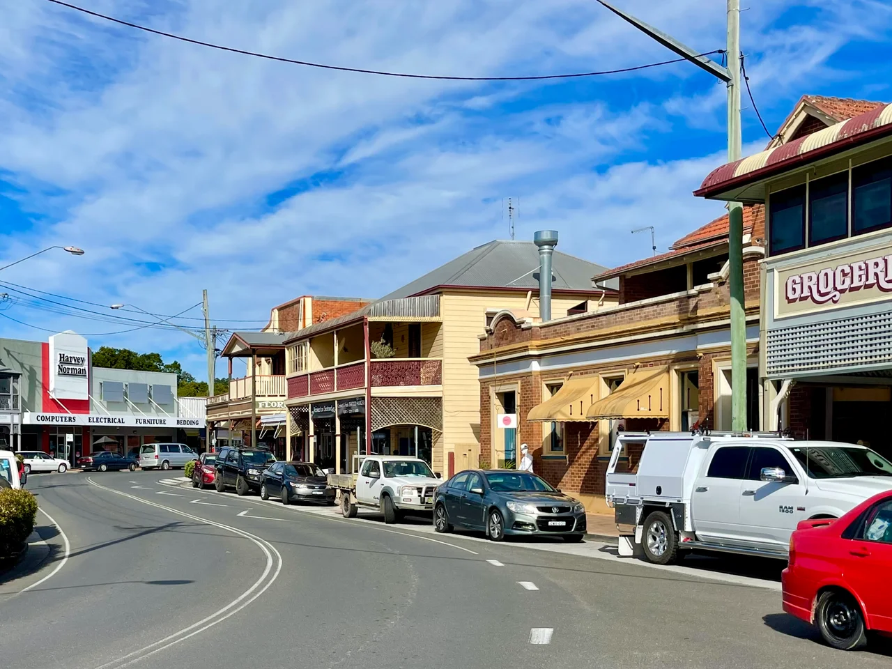

Maclean, New South Wales
The power poles give it away. Drive into Maclean from the Harwood Bridge and the ordinary timber poles lining the road are wrapped, one after another, in bands of bright Scottish tartan, more than two hundred of them through the town and its surrounds. Street signs carry Scottish Gaelic alongside English, a stone cairn stands in a riverside park, and every Easter the skirl of bagpipes and the thud of tossed cabers fill the showground. Maclean bills itself as 'The Scottish Town in Australia,' and it has leaned into the title hard. But the tartan is the most recent layer on a place whose real story runs much deeper, down to the river that made it and the people who were here first.
The River's First People
Long before any surveyor drew a township, this stretch of the Clarence belonged to the Yaegl people, with the Gumbaynggirr to the south, who lived along the river and its islands. When Matthew Flinders sailed past the river mouth in 1799 he named it Shoal Bay and dismissed the country as 'deserving of no more than a superficial examination,' and sailed on. The cedar-getters and settlers who followed were not so easily turned away, and their arrival was a catastrophe for the Yaegl. They were forced off their land into ever smaller settlements, and several massacres of Aboriginal people by settlers were recorded along the Clarence. By 1880, some of the displaced Yaegl were living on Ulgundahi Island in the river, a place that remains significant to their descendants today and that no celebration of tartan should be allowed to overshadow.
A Big River and a Boom in Cedar
The European story of Maclean begins with a rumour of a 'big river.' Escaped convicts moving south from Moreton Bay in the 1820s and 30s brought back word of it, and in 1838 Thomas Small sent a brother and two dozen sawyers down the river aboard the Susan, the first vessel to do so, chasing the stands of valuable red cedar growing along the banks. Governor Gipps named the waterway the Clarence in 1839, after the Duke of Clarence, and the rough river port that grew up was first called Rocky Mouth. It was formally laid out as a township in 1862 and renamed for Alexander Grant McLean, the colony's Surveyor-General. Many of the early settlers came from the Scottish Highlands, joined by Irish and German families, planting the cultural seed the town would later make its brand.
Sugar, and the Long War With Water
Cedar gave way to cane. By the mid-1860s sugar was overtaking the early maize and cotton crops, and in 1874 the Harwood Sugar Mill began crushing, the oldest continuously operating sugar mill in Australia and still working a century and a half later. But a town built on a floodplain pays for the privilege. Maclean has recorded more than a hundred floods since European settlement, an almost rhythmic catastrophe; the June flood of 1950 was the worst since 1890, and the 2001 flood broke even that. Markers on poles around town still show how high the water reached. After 2001 the community built a levee wall, and it has held through the floods of 2009, 2011, 2013, 2021 and the punishing 2022 deluge, even as cracks appeared and low-lying parks went under.
Becoming the Scottish Town
Maclean's tartan identity was, in part, a survival strategy. When the Pacific Highway bypassed the town in 1966 and sugar prices slumped, Maclean needed a reason for travellers to turn off and stop. It reached for its Highland roots: a Scottish cairn went up, and in 1986 a group of locals, led by a former bank manager named Graham Leach, founded the association that promotes the town's Scottish origins. The painted poles came in 2000, when the Sydney Olympic torch passed through, beginning with about a hundred and growing to roughly 240. Older still is the Maclean Highland Gathering, contested for over a century each Easter with caber tossing, highland dancing, pipe bands and bagpiping, the genuine article beneath the marketing, a working river town that turned its ancestry into a festival and made the world take notice.
From the Air
Maclean sits at 29.46°S, 153.20°E, on the lower Clarence River in the Northern Rivers region of New South Wales, nestled at the base of Mount Maclean where the river reunites after splitting around Woodford Island. From the air the setting is the star: a broad, braided river system threading between flat green islands of sugar cane, with the town hugging a low hill on the south bank and the twin Harwood bridges crossing downstream to the northeast. Best viewed from 2,000 to 5,000 feet AGL in clear coastal conditions; the maze of channels, islands and cane fields is striking from above. Nearest airports are Grafton / Clarence Valley Regional (YGFN) upriver to the southwest, with Lismore (YLIS) to the north, Coffs Harbour (YCFS) down the coast, and Ballina Byron Gateway (YBNA) to the northeast. Expect sea breezes, coastal haze, and reduced visibility near the river mouth, especially in summer.
Nearby Stories
- History of New Italy, New South Wales 19 km away
- Yuraygir National Park 20 km away
- Washpool National Park 25 km away
- Guy Fawkes River National Park 45 km away
- Cape Byron Marine Park 56 km away
- Tenterfield School of Arts 56 km away
- Cape Byron Light 90 km away
- SS Elingamite: Gold, Fog, and a Captain Wrongly Blamed 1803 km away