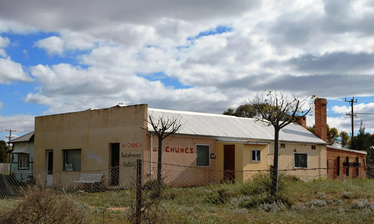

Menindee, New South Wales
In October 1860, Robert O'Hara Burke pulled into a riverside pub on the Darling and ordered a bed. He was leading the most lavishly equipped expedition Australia had ever assembled, bound for the Gulf of Carpentaria across a continent no European had crossed. Menindee was the last town on the map. North of here, his men would be navigating by guesswork, and Burke himself would be dead within the year. The hotel still stands - Maidens Hotel, rebuilt after a fire but trading on the same ground - and it is one of the oldest continuously licensed pubs in the state. That is Menindee in a sentence: a small huddle of brick and iron on a sandhill, perched at the edge of the known world, holding a river the local people call the Baaka.
The Yolk of an Egg
The name comes from Minandichi, the Barkindji word for Lake Menindee, and one account traces it to milhthaka - the yolk of an egg. The Barkindji, or Barkandji, are the people of the Baaka, the river that gives them their name, and their connection to this stretch of water runs back across an almost unimaginable span of time. As the nearby Willandra Lakes dried out after the last ice age some 20,000 years ago, people gathered along the Darling, drawn to a country of overflow lakes and channels that the Barkindji called wontanella - many waters. When the surveyor Thomas Mitchell pushed down the river in 1835, his party met such determined resistance that he judged it too dangerous to continue and turned back. The river was not empty land waiting to be found. It was home, and it had been for a very long time.
The River That Carried Trade
For a few decades, the Darling was a highway. In January 1859, Captain Francis Cadell steered the paddle-steamer Albury up from the Murray junction, proving the river could carry cargo, and Menindee became a riverboat port - a depot store, then a scatter of public houses, stores and cottages. The colonial government tried to christen the town "Perry," a name so unpopular the press mocked it as a "cheap honor" to "some political snob," and within a year it was quietly rescinded in favour of the local name. A visitor in 1881 found the place "higgledy-piggledy," its brick buildings looking "as if they had been dropped down by chance, like a collection of children's toy bricks." In 1927 a great bascule bridge - hinged to swing open for the steamers - finally carried the railway across the Darling, linking Sydney to Broken Hill, 110 kilometres to the northwest.
When the River Died
Menindee sits inside the most contested water system in Australia. A weir diverts the Darling into a chain of shallow overflow lakes - the Menindee Lakes storage scheme - holding water for irrigation downstream into South Australia. In a hot desert climate that can go months without rain, and where the mercury once hit 49.7 degrees Celsius, those lakes are everything. In the summer of 2018-19, the system failed catastrophically. Up to a million native fish died along a 40-kilometre stretch, including Murray cod a century old, as an algal bloom collapsed and stripped the oxygen from the water. Then, in March 2023, it happened again, on a scale that stunned the country: tens of millions of fish, mostly bony bream, choking the river surface from bank to bank. For the Barkindji, these were not statistics. The Baaka is family - and they watched their river die twice.
Many Waters, Still
And yet the country still answers to rain. When widespread storms swept north-west New South Wales and southern Queensland in early 2020, more than 550 gigalitres surged toward the Menindee Lakes, refilling Lake Wetherell and bringing waterbirds back in clouds. The lakes flooded again in 2023. This is a place of violent extremes - drought that cracks the black soil, then floods that fill the desert with shining water - and life here has always been shaped to that rhythm. Today around 537 people call Menindee home, a third of them Aboriginal and Torres Strait Islander. The Outback Xplorer rolls through once a week, west on Mondays and back east on Tuesdays. Fifteen kilometres southwest stands the old Kinchega Woolshed, a relic of the pastoral century. The town is small and remote and easy to drive past. It is also one of the oldest river settlements in the far west, and a barometer for whether Australia can keep its inland rivers alive.
From the Air
Menindee lies at 32.39 degrees south, 142.42 degrees east, on the north bank of the Darling River about 110 km southeast of Broken Hill in far western New South Wales. From altitude, the standout feature is water: the Menindee Lakes spread to the west of town as a chain of broad, shallow blue-grey sheets against red sand country - one of the few large water features in this arid region and a reliable visual landmark. The Darling River threads a green ribbon of black box woodland through otherwise tawny floodplain. The transcontinental railway and its bridge cross the river at the town. Nearest major airport is Broken Hill (YBHI), roughly 100 km northwest; the regional strip at Menindee serves light aircraft. Recommended viewing altitude 6,000-9,000 ft for the lakes-and-river contrast. Visibility is typically excellent in this desert climate, though summer haze and dust can reduce it; the lakes' extent varies dramatically between drought and flood, so the scene differs year to year.
Nearby Stories
- First BHP Offices Chimney Ruin 58 km away
- PS Rodney 61 km away
- Wilcannia 72 km away
- Central Mine Manager's Residence 74 km away
- Wilcannia Athenaeum 101 km away
- Willandra Lakes Region 103 km away
- Broken Hill Mosque 105 km away
- Redruth Gaol 308 km away