
Wilcannia
The Barkandji have a name for the river that the maps call the Darling. They call it the Baaka, and they have belonged to it for tens of thousands of years, far longer than the word "Wilcannia" has existed. On a wide bend of that river, in the second half of the nineteenth century, paddle-steamers stacked with wool tied up three and four deep, camel trains plodded in from stations beyond the horizon, and a town of grand sandstone buildings rose so fast that locals only half-jokingly called it the Queen City of the West. Both things are true here at once: a continuing Aboriginal river community, and the ghost of one of inland Australia's greatest ports.
Where the Steamers Stopped
River transport on the Darling began with a single voyage. In January 1859, Captain Francis Cadell pushed the steamer Albury up from the Murray junction and, eight days later, reached Mount Murchison station, loading a hundred bales of wool for the return. That cargo changed everything. The unloading point grew into a township, declared in 1866 and named Wilcannia by 1868. When the river ran high, the wharves, really just graduated slopes cut into the bank, swarmed with steamers and barges. A barge could carry up to two thousand bales of wool. By the 1880s, ninety to a hundred paddle-steamers worked the Darling, and Wilcannia's customs house was probably the largest inland customs station in New South Wales.
A City of Sandstone and Ambition
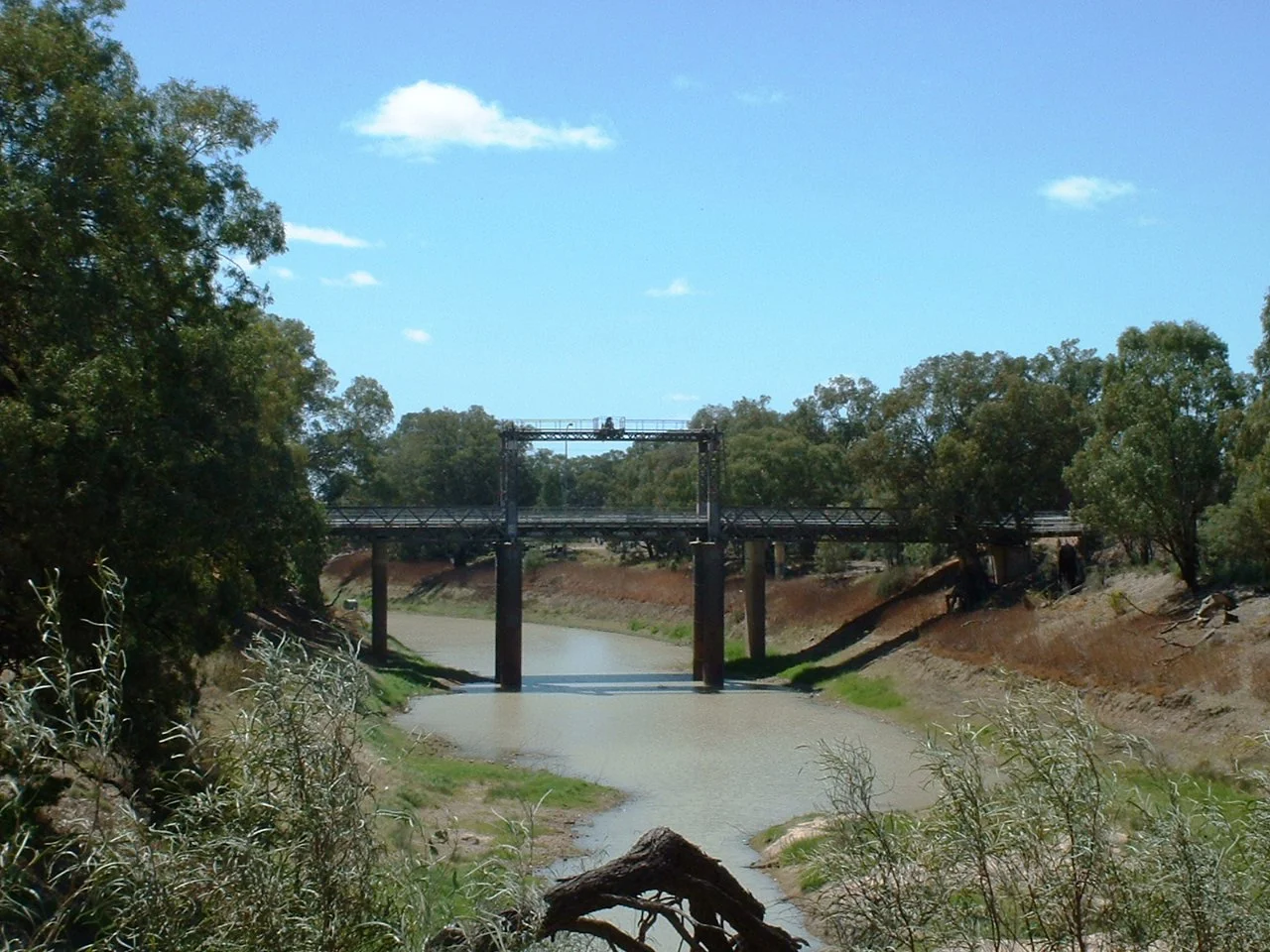
The boom left its signature in stone. A quarry of excellent freestone sat barely two miles from town, and Wilcannia spent it lavishly: a handsome post and telegraph office finished in 1880, stores praised for their "considerable architectural beauty," banks, a hospital, two competing newspapers, and the sandstone Athenaeum with its carved urns. The town was strikingly cosmopolitan for its remoteness. A thriving Chinese community ran the bakeries, gardens, and laundries, and in 1881 the population topped 1,400. Crowning it all, in 1896, came the great bridge across the Darling, designed by J. A. McDonald, its central span lifting on wire ropes and counterweights so the steamers could pass beneath. It still stands, one of the last movable bridges left on the entire Murray-Darling system.
The People of the Baaka
Long before any of this, and long after the steamers stopped, the river belonged to the Barkandji, the Paakantyi, whose name means "people of the Baaka." Today around three-fifths of Wilcannia's residents are Aboriginal, and the town carries its culture with pride. In 2002 five local boys aged nine to fourteen, the Wilcannia Mob, recorded a hip-hop track called "Down River" that reached number 51 on Triple J's Hottest 100 and won a Deadly award; the British artist M.I.A. later sampled their voices on her album Kala. On the main road, the Baaka Cultural Centre is rising in the shape of an emu's foot, built partly by local hands as a gallery for Barkandji art and a place to tell the river's story from the inside.
Hard Country, Held Together
None of this softens the hardship. Wilcannia sits in genuine desert, with barely 260 millimetres of rain a year, and on 11 January 1939 the thermometer hit 50.1 degrees Celsius, among the hottest readings ever recorded in the state. The town has faced real injustice too: failing water quality that forced residents to truck in boxed water from Broken Hill, and a brutal 2021 COVID outbreak that an inquiry heard had been warned about a year in advance. When a 2017 documentary reduced the place to a stereotype, the BBC apologised. The truer portrait came from the community itself, in the ABC's series Positively Wilcannia, and from elders like Annie Moysey, known as Wilcannia's Grandmother. This is a town that knows exactly who it is.
Reading the River
Stand on the lift bridge at dusk and the whole story is laid out below you. The Baaka curls through stands of river red gum, the same trees that shaded Barkandji camps and steamer wharves alike. The sandstone facades, some now art studios and homes, catch the last of the light. The wool barges are gone and the customs house is quiet, but the river endures, and so do its people. Wilcannia is not a town to be pitied. It is a river port that outlived its boom, an Aboriginal community that outlasted every prediction of its disappearance, and a place still telling its own story on its own terms.
From the Air
Wilcannia lies at 31.57 degrees S, 143.37 degrees E, where the Barrier Highway crosses the Darling River, about 965 km west of Sydney. From the air the river is the navigational anchor: a sharply meandering green corridor of river red gums slicing through flat, red-brown semi-arid plain, with the town clustered tightly on the bend and the historic centre-lift bridge marking the crossing. Wilcannia Airport (ICAO YWCA, IATA WIO) sits about 9 km from town with a 3,051-foot asphalt runway. Broken Hill (YBHI) is roughly 195 km west; Cobar lies to the northeast. Best viewed from 2,500 to 5,000 feet AGL. The dry climate usually offers superb visibility, but watch for extreme summer heat, sudden dust storms, and, after rare big rains, dramatic flooding across the riverine plain.
Nearby Stories
- Paroo-Darling National Park 11 km away
- Mutawintji National Park 37 km away
- White Cliffs, New South Wales 52 km away
- Paakantyi 56 km away
- Menindee, New South Wales 71 km away
- Kinchega Woolshed 113 km away
- Ivanhoe 130 km away
- Louth, New South Wales 154 km away