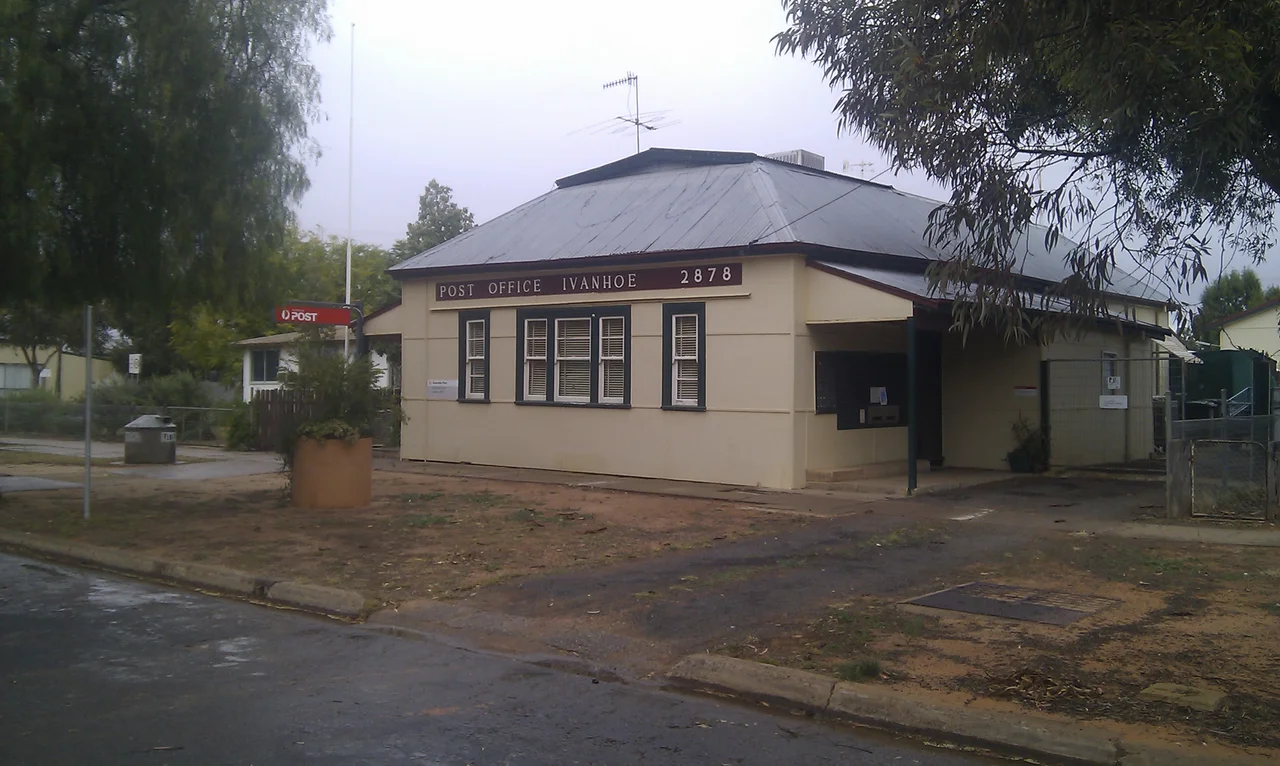

Ivanhoe
Ivanhoe is the kind of place defined by what passes through it. Twice a week the Indian Pacific glides by on its run between Sydney and Perth, slicing across the continent on the line that threads right past town. It does not stop. Out on the dead-straight Cobb Highway, road trains rumble between Hay and Wilcannia through a township of about 162 people, marked by a high street so improbably wide it looks built for a city that never arrived. Ivanhoe has always been a junction, a place where you change horses, change trains, or simply pause before the long empty miles resume.
Change Horses Here
Ivanhoe was born of the coaching age. A hotel went up in 1871, a post office followed in 1874 at Williamson's store, and the town grew around the rhythm of the road. By 1884 it had become a major change-station for Cobb & Co, the legendary coaching firm whose horses hauled mail and passengers across the outback. The town acquired a Cobb & Co Chaff House and stables, and the fresh teams that waited there kept the Darling River routes running. There was a frontier edge to it all: in 1879 police were stationed at Ivanhoe specifically to protect residents from a gang remembered as the Hatfield Bushrangers. Twice a year, from 1887, the whole district gathered for race meetings on a track that was part of the town common.
The Iron Road Arrives
The coaches gave way to steam. In 1925 the railway reached Ivanhoe from Sydney via Parkes, and for two years the town sat at the very end of the line, a frontier railhead staring west into nothing. Then, in 1927, the rails pushed on to Broken Hill, and Ivanhoe found itself a link in something vast: the transcontinental east-west corridor connecting Sydney to Perth. The railway built its own settlement, a separate "rail town" beside the station three kilometres south of the main township, complete with workshops, locomotive depots, crew barracks, and worker housing. For decades the railway, not the highway, was the lifeline that kept Ivanhoe on the map.
Where Two Trains Can Meet
On a single-track railway running hundreds of kilometres through empty country, the few places where trains can pass each other become quietly vital. Ivanhoe is one of them: a 1,850-metre loop of double track, 816 rail kilometres from Sydney, sitting between the crossing points of Trida, 65 km east, and Darnick, 64 km west. The station is unattended now, but NSW TrainLink's Outback Xplorer still calls, heading to Broken Hill on Mondays and back toward Sydney on Tuesdays. In a landscape this vast, even the act of two trains slipping past one another in the dark is a small piece of infrastructure poetry, choreographed across a continent.
Lifelines in the Heat
Survival out here depends on holding services together against the distance. Ivanhoe bakes under a hot semi-arid sky; the mercury reached 48.5 degrees Celsius in February 2004. Its health service, staffed by nurses and Aboriginal health workers, runs a 24-hour emergency room and a four-wheel-drive ambulance, and the Royal Flying Doctor Service drops in twice a week, flying the seriously ill to Broken Hill. For years a minimum-security correctional centre sat in the old rail town, its inmates carving the very story poles that stand outside the clinic, until it closed in 2020 and was sold to house workers for a nearby mineral-sands mine. New industry, old isolation: in November 2022, floods south of Mossgiel cut the highway for weeks, and for a time the only road into Ivanhoe ran the long way round.
From the Air
Ivanhoe sits at 32.90 degrees S, 144.30 degrees E, on the Cobb Highway (National Route 75) midway between the Lachlan and Darling rivers, about 182 km south of Wilcannia and 210 km north of Hay. From the air the clearest markers are the arrow-straight Broken Hill railway line and the broad Cobb Highway converging on a small grid of streets, with the original rail town and station set apart roughly 3 km south of the main township. The surrounding country is flat red-brown semi-arid plain dotted with saltbush and the occasional station tank. There is a local airfield at Ivanhoe; Broken Hill (ICAO YBHI) lies well to the northwest and Hay (YHAY) to the south. Best viewed from 3,000 to 6,000 feet AGL. Visibility is typically excellent in the dry air, but expect severe summer heat, dust storms, and broad sheet flooding across the plains after rare heavy rain.
Nearby Stories
- Mossgiel 17 km away
- Willandra National Park 68 km away
- Willandra Lakes Region 78 km away
- Mount Hope, New South Wales 105 km away
- Mungo National Park 113 km away
- Wilcannia 132 km away
- Nymagee 132 km away
- Paroo-Darling National Park 136 km away