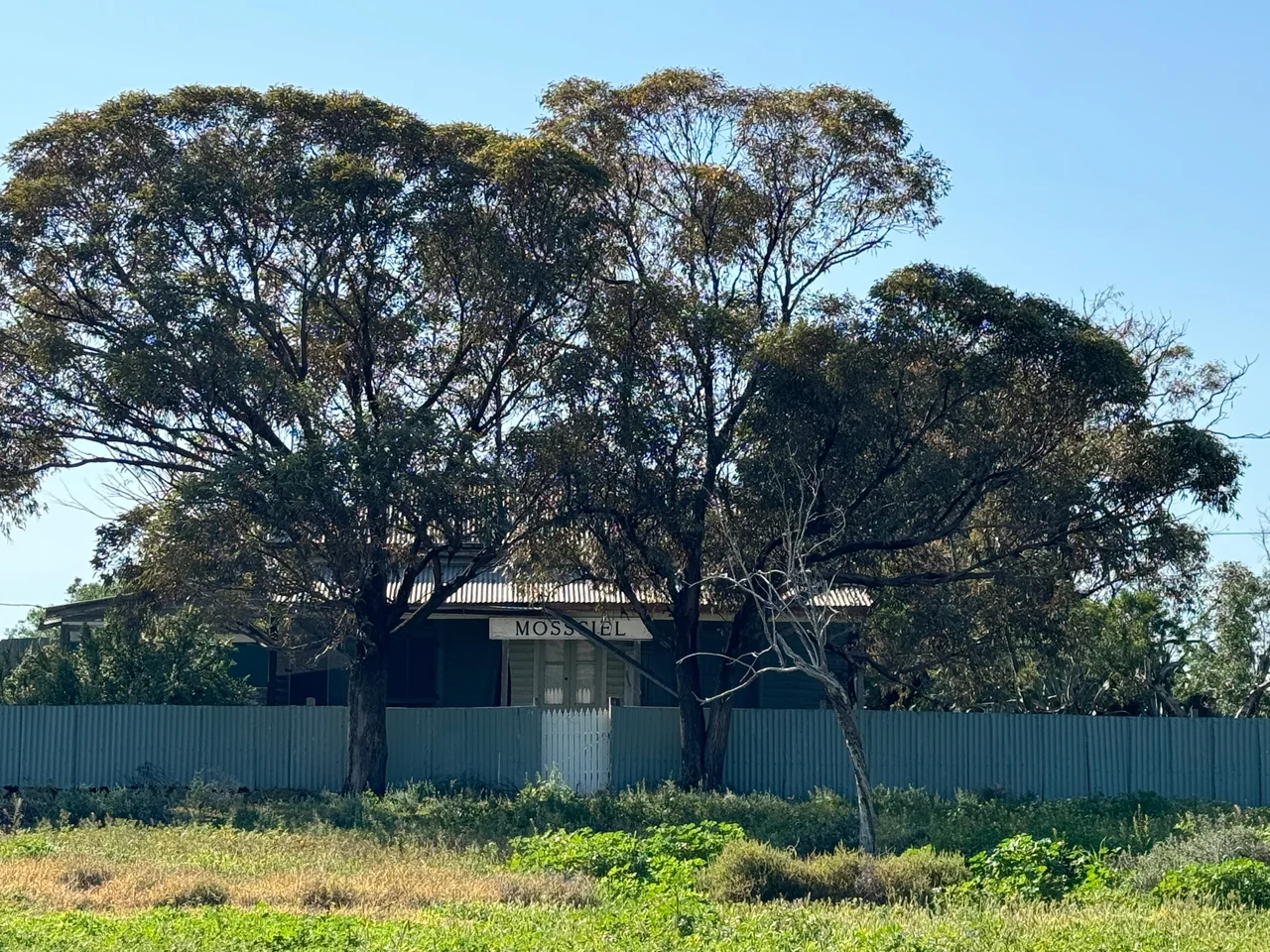

Mossgiel
Today, the township of Mossgiel is a single house, a community hall, and a great deal of sky. The house was once the post office. The rest of the town, the two hotels, the stores, the blacksmith, the saddler, the school, has dissolved back into the saltbush plain it briefly interrupted. It is one of the loneliest spots on the long, straight Cobb Highway between Hay and the Darling, and its name carries an odd grace note: Mossgiel was named for a farm in Ayrshire, Scotland, the land worked by the poet Robert Burns and his brother Gilbert.
Wringing Water From the Plain
The plains around Mossgiel are flat to the point of disorientation, and the great problem was never space but water. In about 1864 the Desailly brothers, Francis and George, took up the Mossgiel and Booligal runs as "back block" stations, and the effort to keep stock alive was enormous. They put a small army of men to fencing, digging tanks, and sinking wells, and reportedly imported the first centrifugal pump and steam engine in the entire Riverina. Water hauled up by horse-driven whims and by that hissing steam pump ran into iron troughs at every well. Out here, an engine that lifted water was not a luxury. It was the difference between a sheep station and bare dirt.
Two Pubs and No Town
When a coach service began running from Booligal toward the Darling River around 1868, a township sprouted along the route almost overnight. Robert Riordan opened the Mossgiel Hotel in 1869; William Carter followed with the Wool-pack Hotel that December. A post office, a store, a blacksmith, and a saddler appeared in quick succession. The growth was so disorderly that in 1873 the Hay Police Court rejected yet another publican's license, on the wonderful grounds that "there are two hotels already there and no town whatever, only the Mossgiel station." The court added a dry verdict on the local culture: "The drinking there is said to be fearful." A school finally opened in 1886, lending a little permanence.
Drought, Then the Sand
The plains gave, and then they took. The Federation Drought of 1895 to 1903 emptied the district; stations closed to caretaker staff, the supply routes collapsed, and flour and fodder had to come by camel train from Wilcannia down to Ivanhoe and on to Mossgiel by coach. By early 1903 the government water tank ran dry, and water was carted eleven miles from Lignum Park station. Then, in February 1904, barely after the rains returned, a sandstorm howled out of the southwest at "hurricane speed for sixty hours without intermission," the worst the oldest residents had seen. It buried the town in dunes. Galland's store could only be entered from one end of the verandah, where sheets of galvanised iron held back "a perfect mountain of sand."
The Railway That Passed It By
A town can survive drought and even burial, but not irrelevance. The blow that finished Mossgiel was quiet and bureaucratic: the railway, when it came, ran through Ivanhoe, thirty-five miles away, and not through Mossgiel at all. By 1936 the town had dwindled so far that the cottage hospital and the last hotel both closed. The plain, however, keeps one small secret of its own. The threatened Mossgiel daisy, a perennial with mauve petals around a yellow eye, takes its name from this region, flowering quietly in the clay among the bladder saltbush and bluebush, in a place where almost nothing else of the human town remains.
From the Air
Mossgiel lies at 33.32 degrees S, 144.46 degrees E, on the Cobb Highway about 50 km southeast of Ivanhoe and roughly midway across the vast plains between Hay and the Darling River. From the air it is genuinely hard to spot: a faint scatter of structures where the dead-straight ribbon of the Cobb Highway meets the Hillston road, set in an almost featureless expanse of saltbush and clay pan. The flatness itself is the landmark, broken only by the geometric scars of old station tanks and fence lines. Nearest airfields are at Ivanhoe to the northwest and Hay (ICAO YHAY) to the south; Hillston (YHLL) lies east. Best viewed from 3,000 to 6,000 feet AGL in clear conditions. The plains breed fierce dust storms and shimmering heat haze in summer, and the same flat ground floods broadly after heavy rain.
Nearby Stories
- Ivanhoe 17 km away
- Willandra Lakes Region 64 km away
- Willandra National Park 65 km away
- Mungo National Park 87 km away
- Mount Hope, New South Wales 108 km away
- Menindee, New South Wales 148 km away
- Warangesda Aboriginal Mission 157 km away
- Echuca 287 km away