.jpg)
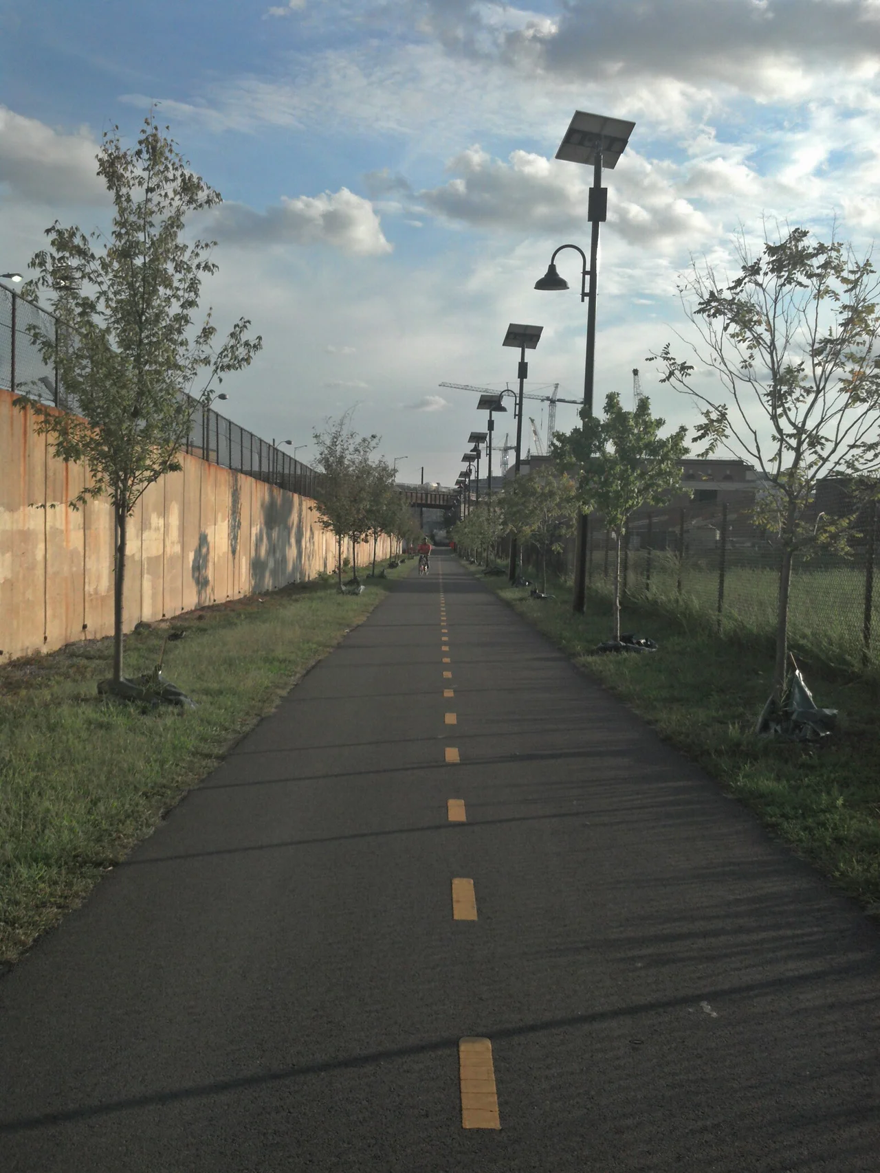
Metropolitan Branch Trail
In 1988, a Brookland resident named Patrick Hare looked at a strip of abandoned B&O railroad land cutting through his neighborhood and saw something nobody else was looking at: a continuous corridor of public right-of-way running eight miles from the Capitol Dome to the dome of the Basilica of the Shrine of the Immaculate Conception at Catholic University. He started calling it the Dome to Dome Trail. The right-of-way had been laid down in 1873, when the Baltimore and Ohio Railroad opened its Metropolitan Branch to connect Washington with the main line at Point of Rocks, Maryland. The tracks were still active, though running through a less industrialized city than they had been built for. The land beside them was sitting empty. Hare organized eleven cyclists in 1989 to walk and bike the route. From that group came the Coalition for the Metropolitan Branch Trail. Thirty-six years later, after a thousand bureaucratic battles, the trail is now nearly complete.
Eight Miles, One at a Time
The trail enters Washington at the Maryland border and follows the Red Line of the Washington Metro - which itself uses the old B&O right-of-way - all the way south to Union Station, where it meets the Capitol Dome. One mile in Maryland, seven in D.C. The first physical piece was built almost by accident in 1998, when the D.C. Department of Transportation paved a nearly one-mile segment along John McCormack Road near Catholic University as part of routine road maintenance. Federal Congestion Mitigation and Air Quality money covered the $1.9 million cost. On October 21, 1999, the trail was named one of fifty Millennium Legacy Trails at a White House ceremony with First Lady Hillary Rodham Clinton and Transportation Secretary Rodney Slater. A formal ribbon-cutting at the Brookland-Catholic University Metro station followed five days later. The trail then sat in pieces for the next decade. Construction on the central 1.5-mile segment from New York Avenue to Franklin Street finally began in June 2009. It opened in May 2010, making the whole D.C. spine usable for the first time.
The NoMa Difficulty
The hardest section was always going to be the south end, where the trail had to thread through the dense NoMa neighborhood and bridge the rail trench by the New York Ave-Florida Ave-Gallaudet U Metro station. In 2002, when WMATA was building that new station, trail advocates negotiated to have a 2,000-foot segment of the trail built on a raised structure as part of the project. It opened with the station in November 2004 - but stayed inaccessible to the public for another six years because the connections to street level had not yet been built. Stairs from the station to L Street NE and a connector under the tracks finally opened in spring 2008. The 100 Florida Avenue development created a temporary trail connection to street level. Construction at 200 and 202 Florida Avenue closed and reopened the access ramps multiple times between 2019 and 2024. The current configuration, with a bike lobby and staircase inside the 202 Florida Avenue building, opened in 2024.
Right-of-Way From L'Enfant
The original Metropolitan Branch right-of-way south of Franklin Street NE - a strip 200 feet wide in some places - had been laid out in Pierre L'Enfant's 1791 plan for Washington as an extension of Delaware Avenue. In the late nineteenth and early twentieth centuries, the city converted the unused street grant into railroad sidings to serve Capitol Hill's industrial users. The sidings fell into disuse as industries left the city, and CSX, the right-of-way's eventual owner, sold the active main line tracks to the Washington Metro under a joint-use agreement. The grassy strips beside the tracks became unofficial shortcuts for pedestrians and cyclists trying to access the Red Line. The Metropolitan Branch Trail formalized what people had already been doing - turning the informal path into a paved corridor with grades worked out, bridges added, drainage installed, and lighting where neighborhood character allowed.
The Fort Totten Stretch
In 2017, DDOT began design-build construction on the next significant section - from John McCormack Drive in Brookland north to the Fort Totten Metro Station. Contractor problems and the COVID-19 pandemic delayed the originally planned 2020 completion. An 800-foot replacement connector between Gallatin Street NE and 1st Place NE reopened in June 2020. The section to existing trail on John McCormack opened in April 2022. In summer 2023, DDOT began work on the last unbuilt D.C. segment - from Fort Totten north to Takoma. Construction proceeded in pieces along South Dakota Avenue, Blair Road, and Oglethorpe Street through 2024 and 2025. A ribbon-cutting ceremony for the full Fort Totten-to-Takoma section was held on November 12, 2025. The northbound rider can now reach the Maryland line without leaving dedicated trail.
The Maryland Mile
Across the border in Montgomery County, the one final mile to the Silver Spring Transit Center has been slower in coming. Montgomery College built half a mile of mostly paved trail in 2003 along Fenton Street to its Takoma campus, including a bridge over the rail tracks that opened in July 2004. Various developments through the 2010s added small connecting segments. In June 2018, the county built its first dedicated piece - a two-block segment along Fenton and King Streets - that was not piggybacking on a private development. In March 2024, the county began Phase 2A, which will close the major gap between Dixon Avenue and Georgia Avenue and add a new bridge over Georgia Avenue. Phase 2B, running along Selim Road through a new tunnel under Burlington Avenue, has no announced start date. The original bids on the combined project came in too high in 2022 and were rejected; the county broke the work into two phases. The Dome-to-Dome Trail will be eight miles. Seven and change are now ridable. The last piece has been almost as hard to build as the first seven combined.
From the Air
The Metropolitan Branch Trail runs roughly north-south through Northeast Washington, paralleling the WMATA Red Line and CSX tracks. Trail midpoint near Brookland sits at approximately 38.9333 N, 77.0036 W. Best viewed from 1,500 to 3,000 feet AGL when following the corridor. The dome of the Basilica of the Shrine of the Immaculate Conception (Catholic University) is visible to the northeast; the U.S. Capitol dome lies at the trail's southern terminus at Union Station. Reagan National (KDCA) sits five to seven nautical miles south depending on trail segment. The corridor is inside the Washington Flight Restricted Zone; GA overflight prohibited.
Nearby Stories
- Gunston Hall 1.1 km away
- 2023 Baltimore Shooting 4.9 km away
- Battle of Middleburg 6.6 km away
- Crownsville Hospital Center 10 km away
- Battle of Loudoun Heights 13 km away
- First Battle of Rappahannock Station 20 km away
- Howard County, Maryland 21 km away
- Harriet Tubman Underground Railroad 50 km away