
Mo Tat
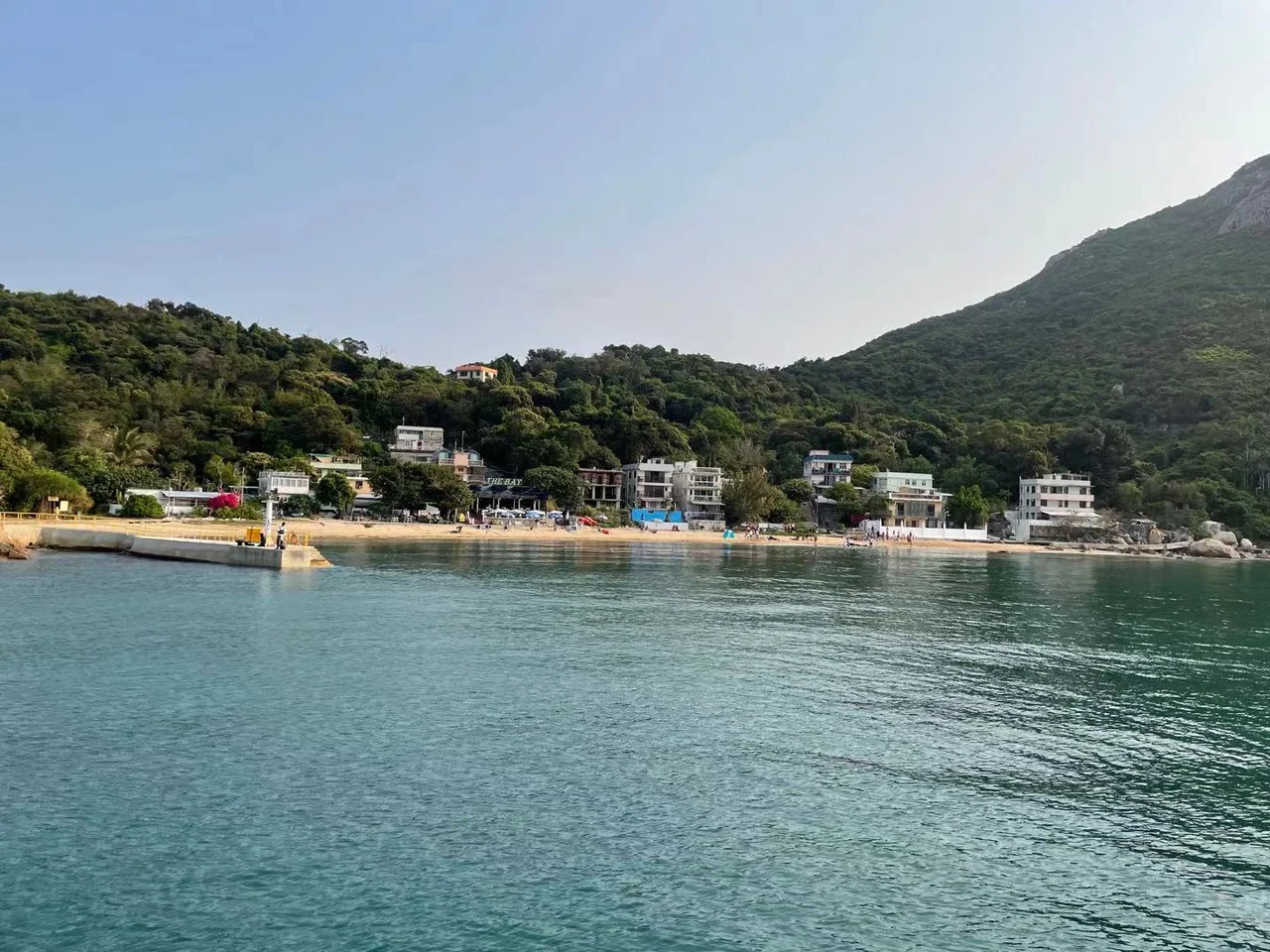
Twenty minutes on foot from Sok Kwu Wan, or a short ferry ride from Aberdeen, Mo Tat sits on a spur of land that juts eastward from the southern half of Lamma Island. It has no shops. It has no commercial centre. What it has is a beach, a low hill, a valley, and the particular quality of quiet that comes only when a place is genuinely difficult to reach — not prohibitively so, but enough to thin the foot traffic to a trickle.
Three Villages, One Spur
The Mo Tat area is actually three distinct settlements arranged across a small stretch of coastline and hillside. Mo Tat Wan occupies the beach. Mo Tat Sun Tsuen — the newer village — sits on a low hill to its south. Mo Tat Old Village, the original settlement, lies in the valley south of that. Together they form a loose cluster that the Hong Kong government recognises as an administrative area and that residents recognise as home. Both Mo Tat and Mo Tat Wan are designated villages under the New Territories Small House Policy, which grants indigenous male villagers the right to build a house on village land. The policy has been contested in courts and legislatures, but in practice it has helped preserve the character of villages like these — quieter, lower, more human in scale than the apartment towers of urban Kowloon and Hong Kong Island visible across the water.
The Turtle Shore They Saved
To the south of Mo Tat, past the villages, lies Sham Wan. The beach there is one of the few remaining nesting grounds in Hong Kong for the endangered green turtle, and the government has listed it as a site of special scientific interest with restricted seasonal entry. When mainland China-based Agile Property Holdings proposed a development in 2011 — 900 upmarket residential units, a 120-room hotel, and a 500-yacht marina spread across Tung O Wan to the northern part of the bay — the proximity to Sham Wan was immediately flagged. The proposed site boundary would have been only 200 to 300 metres from the turtle nesting ground. Alan Leung Sze-lun, senior conservation officer for WWF Hong Kong, publicly expressed serious concern about the project's impact on the endangered species. The development was rejected. Sham Wan's turtles still return each season.
Getting There Is Most of It
The ferry is operated by Chuen Kee Ferry, running between Aberdeen on Hong Kong Island and Sok Kwu Wan on Lamma, stopping at Mo Tat along the way. From Sok Kwu Wan — famous for its seafood restaurants — Mo Tat is a 20-minute walk across the island's southern hills. Neither route is difficult, but neither is automatic. You have to decide to go. Once there, the single restaurant near the pier provides whatever the ferry schedule doesn't. A Hong Kong publication reported that only around 40 people live here permanently — residents who, in the words of one, wanted to be left alone. The lack of shops is not a hardship that awaits a future solution. It is a feature that has been maintained by the people who chose to stay.
The View Back Toward the City
From the hillside above Mo Tat Wan, the Aberdeen Harbour is visible across the water — container ships at anchor, the tower blocks of Aberdeen rising behind them, the hum of the city carried on the wind. Lamma Island sits in the southwest of the Hong Kong Special Administrative Region, outside the main harbour, separated from the congestion of the urban core by a stretch of open water. The contrast is not subtle. Hong Kong is one of the most densely populated places on Earth; Mo Tat is one of its breathing spaces. The island itself is home to two power stations that supply much of the city's electricity — steel towers and cooling stacks visible from the northern shore — but the southern tip where Mo Tat sits remains mostly as it was: hillside, bay, beach, and a few dozen people who know the ferry schedule.
From the Air
Mo Tat is located at 22.208°N, 114.145°E on the southern tip of Lamma Island, southwest of Hong Kong. From the air, Lamma is identifiable by its two large power station stacks on the northern shore. The spur where Mo Tat sits juts eastward toward Aberdeen. Hong Kong International Airport (VHHH) lies approximately 22 km to the northwest on Lantau Island. A low-altitude pass at 2,000–3,000 feet over the southern tip of Lamma reveals the beach at Mo Tat Wan and the terrain separating the three villages. Aberdeen Harbour is visible to the east across the water.
Nearby Stories
- Lok Ma Chau Loop 2.3 km away
- Portas do Cerco 2.3 km away
- Kweilin Incident 17 km away
- Wanshan Archipelago Campaign 34 km away
- Nanxiong Formation 115 km away
- Battle of Nanpeng Island 148 km away
- Heyuan 169 km away
- Cape Maobitou 632 km away